
Articles | Volume 19, issue 15
https://doi.org/10.5194/amt-19-5281-2026
© Author(s) 2026. This work is distributed under
the Creative Commons Attribution 4.0 License.
the Creative Commons Attribution 4.0 License.
https://doi.org/10.5194/amt-19-5281-2026
© Author(s) 2026. This work is distributed under
the Creative Commons Attribution 4.0 License.
the Creative Commons Attribution 4.0 License.
Research article
| 
12 Aug 2026
Research article |
| 12 Aug 2026
| 12 Aug 2026
Impact comparison of different aerosol types on atmospheric correction of Landsat 8 over land
Shuning Zhang
The Key Laboratory of Digital Earth Science, Aerospace Information Research Institute, Chinese Academy of Sciences, Beijing 100094, China
The International Research Center of Big Data for Sustainable Development Goals, Beijing 100094, China
The College of Resources and Environment, University of Chinese Academy of Sciences, Beijing 100049, China

The State Key Laboratory of Remote Sensing and Digital Earth, Aerospace Information Research Institute, Chinese Academy of Sciences, Beijing 100094, China
Bing Zhang
The College of Resources and Environment, University of Chinese Academy of Sciences, Beijing 100049, China
The State Key Laboratory of Remote Sensing and Digital Earth, Aerospace Information Research Institute, Chinese Academy of Sciences, Beijing 100094, China
Zhenzhen Cui
The Key Laboratory of Digital Earth Science, Aerospace Information Research Institute, Chinese Academy of Sciences, Beijing 100094, China
The International Research Center of Big Data for Sustainable Development Goals, Beijing 100094, China
Related authors
No articles found.
Zihang Lou, Dailiang Peng, Zhou Shi, Hongyan Wang, Ke Liu, Yaqiong Zhang, Xue Yan, Zhongxing Chen, Su Ye, Le Yu, Jinkang Hu, Yulong Lv, Hao Peng, Yizhou Zhang, and Bing Zhang
Earth Syst. Sci. Data, 17, 3777–3796, https://doi.org/10.5194/essd-17-3777-2025, https://doi.org/10.5194/essd-17-3777-2025, 2025
Short summary
Short summary
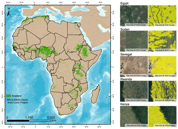
This study creates the first detailed annual maps of Africa's cropland extent from 2000 to 2022 in 30 m resolution to support global efforts against hunger and sustainable farming. Our findings show Africa's cropland grew by 8.5 % over 2 decades, while 11.5 % of cropland was abandoned by 2018, revealing hidden challenges in agricultural sustainability. These yearly field-sized maps help governments track where farming grows or shrinks, plan food supplies, and protect vital cropland.
Cited articles
Ångström, A.: The parameters of atmospheric turbidity, Tellus, 16, 64–75, https://doi.org/10.1111/j.2153-3490.1964.tb00144.x, 1964.
Anderson, G. P., Pukall, B., Allred, C. L., Jeong, L. S., Hoke, L. M., Chetwynd, J. H., Adler-Golden, S. M., Berk, A., Bernstein, L. S., Bernstein, S. C., Acharya, P. K., and Matthew, W. M.: FLAASH and MODTRAN4: state-of-the-art atmospheric correction for hyperspectral data, in: 1999 IEEE Aerosp. Conf. Proc., 4, 177–181, https://doi.org/10.1109/AERO.1999.792088, 1999.
Berk, A., Bosch, J., Hawes, F., Perkins, T., Conforti, P. F., Anderson, G. P., Kennett, R. G., and Acharya, P. K.: MODTRAN® 6.0 User's Manual, Air Force Res. Lab., 2018.
Brazile, J., Richter, R., Schläpfer, D., Schaepman, M. E., and Itten, K. I.: Cluster versus grid for operational MODTRAN-based look-up table generation of ATCOR tables, Parallel Comput., 34, 32–46, https://doi.org/10.1016/j.parco.2007.11.002, 2008.
Chen, L., Wang, R., Fei, Y., Fang, P., Zha, Y., and Chen, H.: Multi-angle aerosol optical depth retrieval method based on improved surface reflectance, Atmos. Meas. Tech., 17, 4411–4424, https://doi.org/10.5194/amt-17-4411-2024, 2024.
Doxani, G., Vermote, E. F., Roger, G. C., Skakun, S., Gascon, F., Collison, A., Keukelaere, L. D., Desjardins, C., Frantz, D., Hagolle, O., Kim, M., Louis, J., Pacifici, F., Pflug, B., Poilvé, H., Ramon, D., Richter, R., and Yin, F.: Atmospheric correction inter-comparison exercise (ACIX-II Land): An assessment of atmospheric correction processors for Landsat-8 and Sentinel-2 over land, Remote Sens. Environ., 285, 113412, https://doi.org/10.1016/j.rse.2022.113412, 2023.
Dubovik, O., Smirnov, A., Holben, B. N., King, M. D., Kaufman, Y. J., Eck, T. F., and Slutsker, I.: Accuracy assessments of aerosol optical properties retrieved from Aerosol Robotic Network (AERONET) Sun and sky radiance measurements, J. Geophys. Res.-Atmos., 105, 9791–9806, https://doi.org/10.1029/2000JD900040, 2000.
Dubovik, O., Holben, B. N., Eck, T. F., Smirnov, A., Kaufman, Y. J., King, M. D., Tanré, D., and Slutsker, I.: Variability of absorption and optical properties of key aerosol types observed in worldwide locations, J. Atmos. Sci., 59, 590–608, https://doi.org/10.1175/1520-0469(2002)059<0590:VOAAOP>2.0.CO;2, 2002.
Dwyer, J. L., Roy, D. P., Sauer, B., Jenkerson, C. B., Zhang, H. K., and Lymburner, L.: Analysis ready data: enabling analysis of the Landsat archive, Remote Sens., 10, 1363, https://doi.org/10.3390/rs10091363 , 2018.
Eck, T. F., Holben, B. N., Reid, J. S., O'Neill, N. T., Schafer, J. S., Dubovik, O., Smirnov, A., Yamasoe, M. A., and Artaxo, P.: High aerosol optical depth biomass burning events: a comparison of optical properties for different source regions, Geophys. Res. Lett., 30, https://doi.org/10.1029/2003GL017861, 2003.
Foga, S., Scaramuzza, P. L., Guo, S., Zhu, Z., Dilley, R. D., Beckmann, T., Schmidt, G. L., Dwyer, J. L., Hughes, M. J., and Laue, B.: Cloud detection algorithm comparison and validation for operational Landsat data products, Remote Sens. Environ., 194, 379–390, https://doi.org/10.1016/j.rse.2017.03.026, 2017.
Friedl, M. A., McIver, D. K., Hodges, J. C. F., Zhang, X. Y., Muchoney, D., Strahler, A. H., Woodcock, C. E., Gopal, S., Schneider, A., Cooper, A., Baccini, A., Gao, F., and Schaaf, C.: Global land cover mapping from MODIS: algorithms and early results, Remote Sens. Environ., 83, 287–302, https://doi.org/10.1016/S0034-4257(02)00078-0, 2002.
Gao, B. C., Heidebrecht, K. B., and Goetz, A. F. H.: Atmospheric removal program (ATREM) user's guide, Center Study Earth Space, Univ. Colorado, Boulder, 1992.
Gathman, S. G.: Optical properties of the marine aerosol as predicted by a BASIC version of the Navy Aerosol Model, Naval Res. Lab. Rep., 1983.
Giles, D. M., Sinyuk, A., Sorokin, M. G., Schafer, J. S., Smirnov, A., Slutsker, I., Eck, T. F., Holben, B. N., Lewis, J. R., Campbell, J. R., Welton, E. J., Korkin, S. V., and Lyapustin, A. I.: Advancements in the Aerosol Robotic Network (AERONET) Version 3 database – automated near-real-time quality control algorithm with improved cloud screening for Sun photometer aerosol optical depth (AOD) measurements, Atmos. Meas. Tech., 12, 169–209, https://doi.org/10.5194/amt-12-169-2019, 2019.
Grey, W. M. F., North, P. R. J., Los, S. O., and Mitchell, R. M.: Aerosol optical depth and land surface reflectance from multi-angle AATSR measurements, IEEE T. Geosci. Remote, 44, 2184–2197, https://doi.org/10.1109/TGRS.2006.872079, 2006.
Guanter, L., Richter, R., and Kaufmann, H.: On the application of the MODTRAN4 atmospheric radiative transfer code to optical remote sensing, Int. J. Remote Sens., 30, 1407–1424, https://doi.org/10.1080/01431160802438555, 2009.
Holben, B. N., Eck, T. F., Slutsker, I., Tanré, D., Buis, J. P., Setzer, A., Vermote, E. F., Reagan, J. A., Kaufman, Y. J., Nakajima, T., Lavenu, F., Jankowiak, I., and Smirnov, A.: AERONET – a federated instrument network and data archive for aerosol characterization, Remote Sens. Environ., 66, 1–16, https://doi.org/10.1016/S0034-4257(98)00031-5, 1998.
Hall, D. K. and Riggs, G. A.: Normalized-difference snow index (NDSI), in: Encyclopedia of Snow, Ice and Glaciers, edited by: Singh, V. P., Singh, P., and Haritashya, U. K., Springer Netherlands, Dordrecht, 779–780, https://doi.org/10.1007/978-90-481-2642-2_376, 2011.
Hsu, N. C., Jeong, M. J., Bettenhausen, C., Sayer, A. M., Hansell, M., Seftor, C. S., Huang, J., and Tsay, S. C.: Enhanced Deep Blue aerosol retrieval algorithm: the second generation, J. Geophys. Res.-Atmos., 118, 9296–9315, https://doi.org/10.1002/jgrd.50712, 2013.
Huang, W., Sun, S., Jiang, H., Gao, C., and Zong, X.: GF-2 satellite 1 m/4 m camera design and in-orbit commissioning, Chin. J. Electron., 27, 1316–1321, https://doi.org/10.1049/cje.2018.09.018, 2018.
Ichoku, C., Remer, L. A., Kaufman, Y. J., Levy, R., Chu, D. A., Tanré, D., and Holben, B. N.: MODIS observation of aerosols and estimation of aerosol radiative forcing over southern Africa during SAFARI 2000, J. Geophys. Res.-Atmos., 108, https://doi.org/10.1029/2002JD002366, 2003.
Kaufman, Y. J., Tanré, D., Remer, L. A., Vermote, E. F., Chu, A., and Holben, B. N.: Operational remote sensing of tropospheric aerosol over land from EOS moderate resolution imaging spectroradiometer, J. Geophys. Res.-Atmos., 102, 17051–17067, https://doi.org/10.1029/96JD03988, 1997.
Kottek, M., Grieser, J., Beck, C., Rudolf, B., and Rubel, F.: World Map of the Köppen–Geiger climate classification updated, Meteorol. Z., 15, 259–263, https://doi.org/10.1127/0941-2948/2006/0130, 2006.
Levy, R. C., Remer, L. A., and Dubovik, O.: Global aerosol optical properties and application to Moderate Resolution Imaging Spectroradiometer aerosol retrieval over land, J. Geophys. Res.-Atmos., 112, https://doi.org/10.1029/2006JD007815, 2007a.
Levy, R. C., Remer, L. A., Mattoo, S., Vermote, E. F., and Kaufman, Y. J.: Second-generation operational algorithm: Retrieval of aerosol properties over land from inversion of Moderate Resolution Imaging Spectroradiometer spectral reflectance, J. Geophys. Res.-Atmos., 112, https://doi.org/10.1029/2006JD007811, 2007b.
Li, Z., Xu, H., Li, K. T., Li, D. H., Xie, Y. S., Li, L., Zhang, Y., Gu, X. F., Zhao, W., Tian, Q. J., Deng, R. R., Su, X. L., Huang, B., Qiao, Y. L., Cui, W. Y., Hu, Y., Gong, C. L., Wang, Y. Q., Wang, X. F., Wang, J. P., Du, W. B., Pan, Z. Q., Li, Z. Z., and Bu, D.: Comprehensive study of optical, physical, chemical, and radiative properties of total columnar atmospheric aerosols over China: An overview of Sun–Sky Radiometer Observation Network (SONET) measurements, B. Am. Meteorol. Soc., 99, 739–755, https://doi.org/10.1175/BAMS-D-17-0133.1, 2018.
Longtin, D. R., Shettle, E. P., Hummel, J. R., and Pryce, J. D.: A wind-dependent desert aerosol model: radiative properties, Air Force Geophys. Lab., 1988.
Lu, C. and Bai, Z.: Characteristics and typical applications of GF-1 satellite, in: 2015 IEEE Int. Geosci. Remote Sens. Symp. (IGARSS), 1246–1249, https://doi.org/10.1109/IGARSS.2015.7325999, 2015.
Lyapustin, A., Wang, Y., Korkin, S., and Huang, D.: MODIS Collection 6 MAIAC algorithm, Atmos. Meas. Tech., 11, 5741–5765, https://doi.org/10.5194/amt-11-5741-2018, 2018.
Lyapustin, A., Zhao, F., and Wang, Y.: A comparison of multi-angle implementation of atmospheric correction and MOD09 daily surface reflectance products from MODIS, Front. Remote Sens., 2, 712093, https://doi.org/10.3389/frsen.2021.712093, 2021.
Maciel, D. A., Pahlevan, N., Barbosa, C. C. F., Novo, E. M. L. M., Paulino, R. S., Martins, V. S., Vermote, E. F., and Crawford, C. J.: Validity of the Landsat surface reflectance archive for aquatic science: Implications for cloud-based analysis, Limnol. Oceanogr. Lett., 8, 850–858, https://doi.org/10.1002/lol2.10344, 2023.
Mann, J., Maddox, E., Shrestha, M., Irwin, J., Czapla-Myers, J., Gerace, A., Rehman, E., Raqueno, N., Coburn, C., Byrne, G., Broomhall, M., and Walsh, A.: Landsat-8 and 9 underfly international surface reflectance validation collaboration, Remote Sens., 16, 1492, https://doi.org/10.3390/rs16091492, 2024.
Masek, J. G., Vermote, E. F., Saleous, N. E., Wolfe, R., Hall, F. G., Huemmrich, K. F., Gao, F., Kutler, J., and Lim, T. K.: A Landsat surface reflectance dataset for North America 1990–2000, IEEE Geosci. Remote S., 3, 68–72, https://doi.org/10.1109/LGRS.2005.857030, 2006.
McFeeters, S. K.: The use of the normalized difference water index (NDWI) in the delineation of open water features, Int. J. Remote Sens., 17, 1425–1432, https://doi.org/10.1080/01431169608948714, 1996.
Meghraj, K. C., Leigh, L., Pinto, C. T., and Kaewmanee, M.: Method of validating satellite surface reflectance product using empirical line method, Remote Sens., 15, 2240, https://doi.org/10.3390/rs15092240, 2023.
Miller, C. J.: Performance assessment of ACORN atmospheric correction algorithm, Proc. SPIE, 4725, 438–449, https://doi.org/10.1117/12.478777, 2002.
Mueller-Wilm, U., Devignot, O., and Pessiot, L.: Sen2Cor configuration and user manual, ESA, 2017.
Pashayi, M., Satari, M., and Momeni Shahraki, M.: Multi-layer retrieval of aerosol optical depth in the troposphere using SEVIRI data: a case study of the European continent, Atmos. Meas. Tech., 18, 1415–1439, https://doi.org/10.5194/amt-18-1415-2025, 2025.
Perkins, T., Adler-Golden, S., Cappelaere, P., and Mandl, D.: High-speed atmospheric correction for spectral image processing, Proc. SPIE, 8390, 246–252, https://doi.org/10.1117/12.918908, 2012a.
Perkins, T., Adler-Golden, S., Matthew, M. W., Berk, A., Bernstein, L. S., Lee, J., and Fox, M.: Speed and accuracy improvements in FLAASH atmospheric correction of hyperspectral imagery, Opt. Eng., 51, 111707, https://doi.org/10.1117/1.OE.51.11.111707, 2012b.
Radosavljevic, V., Vucetic, S., and Obradovic, Z.: Aerosol optical depth retrieval by neural networks ensemble with adaptive cost function, in: Proc. 10th Int. Conf. Eng. Appl. Neural Netw., 266–275, ISBN 978-960-287-093-8, 2007.
Remer, L. A. and Kaufman, Y. J.: Dynamic aerosol model: urban/industrial aerosol, J. Geophys. Res.-Atmos., 103, 13859–13871, https://doi.org/10.1029/98JD00994, 1998.
Remer, L. A., Kaufman, Y. J., Tanré, D., Mattoo, S., Chu, D. A., Martins, J. V., Li, R. R., Ichoku, C., Levy, R. C., Kleidman, R. G., Eck, T. F., Vermote, E. F., and Holben, B. N.: The MODIS aerosol algorithm, products, and validation, J. Atmos. Sci., 62, 947–973, https://doi.org/10.1175/JAS3385.1, 2005.
Richter, R. and Schläpfer, D.: Atmospheric and topographic correction (ATCOR theoretical background document), DLR IB, 1, 0564–03, 2019.
Richter, R., Louis, J., Muller-Wilm, U., Laroque, C., and Dingeldey, C.: Sentinel-2 MSI Level 2A Products Algorithm Theoretical Basis Document Issue: 2.0, ESA, 2012.
Rikimaru, A., Roy, P. S., and Miyatake, S.: Tropical forest cover density mapping, Trop. Ecol., 43, 39–47, 2002.
Rouse, J. W., Haas, R. H., Schell, J. A., and Deering, D. W.: Monitoring vegetation systems in the Great Plains with ERTS, in: Third Earth Resources Technology Satellite-1 Symposium, NASA SP-351, Vol. 1, 309–317, https://ntrs.nasa.gov/citations/19740022614 (last access: 12 August 2026), 1974.
Roy, D. P., Ju, J., Kline, K., Scaramuzza, P. L., Kovalskyy, V., Hansen, M., Loveland, T., Vermote, E. F., and Zhang, C.: Web-enabled Landsat Data (WELD): Landsat ETM+ composited mosaics of the conterminous United States, Remote Sens. Environ., 114, 35–49, https://doi.org/10.1016/j.rse.2009.08.011, 2010.
Roy, D. P., Wulder, M. A., Loveland, T. R., Woodcock, C. E., Allen, R. G., Anderson, M. C., Helder, D., Irons, J. R., Johnson, D. M., Kennedy, R., Scambos, T. A., Schaaf, C. B., Schott, J. R., Sheng, Y., Vermote, E. F., Belward, A. S., Bindschadler, R., Cohen, W. B., Gao, F., Hipple, J. D., Hostert, P., Huntington, J., Justice, C. O., Kilic, A., Kovalskyy, V., Lee, Z. P., Lymburner, L., Masek, J. G., McCorkel, J., Shuai, Y., Trezza, R., Vogelmann, J., Wynne, R. H., and Zhu, Z.: Landsat-8: science and product vision for terrestrial global change research, Remote Sens. Environ., 145, 154–172, https://doi.org/10.1016/j.rse.2014.02.001, 2014.
Satheesh, S. K. and Moorthy, K. K.: Radiative effects of natural aerosols: a review, Atmos. Environ., 39, 2089–2110, 2005.
Schläpfer, D. and Richter, R.: Geo-atmospheric processing of airborne imaging spectrometry data. Part 1: parametric orthorectification, Int. J. Remote Sens., 23, 2609–2630, https://doi.org/10.1080/01431160110115825, 2002.
She, L., Zhang, H. K., Bu, Z., Shi, Y., Yang, L., and Zhao, J.: A Deep-Neural-Network-Based Aerosol Optical Depth (AOD) Retrieval from Landsat-8 Top of Atmosphere Data, Remote Sens., 14, 1411, https://doi.org/10.3390/rs14061411, 2022.
She, L., Li, Z., Leeuw, G., Wang, W., Wang, Y., Yang, L., Feng, Z., Yang, C., and Shi, Y.: Time series retrieval of multi-wavelength aerosol optical depth by adapting Transformer (TMAT) using Himawari-8 AHI data, Remote Sens. Environ., 305, 114115, https://doi.org/10.1016/j.rse.2024.114115, 2024.
Shettle, E. P. and Fenn, R. W.: Models for the Aerosols of the Lower Atmosphere and the Effects of Humidity Variations on Their Optical Properties, Air Force Geophys. Lab., 1979.
Staenz, K. and Williams, D.: Retrieval of surface reflectance from hyperspectral data using a look-up table approach, Can. J. Remote Sens., 23, 354–368, https://doi.org/10.1080/07038992.1997.10855221, 1997.
Staenz, K., Szeredi, T., and Schwarz, J.: ISDAS – a system for processing and analyzing hyperspectral data, Can. J. Remote Sens., 24, 99–113, https://doi.org/10.1080/07038992.1998.10855230, 1998.
Superczynski, S. D., Kondragunta, S., and Lyapustin, A. I.: Evaluation of the multi-angle implementation of atmospheric correction (MAIAC) aerosol algorithm through intercomparison with VIIRS aerosol products and AERONET, J. Geophys. Res.-Atmos., 122, 3005–3022, https://doi.org/10.1002/2016JD025720, 2017.
Takamura, T., Nakajima, T., and SKYNET Community Group: Overview of SKYNET and its activities, Opt. Pura Apl., 37, 3303–3308, 2004.
Toller, G., Isaacman, A., and Kuyper, J.: MODIS Level 1B Product User's Guide for Level 1B Version 6.1.0 (Terra) and Version 6.1.1 (Aqua), NASA MCST, 2009.
Vermote, E. F. and Kotchenova, S.: Atmospheric correction for the monitoring of land surfaces, J. Geophys. Res.-Atmos., 113, https://doi.org/10.1029/2007JD009662, 2008.
Vermote, E. F. and Saleous, N.: Operational atmospheric correction of MODIS visible to middle infrared land surface data in the case of an infinite Lambertian target, Earth Sci. Satell. Remote Sens., 1, 123–153, https://doi.org/10.1007/978-3-540-37293-6_8, 2006.
Vermote, E. F. and Saleous, N.: LEDAPS surface reflectance product description, Univ. Maryland, 1–21 pp., 2007.
Vermote, E. F., Tanré, D., Deuze, J. L., Herman, M., and Morcrette, J. J.: Second Simulation of a Satellite Signal in the Solar Spectrum – Vector (6SV), Remote Sens. Environ., 58, 101–111, 1997.
Vermote, E. F., Tanré, D., Deuzé, J. L., Herman, M., Morcrette, J. J., and Kotchenova, S. Y.: Second simulation of a satellite signal in the solar spectrum – vector (6SV) user guide, version 3, Air Force Res. Lab., Hanscom AFB, MA, USA, 2006.
Vermote, E. F., Justice, C., Claverie, M., and Franch, B.: Preliminary analysis of the performance of the Landsat-8/OLI land surface reflectance product, Remote Sens. Environ., 185, 46–56, https://doi.org/10.1016/j.rse.2016.04.008, 2016.
World Meteorological Organization: Report of the expert meeting on aerosols and their climatic effects, WCP-55, Geneva, Switzerland, 1983.
World Meteorological Organization: A preliminary cloudless standard atmosphere for radiation computations, WCP-112, Geneva, Switzerland, 1986.
Zha, Y., Gao, J., and Ni, S.: Use of normalized difference built-up index in automatically mapping urban areas from TM imagery, Int. J. Remote Sens., 24, 583–594, https://doi.org/10.1080/01431160304987, 2003.
Zhang, B., Chen, Z., Peng, D., Benediktsson, J. A., Liu, B., Zou, L., Li, J., and Plaza, A.: Remotely sensed big data: evolution in model development for information extraction, Proc. IEEE, 107, 2294–2301, https://doi.org/10.1109/JPROC.2019.2948454, 2019.
Zhang, H., Yan, D., Zhang, B., Fu, Z., Li, B., and Zhang, S.: An operational atmospheric correction framework for multi-source medium-high-resolution remote sensing data of China, Remote Sens., 14, 5590, https://doi.org/10.3390/rs14215590, 2022.
Short summary
Landsat 8 images map the land but must be corrected for the atmosphere. The aerosol type assumed in this step affects accuracy. To improve this, we used Landsat 8 data from one hundred sites worldwide to compare three common assumptions. The best choice depends on the situation: one for general use and for aerosol amount, another for bright surfaces like deserts, and the standard one in some bands. The results give guidance on which to use when, so land surface maps can be more accurate.
Landsat 8 images map the land but must be corrected for the atmosphere. The aerosol type assumed...


