
Articles | Volume 19, issue 21
https://doi.org/10.5194/amt-19-7217-2026
© Author(s) 2026. This work is distributed under
the Creative Commons Attribution 4.0 License.
the Creative Commons Attribution 4.0 License.
https://doi.org/10.5194/amt-19-7217-2026
© Author(s) 2026. This work is distributed under
the Creative Commons Attribution 4.0 License.
the Creative Commons Attribution 4.0 License.
Research article
| 
12 Nov 2026
Research article |
| 12 Nov 2026
| 12 Nov 2026
Plume emission rate estimation using Gaussian plumes in remote imaging spectroscopy with SPIIRE

Jet Propulsion Laboratory, California Institute of Technology, 4800 Oak Grove Drive, Pasadena, CA 91109, USA
Philip G. Brodrick
Jet Propulsion Laboratory, California Institute of Technology, 4800 Oak Grove Drive, Pasadena, CA 91109, USA
David R. Thompson
Jet Propulsion Laboratory, California Institute of Technology, 4800 Oak Grove Drive, Pasadena, CA 91109, USA
Andrew K. Thorpe
Jet Propulsion Laboratory, California Institute of Technology, 4800 Oak Grove Drive, Pasadena, CA 91109, USA
Robert O. Green
Jet Propulsion Laboratory, California Institute of Technology, 4800 Oak Grove Drive, Pasadena, CA 91109, USA
Related authors
Daniel Cusworth, Daniel Varon, Dylan Jervis, Jason McKeever, Alexander Turner, Christian Frankenberg, John Worden, Andrew Thorpe, Jay Fahlen, Sudhanshu Pandey, Joannes Maasakkers, Ilse Aben, Annmarie Eldering, Riley Duren, Bradley Conrad, Tia Scarpelli, Daniel Bon, Mackenzie Huffman, Itziar Irakulis-Loitxate, Luis Guanter, Jason Schroeder, Benjamin Hmiel, Evan Sherwin, Sean Crowell, Eric Kort, Adam Brandt, Frances Reuland, Maryann Sargent, James East, and Daniel Jacob
EGUsphere, https://doi.org/10.5194/egusphere-2026-6060, https://doi.org/10.5194/egusphere-2026-6060, 2026
This preprint is open for discussion and under review for Atmospheric Chemistry and Physics (ACP).
Short summary
Short summary
In this review, we summarize the current and anticipated state of satellite remote sensing for point sources. In particular, we are provide and update to the fleet of point source imaging satellites, summarize the nuance around data availability and revisit, detail data processing pipelines and validation procedures, describe how to benchmark detection performance, and finally, describe demonstrated use-cases for satellite point source observations.
Brian D. Bue, Jake H. Lee, Philip G. Brodrick, Vít Růžička, Jay E. Fahlen, Andrew K. Thorpe, David R. Thompson, and Robert O. Green
EGUsphere, https://doi.org/10.5194/egusphere-2026-3851, https://doi.org/10.5194/egusphere-2026-3851, 2026
Short summary
Short summary
Imaging spectroscopy is a powerful tool for observing greenhouse gases from space. Such monitoring systems rely on the matched filter algorithm to retrieve gas concentrations. However, certain surface materials and instrument artifacts often trigger false high concentrations. We introduce the Differential Matched Filter, which corrects the mathematical ambiguities that cause these issues. This method enables the robust monitoring of methane, carbon dioxide, nitrogen dioxide, and ammonia.
Daniel Cusworth, Daniel Varon, Dylan Jervis, Jason McKeever, Alexander Turner, Christian Frankenberg, John Worden, Andrew Thorpe, Jay Fahlen, Sudhanshu Pandey, Joannes Maasakkers, Ilse Aben, Annmarie Eldering, Riley Duren, Bradley Conrad, Tia Scarpelli, Daniel Bon, Mackenzie Huffman, Itziar Irakulis-Loitxate, Luis Guanter, Jason Schroeder, Benjamin Hmiel, Evan Sherwin, Sean Crowell, Eric Kort, Adam Brandt, Frances Reuland, Maryann Sargent, James East, and Daniel Jacob
EGUsphere, https://doi.org/10.5194/egusphere-2026-6060, https://doi.org/10.5194/egusphere-2026-6060, 2026
This preprint is open for discussion and under review for Atmospheric Chemistry and Physics (ACP).
Short summary
Short summary
In this review, we summarize the current and anticipated state of satellite remote sensing for point sources. In particular, we are provide and update to the fleet of point source imaging satellites, summarize the nuance around data availability and revisit, detail data processing pipelines and validation procedures, describe how to benchmark detection performance, and finally, describe demonstrated use-cases for satellite point source observations.
Brian D. Bue, Jake H. Lee, Philip G. Brodrick, Vít Růžička, Jay E. Fahlen, Andrew K. Thorpe, David R. Thompson, and Robert O. Green
EGUsphere, https://doi.org/10.5194/egusphere-2026-3851, https://doi.org/10.5194/egusphere-2026-3851, 2026
Short summary
Short summary
Imaging spectroscopy is a powerful tool for observing greenhouse gases from space. Such monitoring systems rely on the matched filter algorithm to retrieve gas concentrations. However, certain surface materials and instrument artifacts often trigger false high concentrations. We introduce the Differential Matched Filter, which corrects the mathematical ambiguities that cause these issues. This method enables the robust monitoring of methane, carbon dioxide, nitrogen dioxide, and ammonia.
Mads Juul Ahlebæk, David R. Thompson, Regina F. Eckert, Phillip G. Brodrick, Mads Toudal Frandsen, and Robert O. Green
EGUsphere, https://doi.org/10.5194/egusphere-2026-4701, https://doi.org/10.5194/egusphere-2026-4701, 2026
Short summary
Short summary
We developed and tested a new method to improve wavelength calibration of space-based imaging sensors using naturally occurring atmospheric features. Based on nine satellite observations, we identified the most reliable calibration approach and characterized small but systematic cross-track variations in sensor response. These findings improve the accuracy of Earth observation data and support more consistent environmental monitoring from current and future satellite missions.
Patrick C. Taylor, Armin Sorooshian, Rei Ueyama, Sebastian Schmidt, Ihab Abboud, Quincy Allison, Kevin Barry, Sebastian Becker, Holly A. Bender, Joseph R. Bennett, James B. Blair, Niklas Bohn, Linette Boisvert, Matthew D. Brown, Roelof Bruintjes, Anthony Bucholtz, Megan Buzanowicz, Brian Cairns, Filippo Calì Quaglia, Eduard Chemyakin, Bo Chen, Gao Chen, Hong Chen, Yu-Wen Chen, Zezhen Cheng, Swarup China, Dan Chirica, Yonghoon Choi, Peter Colarco, Brian Collister, Ewan Crosbie, Maurice J. Cross, Janet Daniels, Paul DeMott, Joshua P. DiGangi, Alcide Giorgio di Sarra, Glenn S. Diskin, Erica K. Dolinar, Eva-Lou Edwards, Samuel Ephraim, Nikolaos Evangeliou, Romanos Foskinis, Francesca Gallo, Lan Gao, José Luis Gómez-Amo, Daisy Gonzalez, Christine Groot Zwaaftink, Pawan Gupta, Ivan Heckman, Michael Hendrickson, Miguel Ricardo A. Hilario, Ken Hirata, Michelle Hofton, Andrew L. Holen, Ulas Im, Alia L. Khan, Ralph Kahn, Alexei V. Korolev, Sonia Kreidenweis, Thomas Krumpen, Nathan Kurtz, Leslie Lait, Bradley Lamkin, Jack Landy, Nurun Nahar Lata, Paul Lawson, Samuel LeBlanc, Sean Leavor, Jing Li, Thorsten Markus, Hal Maring, Andreas H. Massling, Camille Mavis, Flynn McGinnity, Kerry Meyer, Gabriel Mojica, Richard H. Moore, Parker Morris, Giovanni Muscari, Vikas Nataraja, Amin R. Nehrir, Athanasios Nenes, Edward P. Nowottnick, Matteo Ottaviani, Chelsea Parker, Ryan Patnaude, Michael Perez, Russell J. Perkins, Colten Peterson, Alek Petty, Stevie Phothisane, Chris Polashenski, Kerri A. Pratt, Kayla M. Preisler, John Prytherch, David Rabine, Jens Redemann, Ju-Mee Ryoo, Joseph S. Schlosser, Vanessa Selimovic, Michael A. Shook, Morgan Silverman, Henrik Skov, Alexander Smirnov, Cassidy Soloff, Amy Solomon, Snorre Stamnes, Azusa Takeishi, David R. Thompson, K. Lee Thornhill, Rachel Tilling, Michael Tjernström, Monica Tosco, Pedro C. Valdelomar, David Van Gilst, Jian Wang, Zhien Wang, Andrzej Wasilewski, Manfred Wendisch, Brent Wilder, Edward L. Winstead, Albert Wu, Peng Xian, Lauren M. Zamora, Jiaoshi Zhang, Lei Zhang, Lu Zhang, Luke Ziemba, and Paquita Zuidema
Earth Syst. Sci. Data Discuss., https://doi.org/10.5194/essd-2026-241, https://doi.org/10.5194/essd-2026-241, 2026
Preprint under review for ESSD
Short summary
Short summary
This article summarizes the data sets collected during the Arctic Radiation Cloud aerosol Sea ice Interaction eXperiment (ARCSIX), NASA's most comprehensive Arctic field campaign to date. The overarching goal was to quantify the contributions of surface, clouds, aerosol particles, and precipitation to summer sea ice melt. This paper describes the ARCSIX implementation including the flight strategy, instruments, complementary data sets, access, and usage details.
Thomas Plewa, André Butz, Christian Frankenberg, Andrew K. Thorpe, and Julia Marshall
EGUsphere, https://doi.org/10.5194/egusphere-2026-2572, https://doi.org/10.5194/egusphere-2026-2572, 2026
Short summary
Short summary
In this paper, we present an improved deep learning method to estimate emissions of methane plumes from 2-D imagery. We present a new neural network architecture that provides insight into the wind speed used for the emission estimation and apply it to synthetic data that were used in previous studies. Our analysis illustrates that the performance increases by around 40% compared to the previous version, and that external wind speed data can be used to verify and improve the model's predictions.
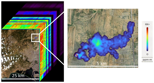
Riley Duren, Daniel Cusworth, Alana Ayasse, Katherine Howell, Alex Diamond, Tia Scarpelli, Jinsol Kim, Kelly O'neill, Judy Lai-Norling, Andrew Thorpe, Sander R. Zandbergen, Lucas Shaw, Mark Keremedjiev, Jeff Guido, Paul Giuliano, Malkam Goldstein, Ravi Nallapu, Geert Barentsen, David R. Thompson, Keely Roth, Daniel Jensen, Michael Eastwood, Frances Reuland, Taylor Adams, Adam Brandt, Eric A. Kort, James Mason, and Robert O. Green
Atmos. Meas. Tech., 18, 6933–6958, https://doi.org/10.5194/amt-18-6933-2025, https://doi.org/10.5194/amt-18-6933-2025, 2025
Short summary
Short summary
We describe the Carbon Mapper emissions monitoring system including methane and carbon dioxide observations from the constellation of Tanager hyperspectral satellites, a global monitoring strategy optimized for enabling mitigation impact at the scale of individual facilities, and a data platform that delivers timely and transparent information for diverse stakeholders. We present early findings from Tanager-1 including the use of our data to locate and repair a leaking oil and gas pipeline.
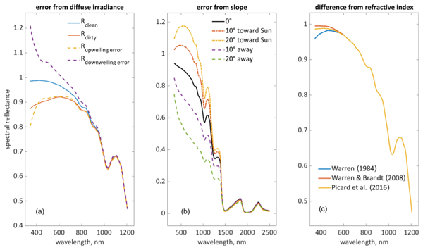
Edward H. Bair, Dar A. Roberts, David R. Thompson, Philip G. Brodrick, Brenton A. Wilder, Niklas Bohn, Christopher J. Crawford, Nimrod Carmon, Carrie M. Vuyovich, and Jeff Dozier
The Cryosphere, 19, 2315–2320, https://doi.org/10.5194/tc-19-2315-2025, https://doi.org/10.5194/tc-19-2315-2025, 2025
Short summary
Short summary
Key to the success of future satellite missions is understanding snowmelt in our warming climate, as this has implications for nearly 2 billion people. An obstacle is that an artifact, called the hook, is often mistaken for soot or dust. Instead, it is caused by three amplifying effects: (1) background reflectance that is too dark, (2) an assumption of level terrain, and (3) differences in optical constants of ice. Sensor calibration and directional effects may also contribute. Solutions are presented.
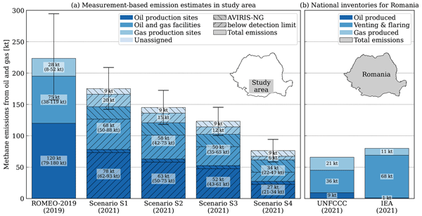
Gerrit Kuhlmann, Foteini Stavropoulou, Stefan Schwietzke, Daniel Zavala-Araiza, Andrew Thorpe, Andreas Hueni, Lukas Emmenegger, Andreea Calcan, Thomas Röckmann, and Dominik Brunner
Atmos. Chem. Phys., 25, 5371–5385, https://doi.org/10.5194/acp-25-5371-2025, https://doi.org/10.5194/acp-25-5371-2025, 2025
Short summary
Short summary
A measurement campaign in 2019 found that methane emissions from oil and gas in Romania were significantly higher than reported. In 2021, our follow-up campaign using airborne remote sensing showed a marked decreases in emissions by 20 %–60 % due to improved infrastructure. The study highlights the importance of measurement-based emission monitoring and illustrates the value of a multi-scale assessment integrating ground-based observations with large-scale airborne remote sensing campaigns.

Niklas Bohn, Edward H. Bair, Philip G. Brodrick, Nimrod Carmon, Robert O. Green, Thomas H. Painter, and David R. Thompson
The Cryosphere, 19, 1279–1302, https://doi.org/10.5194/tc-19-1279-2025, https://doi.org/10.5194/tc-19-1279-2025, 2025
Short summary
Short summary
A new type of Earth-observing satellite is measuring reflected sunlight in all its colors. These measurements can be used to characterize snow properties, which give us important information about climate change. In our work, we emphasize the difficulties of obtaining these properties from rough mountainous regions and present a solution to the problem. Our research was inspired by the growing number of new satellite technologies and the increasing challenges associated with climate change.
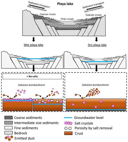
Adolfo González-Romero, Cristina González-Flórez, Agnesh Panta, Jesús Yus-Díez, Patricia Córdoba, Andres Alastuey, Natalia Moreno, Melani Hernández-Chiriboga, Konrad Kandler, Martina Klose, Roger N. Clark, Bethany L. Ehlmann, Rebecca N. Greenberger, Abigail M. Keebler, Phil Brodrick, Robert Green, Paul Ginoux, Xavier Querol, and Carlos Pérez García-Pando
Atmos. Chem. Phys., 24, 9155–9176, https://doi.org/10.5194/acp-24-9155-2024, https://doi.org/10.5194/acp-24-9155-2024, 2024
Short summary
Short summary
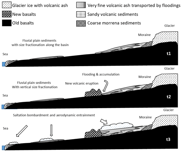
In this research, we studied the dust-emitting properties of crusts and aeolian ripples from the Mojave Desert. These properties are key to understanding the effect of dust upon climate. We found two different playa lakes according to the groundwater regime, which implies differences in crusts' cohesion state and mineralogy, which can affect the dust emission potential and properties. We also compare them with Moroccan Sahara crusts and Icelandic top sediments.
Adolfo González-Romero, Cristina González-Flórez, Agnesh Panta, Jesús Yus-Díez, Patricia Córdoba, Andres Alastuey, Natalia Moreno, Konrad Kandler, Martina Klose, Roger N. Clark, Bethany L. Ehlmann, Rebecca N. Greenberger, Abigail M. Keebler, Phil Brodrick, Robert O. Green, Xavier Querol, and Carlos Pérez García-Pando
Atmos. Chem. Phys., 24, 6883–6910, https://doi.org/10.5194/acp-24-6883-2024, https://doi.org/10.5194/acp-24-6883-2024, 2024
Short summary
Short summary
The knowledge of properties from dust emitted in high latitudes such as in Iceland is scarce. This study focuses on the particle size, mineralogy, cohesion, and iron mode of occurrence and reflectance spectra of dust-emitting sediments. Icelandic top sediments have lower cohesion state, coarser particle size, distinctive mineralogy, and 3-fold bulk Fe content, with a large presence of magnetite compared to Saharan crusts.

Alana K. Ayasse, Daniel Cusworth, Kelly O'Neill, Justin Fisk, Andrew K. Thorpe, and Riley Duren
Atmos. Meas. Tech., 16, 6065–6074, https://doi.org/10.5194/amt-16-6065-2023, https://doi.org/10.5194/amt-16-6065-2023, 2023
Short summary
Short summary
Methane is a powerful greenhouse gas, and a significant portion of methane comes from large individual plumes. Recently, airplane-mounted infrared technologies have proven very good at detecting and quantifying these plumes. In order to extract the methane signal from the infrared image, there are two widely used approaches. In this study, we assess the performance of both approaches using controlled-release experiments. We also examine the minimum detection limit of the infrared technology.
Daniel H. Cusworth, Andrew K. Thorpe, Charles E. Miller, Alana K. Ayasse, Ralph Jiorle, Riley M. Duren, Ray Nassar, Jon-Paul Mastrogiacomo, and Robert R. Nelson
Atmos. Chem. Phys., 23, 14577–14591, https://doi.org/10.5194/acp-23-14577-2023, https://doi.org/10.5194/acp-23-14577-2023, 2023
Short summary
Short summary
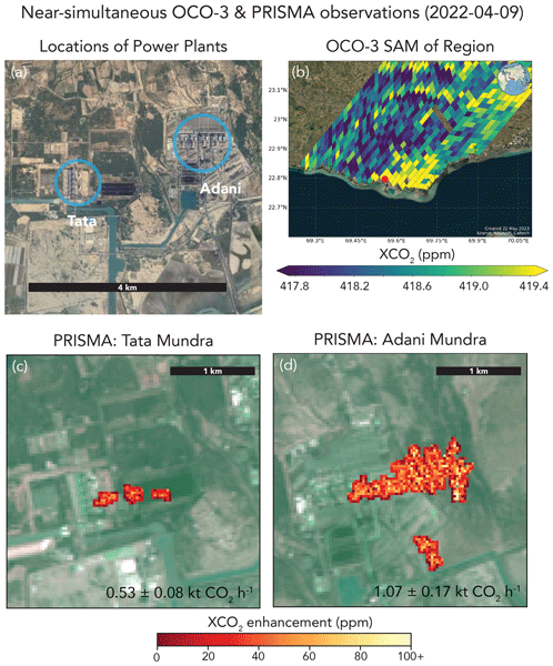
Carbon dioxide (CO2) emissions from combustion sources are uncertain in many places across the globe. Satellites have the ability to detect and quantify emissions from large CO2 point sources, including coal-fired power plants. In this study, we tasked two satellites to routinely observe CO2 emissions at 30 coal-fired power plants between 2021 and 2022. These results present the largest dataset of space-based CO2 emission estimates to date.
María Gonçalves Ageitos, Vincenzo Obiso, Ron L. Miller, Oriol Jorba, Martina Klose, Matt Dawson, Yves Balkanski, Jan Perlwitz, Sara Basart, Enza Di Tomaso, Jerónimo Escribano, Francesca Macchia, Gilbert Montané, Natalie M. Mahowald, Robert O. Green, David R. Thompson, and Carlos Pérez García-Pando
Atmos. Chem. Phys., 23, 8623–8657, https://doi.org/10.5194/acp-23-8623-2023, https://doi.org/10.5194/acp-23-8623-2023, 2023
Short summary
Short summary
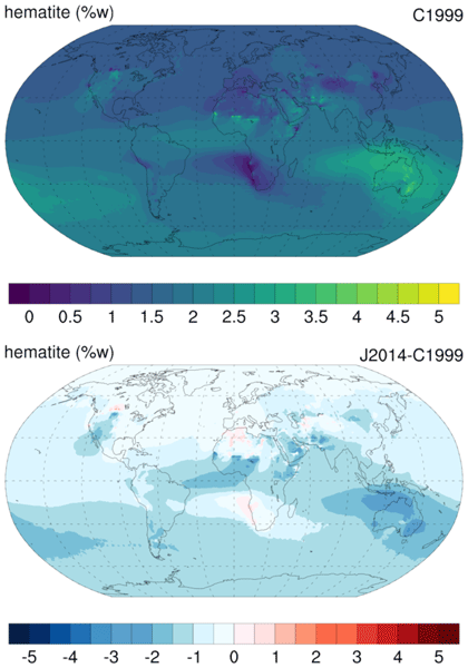
Dust aerosols affect our climate differently depending on their mineral composition. We include dust mineralogy in an atmospheric model considering two existing soil maps, which still have large associated uncertainties. The soil data and the distribution of the minerals in different aerosol sizes are key to our model performance. We find significant regional variations in climate-relevant variables, which supports including mineralogy in our current models and the need for improved soil maps.
Broghan M. Erland, Cristen Adams, Andrea Darlington, Mackenzie L. Smith, Andrew K. Thorpe, Gregory R. Wentworth, Steve Conley, John Liggio, Shao-Meng Li, Charles E. Miller, and John A. Gamon
Atmos. Meas. Tech., 15, 5841–5859, https://doi.org/10.5194/amt-15-5841-2022, https://doi.org/10.5194/amt-15-5841-2022, 2022
Short summary
Short summary
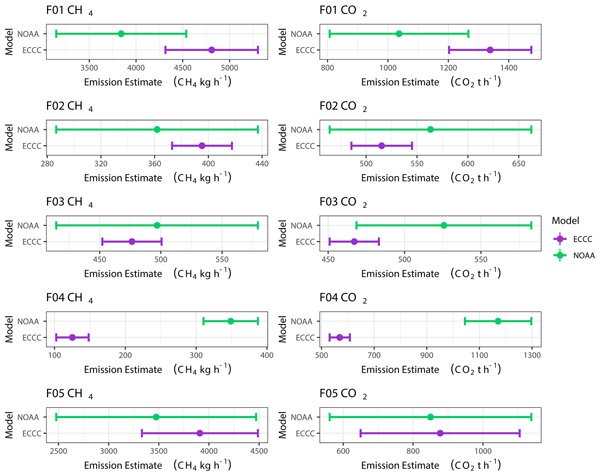
Accurately estimating greenhouse gas (GHG) emissions is essential to reaching net-zero goals to combat the climate crisis. Airborne box-flights are ideal for assessing regional GHG emissions, as they can attain small error. We compare two box-flight algorithms and found they produce similar results, but daily variability must be considered when deriving emissions inventories. Increasing the consistency and agreement between airborne methods moves us closer to achieving more accurate estimates.
Daniel J. Jacob, Daniel J. Varon, Daniel H. Cusworth, Philip E. Dennison, Christian Frankenberg, Ritesh Gautam, Luis Guanter, John Kelley, Jason McKeever, Lesley E. Ott, Benjamin Poulter, Zhen Qu, Andrew K. Thorpe, John R. Worden, and Riley M. Duren
Atmos. Chem. Phys., 22, 9617–9646, https://doi.org/10.5194/acp-22-9617-2022, https://doi.org/10.5194/acp-22-9617-2022, 2022
Short summary
Short summary
We review the capability of satellite observations of atmospheric methane to quantify methane emissions on all scales. We cover retrieval methods, precision requirements, inverse methods for inferring emissions, source detection thresholds, and observations of system completeness. We show that current instruments already enable quantification of regional and national emissions including contributions from large point sources. Coverage and resolution will increase significantly in coming years.

Mark T. Richardson, David R. Thompson, Marcin J. Kurowski, and Matthew D. Lebsock
Atmos. Meas. Tech., 15, 117–129, https://doi.org/10.5194/amt-15-117-2022, https://doi.org/10.5194/amt-15-117-2022, 2022
Short summary
Short summary
Sunlight can pass diagonally through the atmosphere, cutting through the 3-D water vapour field in a way that
smears2-D maps of imaging spectroscopy vapour retrievals. In simulations we show how this smearing is
towardsor
away fromthe Sun, so calculating
across the solar direction allows sub-kilometre information about water vapour's spatial scaling to be calculated. This could be tested by airborne campaigns and used to obtain new information from upcoming spaceborne data products.
Siraput Jongaramrungruang, Georgios Matheou, Andrew K. Thorpe, Zhao-Cheng Zeng, and Christian Frankenberg
Atmos. Meas. Tech., 14, 7999–8017, https://doi.org/10.5194/amt-14-7999-2021, https://doi.org/10.5194/amt-14-7999-2021, 2021
Short summary
Short summary
This study shows how precision error and bias in column methane retrieval change with different instrument specifications and the impact of spectrally complex surface albedos on retrievals. We show how surface interferences can be mitigated with an optimal spectral resolution and a higher polynomial degree in a retrieval process. The findings can inform future satellite instrument designs to have robust observations capable of separating real CH4 plume enhancements from surface interferences.
Cited articles
Ayasse, A. K., Cusworth, D., O'Neill, K., Fisk, J., Thorpe, A. K., and Duren, R.: Performance and sensitivity of column-wise and pixel-wise methane retrievals for imaging spectrometers, Atmos. Meas. Tech., 16, 6065–6074, https://doi.org/10.5194/amt-16-6065-2023, 2023. a
Blondel, M., Berthet, Q., Cuturi, M., Frostig, R., Hoyer, S., Llinares-López, F., Pedregosa, F., and Vert, J.-P.: Efficient and Modular Implicit Differentiation, arXiv [preprint], arXiv:2105.15183, 2021. a
Brodrick, P. G., Thorpe, A. K., Fahlen, J., and Thompson, D. R.: EMIT Greenhouse Gas Algorithms: Greenhouse Gas Point Source Mapping and Related Products, Algorithm Theoretical Basis Document, Tech. rep., NASA Earth Surface Mineral Dust Source Investigation (EMIT), https://github.com/emit-sds/emit-sds-tgp/blob/develop/docs/EMIT_L2B_TRACE_GAS_ATBD.md (last access: 17 March 2026), 2026. a, b, c, d, e, f, g, h, i
Carrascal, M. D., Puigcerver, M., and Puig, P.: Sensitivity of Gaussian plume model to dispersion specifications, Theor. Appl. Climatol., 48, 147–157, https://doi.org/10.1007/BF00864921, 1993. a, b, c
Chlus, A. M., Brodrick, P. G., Thorpe, A. K., Chapman, J. W., Jensen, D. J., Coleman, R. W., Fahlen, J., Olson-Duvall, W., Thompson, D. R., and Green, R. O.: AVIRIS-3 L2B Greenhouse Gas Enhancements, Facility Instrument Collection, ORNL Distributed Active Archive Center [data set], https://doi.org/10.3334/ORNLDAAC/2358, 2024. a, b
Coleman, R. W., Thorpe, A. K., Brodrick, P. G., Chlus, A., Fahlen, J. E., Bue, B., Chapman, J., Eckert, R. F., Jensen, D. J., Eastwood, M. L., Thompson, D. R., Elder, C. D., Beltran, S. G., Amezquita, D. R., Hopkins, F., and Green, R. O.: Identifying and quantifying greenhouse gas emissions with the AVIRIS-3 airborne imaging spectrometer, Remote Sens. Environ., 332, 115058, https://doi.org/10.1016/j.rse.2025.115058, 2026. a
Cusworth, D. H., Duren, R. M., Ayasse, A. K., Jiorle, R., Howell, K., Aubrey, A., Green, R. O., Eastwood, M. L., Chapman, J. W., Thorpe, A. K., Heckler, J., Asner, G. P., Smith, M. L., Thoma, E., Krause, M. J., Heins, D., and Thorneloe, S.: Quantifying methane emissions from United States landfills, Science, 383, 1499–1504, https://doi.org/10.1126/science.adi7735, 2024. a, b, c, d
Dowell, D. C., Alexander, C. R., James, E. P., Weygandt, S. S., Benjamin, S. G., Manikin, G. S., Blake, B. T., Brown, J. M., Olson, J. B., Hu, M., Smirnova, T. G., Ladwig, T., Kenyon, J. S., Ahmadov, R., Turner, D. D., Duda, J. D., and Alcott, T. I.: The High-Resolution Rapid Refresh (HRRR): An Hourly Updating Convection-Allowing Forecast Model. Part I: Motivation and System Description, Weather Forecast., 37, 1371–1395, https://doi.org/10.1175/waf-d-21-0151.1, 2022. a
Duren, R., Cusworth, D., Ayasse, A., Howell, K., Diamond, A., Scarpelli, T., Kim, J., O'neill, K., Lai-Norling, J., Thorpe, A., Zandbergen, S. R., Shaw, L., Keremedjiev, M., Guido, J., Giuliano, P., Goldstein, M., Nallapu, R., Barentsen, G., Thompson, D. R., Roth, K., Jensen, D., Eastwood, M., Reuland, F., Adams, T., Brandt, A., Kort, E. A., Mason, J., and Green, R. O.: The Carbon Mapper emissions monitoring system, Atmos. Meas. Tech., 18, 6933–6958, https://doi.org/10.5194/amt-18-6933-2025, 2025. a, b, c, d
Duren, R. M., Thorpe, A. K., Foster, K. T., Rafiq, T., Hopkins, F. M.,Yadav, V., Bue, B. D., Thompson, D. R., Conley, S., Colombi, N. K., Frankenberg, C., McCubbin, I. B., Eastwood, M. L., Falk, M., Herner, J. D., Croes, B. E., Green, R. O., and Miller, C. E.: California's methane super-emitters, Nature, 575, 180–184, 2019. a, b
Eastwood, M. L., Thompson, D. R., Green, R. O., Fahlen, J. E., Adams, T. J., Brandt, A. R., Brodrick, P. G., Chlus, A., Kort, E. A., Reuland, F., and Thorpe, A. K.: Direct measurement of plume velocity to characterize point source emissions, P. Natl. Acad. Sci. USA, 122, e2507350122, https://doi.org/10.1073/pnas.2507350122, 2025. a
El Abbadi, S. H., Chen, Z., Burdeau, P. M., Rutherford, J. S., Chen, Y., Zhang, Z., Sherwin, E. D., and Brandt, A. R.: Technological maturity of aircraft-based methane sensing for greenhouse gas mitigation, Environ. Sci. Technol., 58, 9591–9600, 2024. a
Fahlen, J. E., Brodrick, P. G., Coleman, R. W., Elder, C. D., Thompson, D. R., Thorpe, A. K., Green, R. O., Green, J. J., Lopez, A. M., and Xiang, C.: Sensitivity and Uncertainty in Matched-Filter-Based Gas Detection With Imaging Spectroscopy, IEEE T. Geosci. Remote, 62, 1–10, https://doi.org/10.1109/TGRS.2024.3440174, 2024. a, b, c, d
Fahlen, J. E., Brodrick, P. G., Thompson, D. R., Thorpe, A. K., and Green, R. O.: SPIIRE (Version v0.0.0), Zenodo [code], https://doi.org/10.5281/zenodo.24120950, 2026. a
Fioletov, V. E., McLinden, C. A., Krotkov, N., and Li, C.: Lifetimes and emissions of SO2 from point sources estimated from OMI, Geophys. Res. Lett., 42, 1969–1976, https://doi.org/10.1002/2015GL063148, 2015. a
Frankenberg, C., Thorpe, A. K., Thompson, D. R., Hulley, G.,Kort, E. A., Vance, N., Borchardt, J., Krings, T., Gerilowski, K., Sweeney, C., Conley, S., Bue, B. D., Aubrey, A. D., Hook, S., and Green, R. O.: Airborne methane remote measurements reveal heavy-tail flux distribution in Four Corners region, P. Natl. Acad. Sci. USA, 113, 9734–9739, 2016. a
Gałkowski, M., Marshall, J., Fuentes Andrade, B., and Gerbig, C.: Impact of atmospheric turbulence on the accuracy of point source emission estimates using satellite imagery, Atmos. Chem. Phys., 25, 13831–13848, https://doi.org/10.5194/acp-25-13831-2025, 2025. a
Gorroño, J., Pei, Z., Valverde, A., and Guanter, L.: Considering the observation and illumination angular configuration for an improved detection and quantification of methane emissions, Atmos. Meas. Tech., 19, 1245–1257, https://doi.org/10.5194/amt-19-1245-2026, 2026. a, b, c, d
Green, R. O., Mahowald, N., Thompson, D. R., Ung, C., Brodrick, P., Pollock, R., Bennett, M., Lundeen, S., Joyce, M., Olson-Duvall, W., Oaida, B., Bradley, C., Diaz, E., Clark, R., Vannan, S., Swayze, G., Kokaly, R., Ginoux, P., Miller, R., Okin, G., Garcia-Pando, C. P., Ehlmann, B., Kalashnikova, O., Painter, T. H., Realmuto, V., Chadwick, D., Ben-Dor, E., Pearlshtien, D. H., Guanter, L., Phillips, B., Reath, K., Thorpe, A., Shaw, L., Keebler, A., Ochoa, F., Grant, K., Sen, A., Duren, R., Obiso, V., Gonçalves-Ageitos, M., and Huang, Y.: Performance and Early Results from the Earth Surface Mineral Dust Source Investigation (EMIT) Imaging Spectroscopy Mission, in: 2023 IEEE Aerospace Conference, pp. 1–10, https://doi.org/10.1109/AERO55745.2023.10115851, 2023. a
Guanter, L., Irakulis-Loitxate, I., Gorroño, J., Sánchez-García, E., Cusworth, D. H., Varon, D. J., Cogliati, S., and Colombo, R.: Mapping methane point emissions with the PRISMA spaceborne imaging spectrometer, Remote Sens. Environ., 265, 112671, https://doi.org/10.1016/j.rse.2021.112671, 2021. a
Hersbach, H., Bell, B., Berrisford, P., Hirahara, S., Horányi, A., Muñoz-Sabater, J., Nicolas, J., Peubey, C., Radu, R., Schepers, D., Simmons, A., Soci, C., Abdalla, S., Abellan, X., Balsamo, G., Bechtold, P., Biavati, G., Bidlot, J., Bonavita, M., De Chiara, G., Dahlgren, P., Dee, D., Diamantakis, M., Dragani, R., Flemming, J., Forbes, R., Fuentes, M., Geer, A., Haimberger, L., Healy, S., Hogan, R. J., Hólm, E., Janisková, M., Keeley, S., Laloyaux, P., Lopez, P., Lupu, C., Radnoti, G., de Rosnay, P., Rozum, I., Vamborg, F., Villaume, S., and Thépaut, J.-N.: The ERA5 global reanalysis, Q. J. Roy. Meteor. Soc., 146, 1999–2049, https://doi.org/10.1002/qj.3803, 2020. a
Irakulis-Loitxate, I., Guanter, L., Liu, Y.-N., Varon, D. J., Maasakkers, J. D., Zhang, Y., Chulakadabba, A., Wofsy, S. C., Thorpe, A. K., Duren, R. M., Frankenberg, C., Lyon, D. R., Hmiel, B., Cusworth, D. H., Zhang, Y., Segl, K., Gorroño, J., Sánchez-García, E., Sulprizio, M. P., Cao, K., Zhu, H., Liang, J., Li, X., Aben, I., and Jacob, D. J.: Satellite-based survey of extreme methane emissions in the Permian basin, Science Advances, 7, eabf4507, https://doi.org/10.1126/sciadv.abf4507, 2021. a
Jacob, D. J., Varon, D. J., Cusworth, D. H., Dennison, P. E., Frankenberg, C., Gautam, R., Guanter, L., Kelley, J., McKeever, J., Ott, L. E., Poulter, B., Qu, Z., Thorpe, A. K., Worden, J. R., and Duren, R. M.: Quantifying methane emissions from the global scale down to point sources using satellite observations of atmospheric methane, Atmos. Chem. Phys., 22, 9617–9646, https://doi.org/10.5194/acp-22-9617-2022, 2022. a
Jongaramrungruang, S., Thorpe, A. K., Matheou, G., and Frankenberg, C.: MethaNet – An AI-driven approach to quantifying methane point-source emission from high-resolution 2-D plume imagery, Remote Sens. Environ., 269, 112809, https://doi.org/10.1016/j.rse.2021.112809, 2022. a
Kim, J., Cusworth, D. H., Ayasse, A. K., Howell, K., O'Neill, K., and Duren, R. M.: Performance of Airborne Imaging Spectrometers for Carbon Dioxide Detection and Emission Quantification, J. Geophys. Res.-Atmos., 130, e2024JD042755, https://doi.org/10.1029/2024JD042755, 2025. a
Krings, T., Gerilowski, K., Buchwitz, M., Reuter, M., Tretner, A., Erzinger, J., Heinze, D., Pflüger, U., Burrows, J. P., and Bovensmann, H.: MAMAP – a new spectrometer system for column-averaged methane and carbon dioxide observations from aircraft: retrieval algorithm and first inversions for point source emission rates, Atmos. Meas. Tech., 4, 1735–1758, https://doi.org/10.5194/amt-4-1735-2011, 2011. a
Kuhlmann, G., Koene, E., Meier, S., Santaren, D., Broquet, G., Chevallier, F., Hakkarainen, J., Nurmela, J., Amorós, L., Tamminen, J., and Brunner, D.: The ddeq Python library for point source quantification from remote sensing images (version 1.0), Geosci. Model Dev., 17, 4773–4789, https://doi.org/10.5194/gmd-17-4773-2024, 2024. a, b, c
Li, F., Lin, K., Yan, Y., Bai, S., Huang, Q., Feng, C., Sun, S., Zhao, S., Zhou, W., Zhou, C., Lin, J., Zhang, X., and Zhang, Y.: Comparing the performance of different hyperspectral satellite imaging spectroscopy in mapping methane point-source emissions, Remote Sens. Environ., 334, 115224, https://doi.org/10.1016/j.rse.2025.115224, 2026. a
Maasakkers, J. D., Varon, D. J., Elfarsdóttir, A., McKeever, J., Jervis, D., Mahapatra, G., Pandey, S., Lorente, A., Borsdorff, T., Foorthuis, L. R., Schuit, B. J., Tol, P., van Kempen, T. A., van Hees, R., and Aben, I.: Using satellites to uncover large methane emissions from landfills, Science Advances, 8, eabn9683, https://doi.org/10.1126/sciadv.abn9683, 2022. a
Marjani, M., Mohammadimanesh, F., Varon, D. J., Radman, A., and Mahdianpari, M.: PRISMethaNet: A novel deep learning model for landfill methane detection using PRISMA satellite data, ISPRS J. Photogramm., 218, 802–818, https://doi.org/10.1016/j.isprsjprs.2024.10.003, 2024. a
Nassar, R., Mastrogiacomo, J.-P., Bateman-Hemphill, W., McCracken, C., MacDonald, C. G., Hill, T., O'Dell, C. W., Kiel, M., and Crisp, D.: Advances in quantifying power plant CO2 emissions with OCO-2, Remote Sens. Environ., 264, 112579, https://doi.org/10.1016/j.rse.2021.112579, 2021. a, b
Pang, Y., Tian, L., Hu, D., Gao, S., and Liu, G.: Separating and quantifying facility-level methane emissions with overlapping plumes for spaceborne methane monitoring, Atmos. Meas. Tech., 18, 455–470, https://doi.org/10.5194/amt-18-455-2025, 2025. a, b, c
Reuland, F. E., Adams, T., Sherwin, E. D., El Abbadi, S. H., Kort, E. A, and Brandt, A. R.: Evaluating space-based methane detection through a one-year blind test, Nature, 658, 673–681, https://doi.org/10.1038/s41586-026-11115-0, 2026. a
Roberts, C., Maasakkers, J. D., de Jong, T. A., Schuit, B. J., Sharma, S., Huegens, T., van den Berg, A.-W., Houweling, S., and Aben, I.: Machine learning-based emission rate estimates of global methane super-emissions, Atmos. Meas. Tech., 19, 5659–5682, https://doi.org/10.5194/amt-19-5659-2026, 2026. a
Roger, J., Irakulis-Loitxate, I., Valverde, A., Gorroño, J., Chabrillat, S., Brell, M., and Guanter, L.: High-Resolution Methane Mapping With the EnMAP Satellite Imaging Spectroscopy Mission, IEEE T. Geosci. Remote, 62, 1–12, https://doi.org/10.1109/TGRS.2024.3352403, 2024. a
Sánchez-García, E., Gorroño, J., Irakulis-Loitxate, I., Varon, D. J., and Guanter, L.: Mapping methane plumes at very high spatial resolution with the WorldView-3 satellite, Atmos. Meas. Tech., 15, 1657–1674, https://doi.org/10.5194/amt-15-1657-2022, 2022. a, b, c
Shah, A., Allen, G., Pitt, J. R., Ricketts, H., Williams, P. I., Helmore, J., Finlayson, A., Robinson, R., Kabbabe, K., Hollingsworth, P., Rees-White, T. C., Beaven, R., Scheutz, C., and Bourn, M.: A near-field Gaussian plume inversion flux quantification method, applied to unmanned aerial vehicle sampling, Atmosphere, 10, 396, https://doi.org/10.3390/atmos10070396, 2019. a
Thompson, D., Thorpe, A., Frankenberg, C., Green, R., Duren, R., Guanter, L., Hollstein, A., Middleton, E., Ong, L., and Ungar, S.: Space-based remote imaging spectroscopy of the Aliso Canyon CH4 superemitter, Geophys. Res. Lett., 43, 6571–6578, 2016. a
Thompson, D. R., Leifer, I., Bovensmann, H., Eastwood, M., Fladeland, M., Frankenberg, C., Gerilowski, K., Green, R. O., Kratwurst, S., Krings, T., Luna, B., and Thorpe, A. K.: Real-time remote detection and measurement for airborne imaging spectroscopy: a case study with methane, Atmos. Meas. Tech., 8, 4383–4397, https://doi.org/10.5194/amt-8-4383-2015, 2015. a
Thorpe, A., Brodrick, P., Chadwick, D., Lopez, A., Villanueva-Weeks, C., Fahlen, J., Jensen, D., Bender, H., Vinckier, Q., Xiang, C., Olson-Duvall, W., Chlus, A., Lundeen, S., Thompson, D., and Green, R.: EMIT L2B Methane Enhancement Data 60 m V002, NASA Land Processes Distributed Active Archive Center [data set], https://doi.org/10.5067/EMIT/EMITL2BCH4ENH.002, 2025. a, b, c, d
Thorpe, A. K., Roberts, D. A., Bradley, E. S., Funk, C. C., Dennison, P. E., and Leifer, I.: High resolution mapping of methane emissions from marine and terrestrial sources using a Cluster-Tuned Matched Filter technique and imaging spectrometry, Remote Sens. Environ., 134, 305–318, https://doi.org/10.1016/j.rse.2013.03.018, 2013. a
Thorpe, A. K., Frankenberg, C., Thompson, D. R., Duren, R. M., Aubrey, A. D., Bue, B. D., Green, R. O., Gerilowski, K., Krings, T., Borchardt, J., Kort, E. A., Sweeney, C., Conley, S., Roberts, D. A., and Dennison, P. E.: Airborne DOAS retrievals of methane, carbon dioxide, and water vapor concentrations at high spatial resolution: application to AVIRIS-NG, Atmos. Meas. Tech., 10, 3833–3850, https://doi.org/10.5194/amt-10-3833-2017, 2017. a
Thorpe, A. K., O'Handley, C., Emmitt, G. D., DeCola, P. L., Hopkins, F. M., Yadav, V., Guha, A., Newman, S., Herner, J. D., Falk, M., and Duren, R. M.: Improved methane emission estimates using AVIRIS-NG and an Airborne Doppler Wind Lidar, Remote Sens. Environ., 266, 112681, https://doi.org/10.1016/j.rse.2021.112681, 2021. a
Thorpe, A. K., Green, R. O., Thompson, D. R., Brodrick, P. G., Chapman, J. W., Elder, C. D., Irakulis-Loitxate, I., Cusworth, D. H., Ayasse, A. K., Duren, R. M., Frankenberg, C., Guanter, L., Worden, J. R., Dennison, P. E., Roberts, D. A., Chadwick, K. D., Eastwood, M. L., Fahlen, J. E., and Miller, C. E.: Attribution of individual methane and carbon dioxide emission sources using EMIT observations from space, Science Advances, 9, eadh2391, https://doi.org/10.1126/sciadv.adh2391, 2023. a, b
Van Trees, H. L.: Detection, Estimation, and Modulation Theory, Part I: Detection, Estimation, and Linear Modulation Theory, John Wiley & Sons, ISBN 978-0-471-46382-5, 2004. a
Varon, D. J., Jacob, D. J., McKeever, J., Jervis, D., Durak, B. O. A., Xia, Y., and Huang, Y.: Quantifying methane point sources from fine-scale satellite observations of atmospheric methane plumes, Atmos. Meas. Tech., 11, 5673–5686, https://doi.org/10.5194/amt-11-5673-2018, 2018. a, b, c, d
Varon, D. J., Jacob, D. J., Jervis, D., and McKeever, J.: Quantifying Time-Averaged Methane Emissions from Individual Coal Mine Vents with GHGSat-D Satellite Observations, Environ. Sci. Technol., 54, 10246–10253, https://doi.org/10.1021/acs.est.0c01213, pMID: 32672947, 2020. a
Zhang, X., Maasakkers, J. D., Roger, J., Guanter, L., Sharma, S., Lama, S., Tol, P., Varon, D. J., Cusworth, D. H., Howell, K., Thorpe, A. K., Brodrick, P. G., and Aben, I.: Global Identification of Solid Waste Methane Super Emitters Using Hyperspectral Satellites, Environ. Sci. Technol., 59, 18134–18145, https://doi.org/10.1021/acs.est.4c14196, pMID: 40827757, 2025. a, b
Short summary
This paper introduces a new method called SPIIRE (Statistical Plume Imaging Inversion for Rate Estimation) to more accurately measure gas emission rates, like methane, using satellite imaging. Past methods often relied on human operators and were therefore error prone. Instead, SPIIRE uses a statistical method that matches data to a flexible plume model, enabling rate estimates for complex plumes. SPIIRE shows good performance on real data including point sources, overlapping plumes, and wide area sources like landfills.
This paper introduces a new method called SPIIRE (Statistical Plume Imaging Inversion for Rate...


Altmetrics
Final-revised paper
Preprint