
Articles | Volume 19, issue 17
https://doi.org/10.5194/amt-19-5785-2026
© Author(s) 2026. This work is distributed under
the Creative Commons Attribution 4.0 License.
the Creative Commons Attribution 4.0 License.
https://doi.org/10.5194/amt-19-5785-2026
© Author(s) 2026. This work is distributed under
the Creative Commons Attribution 4.0 License.
the Creative Commons Attribution 4.0 License.
Research article
| 
14 Sep 2026
Research article |
| 14 Sep 2026
| 14 Sep 2026
Cloud height mapping using multi simultaneous sky images from an all-sky camera network
Celia Herrero del Barrio
CORRESPONDING AUTHOR

Group of Atmospheric Optics (GOA-UVa), Universidad de Valladolid, 47011, Valladolid, Spain
Laboratory of Disruptive Interdisciplinary Science (LaDIS), Valladolid, Spain
Roberto Román
Group of Atmospheric Optics (GOA-UVa), Universidad de Valladolid, 47011, Valladolid, Spain
Laboratory of Disruptive Interdisciplinary Science (LaDIS), Valladolid, Spain
Sara Herrero-Anta
Group of Atmospheric Optics (GOA-UVa), Universidad de Valladolid, 47011, Valladolid, Spain
Laboratory of Disruptive Interdisciplinary Science (LaDIS), Valladolid, Spain
Daniel González-Fernández
Group of Atmospheric Optics (GOA-UVa), Universidad de Valladolid, 47011, Valladolid, Spain
Laboratory of Disruptive Interdisciplinary Science (LaDIS), Valladolid, Spain
Rogelio Carracedo
Group of Atmospheric Optics (GOA-UVa), Universidad de Valladolid, 47011, Valladolid, Spain
Laboratory of Disruptive Interdisciplinary Science (LaDIS), Valladolid, Spain
Ramiro González
Group of Atmospheric Optics (GOA-UVa), Universidad de Valladolid, 47011, Valladolid, Spain
Laboratory of Disruptive Interdisciplinary Science (LaDIS), Valladolid, Spain
Javier Gatón
Group of Atmospheric Optics (GOA-UVa), Universidad de Valladolid, 47011, Valladolid, Spain
Laboratory of Disruptive Interdisciplinary Science (LaDIS), Valladolid, Spain
Bruno Longarela
Group of Atmospheric Optics (GOA-UVa), Universidad de Valladolid, 47011, Valladolid, Spain
Laboratory of Disruptive Interdisciplinary Science (LaDIS), Valladolid, Spain
Juan Carlos Antuña-Sánchez
Group of Atmospheric Optics (GOA-UVa), Universidad de Valladolid, 47011, Valladolid, Spain
David Mateos
Group of Atmospheric Optics (GOA-UVa), Universidad de Valladolid, 47011, Valladolid, Spain
Laboratory of Disruptive Interdisciplinary Science (LaDIS), Valladolid, Spain
Carlos Toledano
Group of Atmospheric Optics (GOA-UVa), Universidad de Valladolid, 47011, Valladolid, Spain
Laboratory of Disruptive Interdisciplinary Science (LaDIS), Valladolid, Spain
Abel Calle
Group of Atmospheric Optics (GOA-UVa), Universidad de Valladolid, 47011, Valladolid, Spain
Laboratory of Disruptive Interdisciplinary Science (LaDIS), Valladolid, Spain
Victoria Cachorro
Group of Atmospheric Optics (GOA-UVa), Universidad de Valladolid, 47011, Valladolid, Spain
Laboratory of Disruptive Interdisciplinary Science (LaDIS), Valladolid, Spain
Ángel de Frutos
Group of Atmospheric Optics (GOA-UVa), Universidad de Valladolid, 47011, Valladolid, Spain
Laboratory of Disruptive Interdisciplinary Science (LaDIS), Valladolid, Spain
Related authors
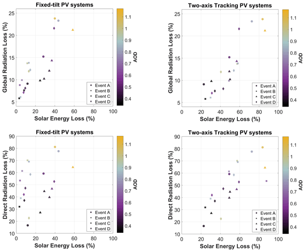
Dimitra Kouklaki, Georgia Charalampous, Anna Moustaka, Alkistis Papetta, Celia Herrero del Barrio, Rizos-Theodoros Chadoulis, S. Yeşer Aslanoğlu, Sara Herrero-Anta, Michail Mytilinaios, Nikolaos Papadimitriou, Katerina Anyfanti, Christos Spyrou, Daniela Meloni, Konstantinos Fragkos, Yevgeny Derimian, Tatiana Di Iorio, Rodanthi-Elisavet Mamouri, Vassilis Amiridis, Stavros Solomos, Stelios Kazadzis, and Ilias Fountoulakis
Atmos. Meas. Tech., 19, 5633–5657, https://doi.org/10.5194/amt-19-5633-2026, https://doi.org/10.5194/amt-19-5633-2026, 2026
Short summary
Short summary
In the present study we investigated how aerosols, and specifically dust, affect solar radiation and energy production by investigating several dust events across multiple sites in the Mediterranean Basin between 2021 and 2022 through ground-based observations and model simulations. The results revealed that dust can significantly attenuate solar radiation and, therefore, lead to considerable losses in solar power generation, specifically in the case of solar tracking systems.
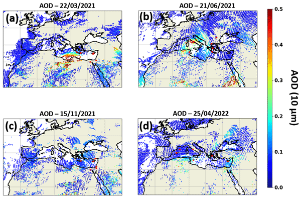
Alkistis Papetta, Celia Herrero del Barrio, S. Yeşer Aslanoğlu, Rizos-Theodoros Chadoulis, Georgia Charalampous, Sara Herrero-Anta, Dimitra Kouklaki, Michail Mytilinaios, Anna Moustaka, Emmanouil Proestakis, Vassilis Amiridis, Christos Spyrou, Antonis Gkikas, Michael Pikridas, Maria Kezoudi, Franco Marenco, Jean Sciare, Sophie Vandenbussche, Stavros Solomos, Stelios Kazadzis, and Ilias Fountoulakis
Atmos. Chem. Phys., 26, 12395–12434, https://doi.org/10.5194/acp-26-12395-2026, https://doi.org/10.5194/acp-26-12395-2026, 2026
Short summary
Short summary
We studied four major dust events from the Sahara and the Middle East over the Mediterranean. Saharan dust events exhibited coarser and more scattering particles, while Middle Eastern dust was finer and mixed with pollution. Differences in absorption could not be explained by mineralogy and are attributed to mixing.
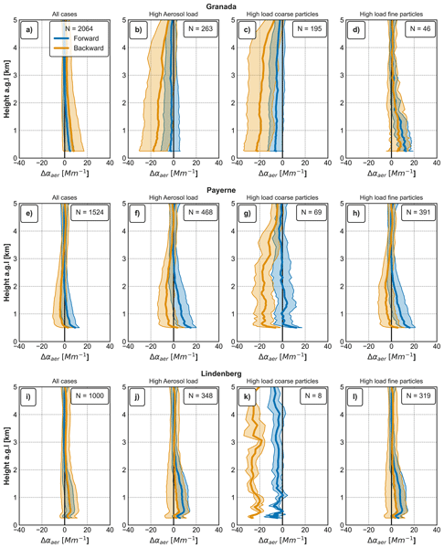
Jorge Muñiz-Rosado, Alberto Cazorla, Eric Sauvageat, Alexander Haefele, Celia Herrero del Barrio, Ramiro González, Roberto Román, Pedro Luis Molina-Molero, Arlett Díaz-Zurita, Víctor Manuel Naval-Hernández, Onel Rodríguez-Navarro, María José Granados-Muñoz, Juan Antonio Bravo-Aranda, Milagros Herrera, Daniel Pérez-Ramírez, Lionel Doppler, Lucas Alados-Arboledas, and Francisco Navas-Guzmán
Atmos. Chem. Phys., 26, 10255–10285, https://doi.org/10.5194/acp-26-10255-2026, https://doi.org/10.5194/acp-26-10255-2026, 2026
Short summary
Short summary
Ceilometers can track dust and pollution particles in the atmosphere, but their measurements need validation. This study statistically compared two processing methods against thousands of measurements from sun-tracking instruments and balloon soundings at three European sites over two years. One method, using an independent calibration procedure, proved more accurate across all conditions, cutting uncertainties by around half. This supports its wider use for air quality monitoring.
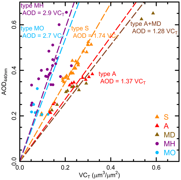
David Mateos, Carlos Toledano, Abel Calle, Roberto Román, Marcos Herreras-Giralda, Ramiro González, Sara Herrero-Anta, Daniel González-Fernández, Celia Herrero-del Barrio, Argyro Nisantzi, Rodanthi E. Mamouri, Silke Groß, Victoria E. Cachorro, Ángel M. de Frutos, and Bernadett Weinzierl
Atmos. Chem. Phys., 26, 1993–2005, https://doi.org/10.5194/acp-26-1993-2026, https://doi.org/10.5194/acp-26-1993-2026, 2026
Short summary
Short summary
A field experiment deployed in Cyprus included two sun photometers of Aerosol Robotic Network in two different sites. Mineral dust was predominant during the experiment, with Saharan and Arabian dust showing distinct optical properties, in particular, the Angstrom Exponent in the near-infrarred range and Volume Efficiency factor. Both magnitudes can served as a reliable proxy for mineral dust typing. No significant black carbon presence was detected.
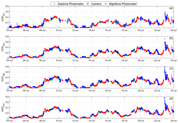
Roberto Román, Daniel González-Fernández, Juan Carlos Antuña-Sánchez, Celia Herrero del Barrio, Sara Herrero-Anta, África Barreto, Victoria E. Cachorro, Lionel Doppler, Ramiro González, Christoph Ritter, David Mateos, Natalia Kouremeti, Gustavo Copes, Abel Calle, María José Granados-Muñoz, Carlos Toledano, and Ángel M. de Frutos
Atmos. Meas. Tech., 18, 2847–2875, https://doi.org/10.5194/amt-18-2847-2025, https://doi.org/10.5194/amt-18-2847-2025, 2025
Short summary
Short summary
This paper presents a novel technique to extract starlight signals from all-sky images and retrieve aerosol optical depth (AOD). It is validated against lunar photometry, showing a strong correlation between data series. This innovative approach will expand nocturnal AOD measurements to more locations, as all-sky cameras are a simpler and more cost-effective alternative to stellar and lunar photometers.
Celia Herrero del Barrio, Roberto Román, Ramiro González, Alberto Cazorla, Marcos Herreras-Giralda, Juan Carlos Antuña-Sánchez, Francisco Molero, Francisco Navas-Guzmán, Antonio Serrano, María Ángeles Obregón, Yolanda Sola, Marco Pandolfi, Sara Herrero-Anta, Daniel González-Fernández, Jorge Muñiz-Rosado, David Mateos, Abel Calle, Carlos Toledano, Victoria Eugenia Cachorro, and Ángel Máximo de Frutos
EGUsphere, https://doi.org/10.5194/egusphere-2024-581, https://doi.org/10.5194/egusphere-2024-581, 2024
Preprint withdrawn
Short summary
Short summary
Introducing CAECENET, a novel system that combines sun-sky photometer and ceilometer data, enabling the continuous monitoring and automatic retrieval of both vertical and columnar aerosol properties in near real-time. A case study on a Saharan dust outbreak illustrates it's efficacy in tracking aerosol events. Additionally, the analysis of Canadian wildfires' long-range transport is presented, showing it's utility in monitoring event propagation, aerosol concentration, and optical properties.
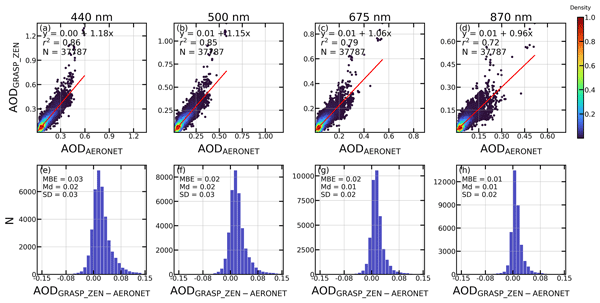
Sara Herrero-Anta, Roberto Román, David Mateos, Ramiro González, Juan Carlos Antuña-Sánchez, Marcos Herreras-Giralda, Antonio Fernando Almansa, Daniel González-Fernández, Celia Herrero del Barrio, Carlos Toledano, Victoria E. Cachorro, and Ángel M. de Frutos
Atmos. Meas. Tech., 16, 4423–4443, https://doi.org/10.5194/amt-16-4423-2023, https://doi.org/10.5194/amt-16-4423-2023, 2023
Short summary
Short summary
This paper shows the potential of a simple radiometer like the ZEN-R52 as a possible alternative for aerosol property retrieval in remote areas. A calibration method based on radiative transfer simulations together with an inversion methodology using the GRASP code is proposed here. The results demonstrate that this methodology is useful for the retrieval of aerosol extensive properties like aerosol optical depth (AOD) and aerosol volume concentration for total, fine and coarse modes.
Dimitra Kouklaki, Georgia Charalampous, Anna Moustaka, Alkistis Papetta, Celia Herrero del Barrio, Rizos-Theodoros Chadoulis, S. Yeşer Aslanoğlu, Sara Herrero-Anta, Michail Mytilinaios, Nikolaos Papadimitriou, Katerina Anyfanti, Christos Spyrou, Daniela Meloni, Konstantinos Fragkos, Yevgeny Derimian, Tatiana Di Iorio, Rodanthi-Elisavet Mamouri, Vassilis Amiridis, Stavros Solomos, Stelios Kazadzis, and Ilias Fountoulakis
Atmos. Meas. Tech., 19, 5633–5657, https://doi.org/10.5194/amt-19-5633-2026, https://doi.org/10.5194/amt-19-5633-2026, 2026
Short summary
Short summary
In the present study we investigated how aerosols, and specifically dust, affect solar radiation and energy production by investigating several dust events across multiple sites in the Mediterranean Basin between 2021 and 2022 through ground-based observations and model simulations. The results revealed that dust can significantly attenuate solar radiation and, therefore, lead to considerable losses in solar power generation, specifically in the case of solar tracking systems.
Alkistis Papetta, Celia Herrero del Barrio, S. Yeşer Aslanoğlu, Rizos-Theodoros Chadoulis, Georgia Charalampous, Sara Herrero-Anta, Dimitra Kouklaki, Michail Mytilinaios, Anna Moustaka, Emmanouil Proestakis, Vassilis Amiridis, Christos Spyrou, Antonis Gkikas, Michael Pikridas, Maria Kezoudi, Franco Marenco, Jean Sciare, Sophie Vandenbussche, Stavros Solomos, Stelios Kazadzis, and Ilias Fountoulakis
Atmos. Chem. Phys., 26, 12395–12434, https://doi.org/10.5194/acp-26-12395-2026, https://doi.org/10.5194/acp-26-12395-2026, 2026
Short summary
Short summary
We studied four major dust events from the Sahara and the Middle East over the Mediterranean. Saharan dust events exhibited coarser and more scattering particles, while Middle Eastern dust was finer and mixed with pollution. Differences in absorption could not be explained by mineralogy and are attributed to mixing.
Jorge Muñiz-Rosado, Alberto Cazorla, Eric Sauvageat, Alexander Haefele, Celia Herrero del Barrio, Ramiro González, Roberto Román, Pedro Luis Molina-Molero, Arlett Díaz-Zurita, Víctor Manuel Naval-Hernández, Onel Rodríguez-Navarro, María José Granados-Muñoz, Juan Antonio Bravo-Aranda, Milagros Herrera, Daniel Pérez-Ramírez, Lionel Doppler, Lucas Alados-Arboledas, and Francisco Navas-Guzmán
Atmos. Chem. Phys., 26, 10255–10285, https://doi.org/10.5194/acp-26-10255-2026, https://doi.org/10.5194/acp-26-10255-2026, 2026
Short summary
Short summary
Ceilometers can track dust and pollution particles in the atmosphere, but their measurements need validation. This study statistically compared two processing methods against thousands of measurements from sun-tracking instruments and balloon soundings at three European sites over two years. One method, using an independent calibration procedure, proved more accurate across all conditions, cutting uncertainties by around half. This supports its wider use for air quality monitoring.
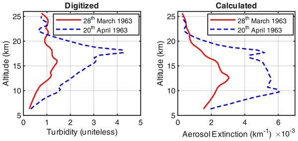
Juan Carlos Antuña-Marrero, Abel Calle, Juan Antonio Añel, Victoria Cachorro, Laura de la Torre, David Barriopedro, Ricardo García Herrera, and Javier Pacheco
Earth Syst. Sci. Data, 18, 4669–4676, https://doi.org/10.5194/essd-18-4669-2026, https://doi.org/10.5194/essd-18-4669-2026, 2026
Short summary
Short summary
New rescued searchlight stratospheric aerosol profiles (SSAEP) at 32° N extent the recovered SAP from late 1963 to 1964 to early 1963 to 1976. It covers 1963 Agung and 1974 Fuego volcanic eruptions and background conditions in between. Early 1963 perturbed SSAEP challenges currently assumed northern hemisphere arrival in second half of 1963. The extended dataset will contribute to advance our limited knowledge and understanding of the Agung stratospheric aerosol transport.
Victoria E. Cachorro, Juan Carlos Antuña-Marrero, Abel Calle, Roberto Román, David Mateos, Carlos Toledano, Juan Carlos Antuña-Sánchez, Ramiro González, Manuel Antón, Javier Vaquero-Martínez, Angel M. de Frutos Baraja, and Javier Pacheco
EGUsphere, https://doi.org/10.5194/egusphere-2026-2374, https://doi.org/10.5194/egusphere-2026-2374, 2026
Short summary
Short summary
Observations of the Arctic integrated water vapor (IWV) from sun photometers (SP) are in general dryer than the ones from GNSS. High correlations between IWV from SP and IWV from GNSS at all sites, show the good agreement between both techniques. Moist bias of hourly IWV magnitudes from ERA5 and MERRA-2 reanalyses respect to GNSS, radiosonde, SP, show that current and future state-of-the-art reanalyses require improvements to match the range of variability of these IWV observation techniques.
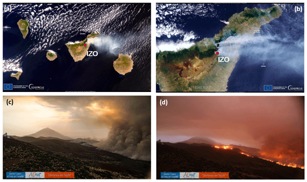
Rosa D. García, África Barreto, Victoria E. Cachorro, Pablo González-Sicilia, Sergio Léon-Luis, Ayoze Álvarez-Hernández, Juan José Bustos, Ramón Ramos, Fernando Almansa, Óscar Álvarez-Losada, Yenny González, Pedro Pablo Rivas, and Carlos Javier Torres
Atmos. Meas. Tech., 19, 3151–3167, https://doi.org/10.5194/amt-19-3151-2026, https://doi.org/10.5194/amt-19-3151-2026, 2026
Short summary
Short summary
This study presents a unique near-source observational analysis of the spectral radiative effects of extreme biomass-burning aerosols during the August 2023 wildfire on Tenerife (Canary Islands, Spain). The exceptional proximity of the wildfire to the Izaña Observatory (2400 m a.s.l.) enabled a rare characterisation of aerosol optical properties, spectral solar irradiance, and surface radiative forcing under free-tropospheric conditions.
África Barreto, Francisco Quirós, Omaira E. García, Jorge Pereda-de-Pablo, Daniel González-Fernández, Andrés Bedoya-Velásquez, Michael Sicard, Carmen Córdoba-Jabonero, Marco Iarlori, Vincenzo Rizi, Nickolay Krotkov, Simon Carn, Reijo Roininen, Antonio J. Molina-Arias, A. Fernando Almansa, Óscar Álvarez-Losada, Carla Aramo, Juan José Bustos, Romain Ceolato, Adolfo Comerón, Alicia Felpeto, Rosa D. García, Pablo González-Sicilia, Yenny González, Pascal Hedelt, Miguel Hernández, María-Ángeles López-Cayuela, Diego Loyola, Stavros Meletlidis, Constantino Muñoz-Porcar, Ermanno Pietropaolo, Ramón Ramos, Alejandro Rodríguez-Gómez, Roberto Román, Pedro M. Romero-Campos, Martin Stuefer, Carlos Toledano, and Ellsworth J. Welton
Atmos. Meas. Tech., 19, 1385–1406, https://doi.org/10.5194/amt-19-1385-2026, https://doi.org/10.5194/amt-19-1385-2026, 2026
Short summary
Short summary
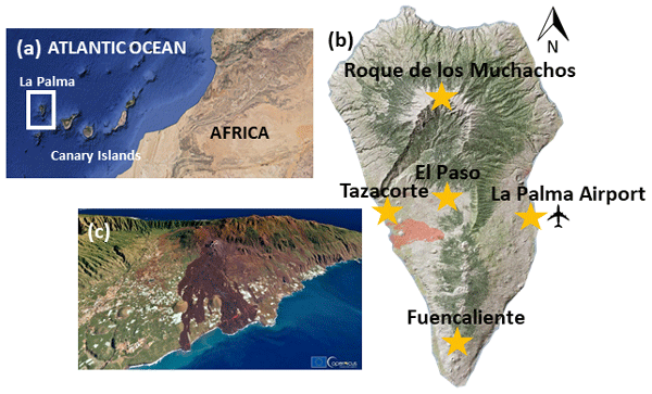
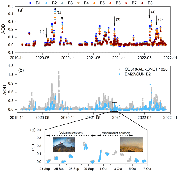
This manuscript describes the instrumental coverage deployed during the Tajogaite eruption (19 September–25 December 2021) by the Instituto Geográfico Nacional (IGN), the Spanish State Meteorological Agency (AEMET), and other Spanish members of ACTRIS (Aerosol, Clouds and Trace Gases Research Infrastructure) to monitor its atmospheric impact. Two complementary methods provide consistent plume height data for future operational surveillance.
David Mateos, Carlos Toledano, Abel Calle, Roberto Román, Marcos Herreras-Giralda, Ramiro González, Sara Herrero-Anta, Daniel González-Fernández, Celia Herrero-del Barrio, Argyro Nisantzi, Rodanthi E. Mamouri, Silke Groß, Victoria E. Cachorro, Ángel M. de Frutos, and Bernadett Weinzierl
Atmos. Chem. Phys., 26, 1993–2005, https://doi.org/10.5194/acp-26-1993-2026, https://doi.org/10.5194/acp-26-1993-2026, 2026
Short summary
Short summary
A field experiment deployed in Cyprus included two sun photometers of Aerosol Robotic Network in two different sites. Mineral dust was predominant during the experiment, with Saharan and Arabian dust showing distinct optical properties, in particular, the Angstrom Exponent in the near-infrarred range and Volume Efficiency factor. Both magnitudes can served as a reliable proxy for mineral dust typing. No significant black carbon presence was detected.
Simone Pulimeno, Angelo Lupi, Vito Vitale, Claudia Frangipani, Carlos Toledano, Stelios Kazadzis, Natalia Kouremeti, Christoph Ritter, Sandra Graßl, Kerstin Stebel, Vitali Fioletov, Ihab Abboud, Sandra Blindheim, Lynn Ma, Norm O'Neill, Piotr Sobolewski, Pawan Gupta, Elena Lind, Thomas F. Eck, Antti Hyvärinen, Veijo Aaltonen, Rigel Kivi, Janae Csavina, Dmitry Kabanov, Sergey M. Sakerin, Olga R. Sidorova, Robert S. Stone, Hagen Telg, Laura Riihimaki, Raul R. Cordero, Martin Radenz, Ronny Engelmann, Michel Van Roozendal, Anatoli Chaikovsky, Philippe Goloub, Junji Hisamitsu, and Mauro Mazzola
Atmos. Chem. Phys., 26, 1809–1846, https://doi.org/10.5194/acp-26-1809-2026, https://doi.org/10.5194/acp-26-1809-2026, 2026
Short summary
Short summary
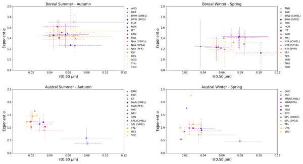
This study analyzed aerosols optical properties over the Arctic and Antarctic to measure them even during long periods of darkness. It found that pollution in the Arctic is decreasing, likely due to European emission regulations, while wildfires are becoming a more important source of particles. In Antarctica, particle levels are higher near the coast than inland, and vary by season. These results help us better understand how air pollution and climate are changing at the Earth’s poles.
Sara Herrero-Anta, Sabine Eckhardt, Nikolaos Evangeliou, Stefania Gilardoni, Sandra Graßl, Dominic Heslin-Rees, Stelios Kazadzis, Natalia Kouremeti, Radovan Krejci, David Mateos, Mauro Mazzola, Christoph Ritter, Roberto Román, Kerstin Stebel, and Tymon Zielinski
Atmos. Chem. Phys., 26, 1435–1457, https://doi.org/10.5194/acp-26-1435-2026, https://doi.org/10.5194/acp-26-1435-2026, 2026
Short summary
Short summary
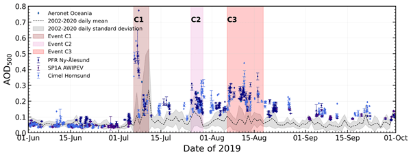
In summer 2019, unusually high aerosol concentrations were measured in the Arctic, extending through the troposphere and stratosphere up to 16 km. Using multiple instruments and models, aerosol particles were linked to wildfires, volcanic eruptions, and anthropogenic pollution. The aerosol consisted of spherical, fine-mode, weakly absorbing particles, which significantly reduced direct solar radiation. This combined approach improves understanding of Arctic aerosol events and climate processes.
Benjamin Torres, Luc Blarel, Philippe Goloub, Gaël Dubois, Maria Fernanda Sanchez-Barrero, Ioana Elisabeta Popovici, Fabrice Maupin, Elena Lind, Alexander Smirnov, Ilya Slutsker, Julien Chimot, Ramiro González, Michaël Sicard, Jean Marc Metzger, and Pierre Tulet
Atmos. Meas. Tech., 18, 4809–4838, https://doi.org/10.5194/amt-18-4809-2025, https://doi.org/10.5194/amt-18-4809-2025, 2025
Short summary
Short summary
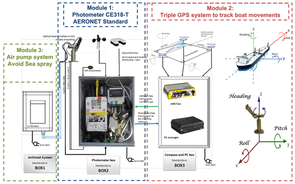
This study shows that it is possible to automatically monitor atmospheric aerosols from research vessels using automated instruments, following the same standards as AERONET (AErosol RObotic NETwork) land-based stations. By collecting 3 years of data in the Indian Ocean, we demonstrate that high-quality measurements can be made, even on a moving platform. These results open new possibilities for observing aerosols over the ocean and improving satellite data and climate studies.
Roberto Román, Daniel González-Fernández, Juan Carlos Antuña-Sánchez, Celia Herrero del Barrio, Sara Herrero-Anta, África Barreto, Victoria E. Cachorro, Lionel Doppler, Ramiro González, Christoph Ritter, David Mateos, Natalia Kouremeti, Gustavo Copes, Abel Calle, María José Granados-Muñoz, Carlos Toledano, and Ángel M. de Frutos
Atmos. Meas. Tech., 18, 2847–2875, https://doi.org/10.5194/amt-18-2847-2025, https://doi.org/10.5194/amt-18-2847-2025, 2025
Short summary
Short summary
This paper presents a novel technique to extract starlight signals from all-sky images and retrieve aerosol optical depth (AOD). It is validated against lunar photometry, showing a strong correlation between data series. This innovative approach will expand nocturnal AOD measurements to more locations, as all-sky cameras are a simpler and more cost-effective alternative to stellar and lunar photometers.
Silke Groß, Volker Freudenthaler, Moritz Haarig, Albert Ansmann, Carlos Toledano, David Mateos, Petra Seibert, Rodanthi-Elisavet Mamouri, Argyro Nisantzi, Josef Gasteiger, Maximilian Dollner, Anne Tipka, Manuel Schöberl, Marilena Teri, and Bernadett Weinzierl
Atmos. Chem. Phys., 25, 3191–3211, https://doi.org/10.5194/acp-25-3191-2025, https://doi.org/10.5194/acp-25-3191-2025, 2025
Short summary
Short summary
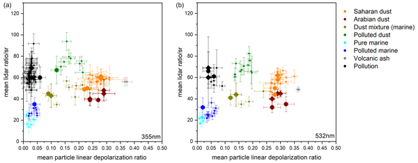
Aerosols contribute to the largest uncertainties in climate change predictions. The eastern Mediterranean is a hotspot for aerosols with natural and anthropogenic contributions. We present lidar measurements performed during A-LIFE (Absorbing aerosol layers in a changing climate: aging, lifetime and dynamics) to characterize aerosols and aerosol mixtures. We extend current lidar classification and separation schemes and compare them to classification schemes using different methods.
Carlos Toledano, Sarah Taylor, África Barreto, Stefan Adriaensen, Alberto Berjón, Agnieszka Bialek, Ramiro González, Emma Woolliams, and Marc Bouvet
Atmos. Chem. Phys., 24, 3649–3671, https://doi.org/10.5194/acp-24-3649-2024, https://doi.org/10.5194/acp-24-3649-2024, 2024
Short summary
Short summary
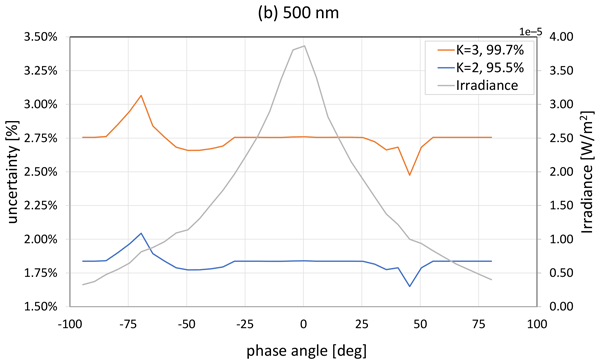
The calibration of Earth observation sensors is key to ensuring the continuity of long-term and global climate records. Satellite sensors, calibrated prior to launch, are susceptible to degradation in space. The Moon provides a stable calibration reference; however, its illumination depends on the Sun–Earth–Moon geometry and must be modelled. A new lunar irradiance model is presented, built upon observations over 5 years at a high-altitude observatory and a rigorous calibration and validation.
Celia Herrero del Barrio, Roberto Román, Ramiro González, Alberto Cazorla, Marcos Herreras-Giralda, Juan Carlos Antuña-Sánchez, Francisco Molero, Francisco Navas-Guzmán, Antonio Serrano, María Ángeles Obregón, Yolanda Sola, Marco Pandolfi, Sara Herrero-Anta, Daniel González-Fernández, Jorge Muñiz-Rosado, David Mateos, Abel Calle, Carlos Toledano, Victoria Eugenia Cachorro, and Ángel Máximo de Frutos
EGUsphere, https://doi.org/10.5194/egusphere-2024-581, https://doi.org/10.5194/egusphere-2024-581, 2024
Preprint withdrawn
Short summary
Short summary
Introducing CAECENET, a novel system that combines sun-sky photometer and ceilometer data, enabling the continuous monitoring and automatic retrieval of both vertical and columnar aerosol properties in near real-time. A case study on a Saharan dust outbreak illustrates it's efficacy in tracking aerosol events. Additionally, the analysis of Canadian wildfires' long-range transport is presented, showing it's utility in monitoring event propagation, aerosol concentration, and optical properties.
Antonio Fernando Almansa, África Barreto, Natalia Kouremeti, Ramiro González, Akriti Masoom, Carlos Toledano, Julian Gröbner, Rosa Delia García, Yenny González, Stelios Kazadzis, Stéphane Victori, Óscar Álvarez, Fabrice Maupin, Virgilio Carreño, Victoria Eugenia Cachorro, and Emilio Cuevas
Atmos. Meas. Tech., 17, 659–675, https://doi.org/10.5194/amt-17-659-2024, https://doi.org/10.5194/amt-17-659-2024, 2024
Short summary
Short summary
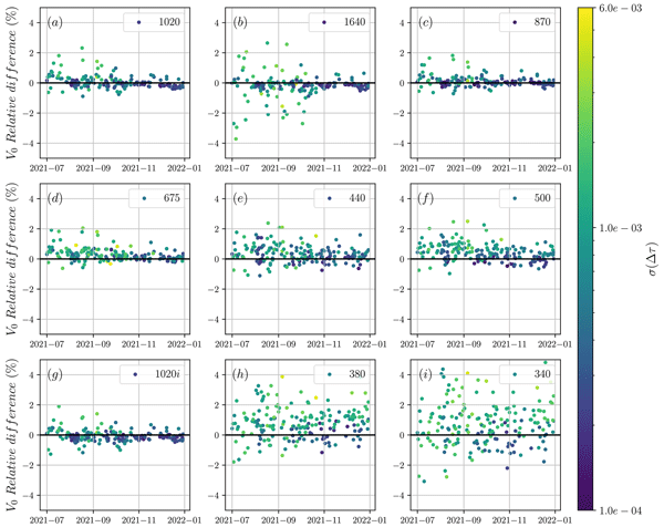
This paper applies sun photometer synergies to improve calibration transference between different sun photometers and also enhance their quality assurance and quality control. We have validated this technique using different instrumentation, the WMO-GAW and NASA-AERONET references, under different aerosol regimes using the standard Langley calibration method as a reference.
Óscar Alvárez, África Barreto, Omaira E. García, Frank Hase, Rosa D. García, Julian Gröbner, Sergio F. León-Luis, Eliezer Sepúlveda, Virgilio Carreño, Antonio Alcántara, Ramón Ramos, A. Fernando Almansa, Stelios Kazadzis, Noémie Taquet, Carlos Toledano, and Emilio Cuevas
Atmos. Meas. Tech., 16, 4861–4884, https://doi.org/10.5194/amt-16-4861-2023, https://doi.org/10.5194/amt-16-4861-2023, 2023
Short summary
Short summary
In this work, we have extended the capabilities of a portable Fourier transform infrared (FTIR) instrument, which was originally designed to provide high-quality greenhouse gas monitoring within COCCON (COllaborative Carbon Column Observing Network). The extension allows the spectrometer to now also provide coincidentally column-integrated aerosol information. This addition of a reference instrument to a global network will be utilised to enhance our understanding of atmospheric chemistry.
Sara Herrero-Anta, Roberto Román, David Mateos, Ramiro González, Juan Carlos Antuña-Sánchez, Marcos Herreras-Giralda, Antonio Fernando Almansa, Daniel González-Fernández, Celia Herrero del Barrio, Carlos Toledano, Victoria E. Cachorro, and Ángel M. de Frutos
Atmos. Meas. Tech., 16, 4423–4443, https://doi.org/10.5194/amt-16-4423-2023, https://doi.org/10.5194/amt-16-4423-2023, 2023
Short summary
Short summary
This paper shows the potential of a simple radiometer like the ZEN-R52 as a possible alternative for aerosol property retrieval in remote areas. A calibration method based on radiative transfer simulations together with an inversion methodology using the GRASP code is proposed here. The results demonstrate that this methodology is useful for the retrieval of aerosol extensive properties like aerosol optical depth (AOD) and aerosol volume concentration for total, fine and coarse modes.
Juan-Carlos Antuña-Marrero, Graham W. Mann, John Barnes, Abel Calle, Sandip S. Dhomse, Victoria E. Cachorro-Revilla, Terry Deshler, Li Zhengyao, Nimmi Sharma, and Louis Elterman
Earth Syst. Sci. Data Discuss., https://doi.org/10.5194/essd-2022-272, https://doi.org/10.5194/essd-2022-272, 2022
Revised manuscript not accepted
Short summary
Short summary
Tropospheric and stratospheric aerosol extinction profiles observations from a searchlight at New Mexico, US, were rescued and re-calibrated. Spanning between December 1963 and 1964, they measured the volcanic aerosols from the 1963 Agung eruption. Contemporary and state of the art information were used in the re-calibration. A unique and until the present forgotten/ignored dataset, it contributes current observational and modelling research on the impact of major volcanic eruptions on climate.
África Barreto, Rosa D. García, Carmen Guirado-Fuentes, Emilio Cuevas, A. Fernando Almansa, Celia Milford, Carlos Toledano, Francisco J. Expósito, Juan P. Díaz, and Sergio F. León-Luis
Atmos. Chem. Phys., 22, 11105–11124, https://doi.org/10.5194/acp-22-11105-2022, https://doi.org/10.5194/acp-22-11105-2022, 2022
Short summary
Short summary
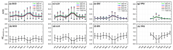
A comprehensive characterization of atmospheric aerosols in the subtropical eastern North Atlantic has been carried out in this paper using long-term ground AERONET photometric observations over the period 2005–2020 from a unique network made up of four stations strategically located from sea level to 3555 m height on the island of Tenerife. This is a region that can be considered a key location to study the seasonal dependence of dust transport from the Sahel-Sahara.
Victoria Eugenia Cachorro, Juan Carlos Antuña-Sanchez, and Ángel Máximo de Frutos
Geosci. Model Dev., 15, 1689–1712, https://doi.org/10.5194/gmd-15-1689-2022, https://doi.org/10.5194/gmd-15-1689-2022, 2022
Short summary
Short summary
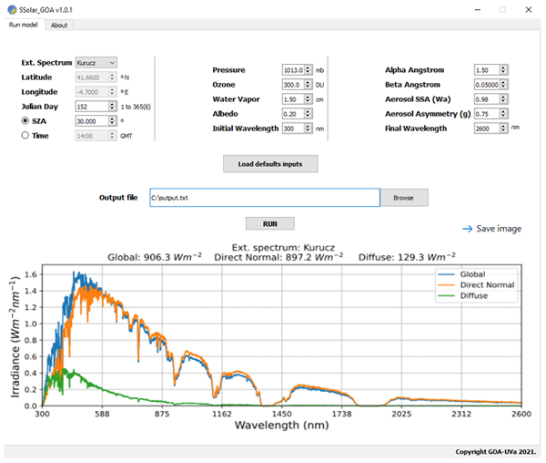
This work describes the features of a simple, fast, accurate, and physically based spectral radiative transfer model (SSolar-GOA) in the solar wavelength range under clear skies. The model is intended for a wide community of users for many different applications, was designed to be easily replicated, and has sufficient accuracy. The validation of the model was carried out through extensive comparison with simulated spectra from the LibRadtran and with direct and global spectral measurements.
Roberto Román, Juan C. Antuña-Sánchez, Victoria E. Cachorro, Carlos Toledano, Benjamín Torres, David Mateos, David Fuertes, César López, Ramiro González, Tatyana Lapionok, Marcos Herreras-Giralda, Oleg Dubovik, and Ángel M. de Frutos
Atmos. Meas. Tech., 15, 407–433, https://doi.org/10.5194/amt-15-407-2022, https://doi.org/10.5194/amt-15-407-2022, 2022
Short summary
Short summary
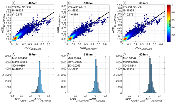
An all-sky camera is used to obtain the relative sky radiance, and this radiance is used as input in an inversion code to obtain aerosol properties. This paper is really interesting because it pushes forward the use and capability of sky cameras for more advanced science purposes. Enhanced aerosol properties can be retrieved with accuracy using only an all-sky camera, but synergy with other instruments providing aerosol optical depth could even increase the power of these low-cost instruments.
Moritz Haarig, Albert Ansmann, Ronny Engelmann, Holger Baars, Carlos Toledano, Benjamin Torres, Dietrich Althausen, Martin Radenz, and Ulla Wandinger
Atmos. Chem. Phys., 22, 355–369, https://doi.org/10.5194/acp-22-355-2022, https://doi.org/10.5194/acp-22-355-2022, 2022
Short summary
Short summary
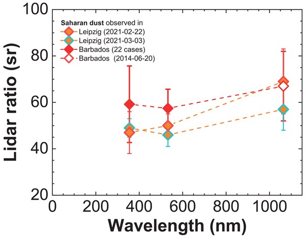
The irregular shape of dust particles makes it difficult to treat them correctly in optical models. Atmospheric measurements of dust optical properties are therefore of great importance. The present study increases the space of observed parameters from 355 and 532 nm towards 1064 nm, which is of special importance for large dust particles. The lidar ratio influenced by mineralogy and the depolarization ratio influenced by shape are measured for the first time at all three wavelengths.
Qiansi Tu, Frank Hase, Matthias Schneider, Omaira García, Thomas Blumenstock, Tobias Borsdorff, Matthias Frey, Farahnaz Khosrawi, Alba Lorente, Carlos Alberti, Juan J. Bustos, André Butz, Virgilio Carreño, Emilio Cuevas, Roger Curcoll, Christopher J. Diekmann, Darko Dubravica, Benjamin Ertl, Carme Estruch, Sergio Fabián León-Luis, Carlos Marrero, Josep-Anton Morgui, Ramón Ramos, Christian Scharun, Carsten Schneider, Eliezer Sepúlveda, Carlos Toledano, and Carlos Torres
Atmos. Chem. Phys., 22, 295–317, https://doi.org/10.5194/acp-22-295-2022, https://doi.org/10.5194/acp-22-295-2022, 2022
Short summary
Short summary
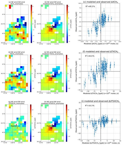
We use different methane ground- and space-based remote sensing data sets for investigating the emission strength of three waste disposal sites close to Madrid. We present a method that uses wind-assigned anomalies for deriving emission strengths from satellite data and estimate their uncertainty to 9–14 %. The emission strengths estimated from the remote sensing data sets are significantly larger than the values published in the official register.
Cited articles
Antuña-Sánchez, J. C., Román, R., Bosch, J., Toledano, C., Mateos, D., González, R., Cachorro, V. E., and de Frutos, A. M.: ORION software tool for the geometrical calibration of all-sky cameras, PLoS One, 17, https://doi.org/10.1371/journal.pone.0265959, 2022. a, b, c
Arbizu-Barrena, C., Pozo-Vázquez, D., Ruiz-Arias, J. A., and Tovar-Pescador, J.: Macroscopic cloud properties in the WRF NWP model: an assessment using sky camera and ceilometer data, J. Geophys. Res.-Atmos., 120, 10,297–10,312, https://doi.org/10.1002/2015JD023502, 2015. a
Aybar, C., Ysuhuaylas, L., Loja, J., Gonzales, K., Herrera, F., Bautista, L., Yali, R., Flores, A., Diaz, L., Cuenca, N., Espinoza, W., Prudencio, F., Llactayo, V., Montero, D., Sudmanns, M., Tiede, D., Mateo-García, G., and Gómez-Chova, L.: CloudSEN12, a global dataset for semantic understanding of cloud and cloud shadow in Sentinel-2, Scientific Data, 9, 782, https://doi.org/10.1038/s41597-022-01878-2, 2022. a
Beekmans, C., Schneider, J., Läbe, T., Lennefer, M., Stachniss, C., and Simmer, C.: Cloud photogrammetry with dense stereo for fisheye cameras, Atmos. Chem. Phys., 16, 14231–14248, https://doi.org/10.5194/acp-16-14231-2016, 2016. a
Bennouna, Y., Cachorro, V., Torres, B., Toledano, C., Berjón, A., de Frutos, A., and Alonso Fernández Coppel, I.: Atmospheric turbidity determined by the annual cycle of the aerosol optical depth over north-center Spain from ground (AERONET) and satellite (MODIS), Atmos. Environ., 67, 352–364, https://doi.org/10.1016/j.atmosenv.2012.10.065, 2013. a
Blum, N. B., Nouri, B., Wilbert, S., Schmidt, T., Lünsdorf, O., Stührenberg, J., Heinemann, D., Kazantzidis, A., and Pitz-Paal, R.: Cloud height measurement by a network of all-sky imagers, Atmos. Meas. Tech., 14, 5199–5224, https://doi.org/10.5194/amt-14-5199-2021, 2021. a
Borque, P., Kollias, P., and Giangrande, S.: First observations of tracking clouds using scanning ARM cloud radars, J. Appl. Meteorol., 53, 2732–2746, https://doi.org/10.1175/JAMC-D-13-0182.1, 2014. a
Cal, A.: CLOSDI: a novel spectral index for cloud shadow detection in Sentinel-2 imagery using NDVI and EVI2, Remote Sensing Applications: Society and Environment, 42, 101990, https://doi.org/10.1016/j.rsase.2026.101990, 2026. a
Calbó, J. and Sabburg, J.: Feature extraction from whole-sky ground-based images for cloud-type recognition, J. Atmos. Ocean. Tech., 25, 3–14, https://doi.org/10.1175/2007JTECHA959.1, 2008. a
Cazorla, A., Casquero-Vera, J. A., Román, R., Guerrero-Rascado, J. L., Toledano, C., Cachorro, V. E., Orza, J. A. G., Cancillo, M. L., Serrano, A., Titos, G., Pandolfi, M., Alastuey, A., Hanrieder, N., and Alados-Arboledas, L.: Near-real-time processing of a ceilometer network assisted with sun-photometer data: monitoring a dust outbreak over the Iberian Peninsula, Atmos. Chem. Phys., 17, 11861–11876, https://doi.org/10.5194/acp-17-11861-2017, 2017. a
Cirés, E., Marcos, J., de la Parra, I., García, M., and Marroyo, L.: The potential of forecasting in reducing the LCOE in PV plants under ramp-rate restrictions, Energy, 188, 116053, https://doi.org/10.1016/j.energy.2019.116053, 2019. a
Costa-Surós, M., Calbó, J., González, J., and Martin-Vide, J.: Behavior of cloud base height from ceilometer measurements, Atmos. Res., 127, 64–76, https://doi.org/10.1016/j.atmosres.2013.02.005, 2013. a
Crispel, P. and Roberts, G.: All-sky photogrammetry techniques to georeference a cloud field, Atmos. Meas. Tech., 11, 593–609, https://doi.org/10.5194/amt-11-593-2018, 2018. a
Drusch, M., Del Bello, U., Carlier, S., Colin, O., Fernandez, V., Gascon, F., Hoersch, B., Isola, C., Laberinti, P., Martimort, P., Meygret, A., Spoto, F., Sy, O., Marchese, F., and Bargellini, P.: Sentinel-2: ESA's optical high-resolution mission for GMES operational services, Remote Sens. Environ., 120, 25–36, https://doi.org/10.1016/j.rse.2011.11.026, 2012. a
Gatón, J., Román, R., Guzman, C., González-Fernández, D., Longarela, B., Toledano, C., and González, R.: Multi-frame cloud prediction in all-sky images from RGB images and segmented masks, Sol. Energy, 311, 114515, https://doi.org/10.1016/j.solener.2026.114515, 2026. a, b
González-Fernández, D., Román, R., Mateos, D., Herrero del Barrio, C., Cachorro, V. E., Copes, G., Sánchez, R., García, R. D., Doppler, L., Herrero-Anta, S., Antuña-Sánchez, J. C., Barreto, Á, González, R., Gatón, J., Calle, A., Toledano, C., and de Frutos, Á: Retrieval of solar shortwave irradiance from all-sky camera images, Remote Sens.-Basel, 16, https://doi.org/10.3390/rs16203821, 2024. a, b
Gregor, P., Zinner, T., Jakub, F., and Mayer, B.: Validation of a camera-based intra-hour irradiance nowcasting model using synthetic cloud data, Atmos. Meas. Tech., 16, 3257–3271, https://doi.org/10.5194/amt-16-3257-2023, 2023. a
Hamann, U., Walther, A., Baum, B., Bennartz, R., Bugliaro, L., Derrien, M., Francis, P. N., Heidinger, A., Joro, S., Kniffka, A., Le Gléau, H., Lockhoff, M., Lutz, H.-J., Meirink, J. F., Minnis, P., Palikonda, R., Roebeling, R., Thoss, A., Platnick, S., Watts, P., and Wind, G.: Remote sensing of cloud top pressure/height from SEVIRI: analysis of ten current retrieval algorithms, Atmos. Meas. Tech., 7, 2839–2867, https://doi.org/10.5194/amt-7-2839-2014, 2014. a
Hartmann, D.: Chapter 6 Radiative effects of clouds on Earth's climate, in: Aerosol–Cloud–Climate Interactions, edited by: Hobbs, P. V., Vol. 54 of International Geophysics, Academic Press, https://doi.org/10.1016/S0074-6142(08)60215-6, 151–173, 1993. a
Herrero del Barrio, C., Román, R., González, R., Cazorla, A., Herreras-Giralda, M., Antuña-Sánchez, J. C., Molero, F., Navas-Guzmán, F., Serrano, A., Obregón, M. Á, Sola, Y., Pandolfi, M., Herrero-Anta, S., González-Fernández, D., Muñiz-Rosado, J., Mateos, D., Calle, A., Toledano, C., Cachorro, V. E., and de Frutos, Á M.: CAECENET: an automatic system processing photometer and ceilometer data from different networks to provide columnar and vertically-resolved aerosol properties, PLoS One, 19, 1–23, https://doi.org/10.1371/journal.pone.0311990, 2024. a
Huertas-Tato, J., Rodríguez-Benítez, F. J., Arbizu-Barrena, C., Aler-Mur, R., Galvan-Leon, I., and Pozo-Vázquez, D.: Automatic cloud-type classification based on the combined use of a sky camera and a ceilometer, J. Geophys. Res.-Atmos., 122, 11,045–11,061, https://doi.org/10.1002/2017JD027131, 2017. a
INE: Instituto Nacional de Estadística. Valladolid: Población por municipios y sexo (Tabla 2904), cifras oficiales de población de los municipios españoles: Revisión del Padrón Municipal, https://www.ine.es/jaxiT3/Datos.htm?t=2904 (last access: 13 February 2026), 2025. a
IPCC: Intergovernmental Panel on Climate Change. The Earth's Energy Budget, Climate Feedbacks and Climate Sensitivity, Cambridge University Press, 923–1054, https://doi.org/10.1017/9781009157896.009, 2023. a
Isaac, G. A., Bailey, M., Boudala, F. S., Burrows, W. R., Cober, S. G., Crawford, R. W., Donaldson, N., Gultepe, I., Hansen, B., Heckman, I., Huang, L. X., Ling, A., Mailhot, J., Milbrandt, J. A., Reid, J., and Fournier, M.: The Canadian Airport Nowcasting System (CAN-Now), Meteorol. Appl., 21, 30–49, https://doi.org/10.1002/met.1342, 2014. a
King, M. D., Platnick, S., Menzel, W. P., Ackerman, S. A., and Hubanks, P. A.: Spatial and temporal distribution of clouds observed by MODIS onboard the terra and aqua satellites, IEEE T. Geosci. Remote, 51, 3826–3852, https://doi.org/10.1109/TGRS.2012.2227333, 2013. a
Lamer, K., Tatarevic, A., Jo, I., and Kollias, P.: Evaluation of gridded scanning ARM cloud radar reflectivity observations and vertical doppler velocity retrievals, Atmos. Meas. Tech., 7, 1089–1103, https://doi.org/10.5194/amt-7-1089-2014, 2014. a
Li, X., Wang, B., Qiu, B., and Wu, C.: An all-sky camera image classification method using cloud cover features, Atmos. Meas. Tech., 15, 3629–3639, https://doi.org/10.5194/amt-15-3629-2022, 2022. a
Liang, K., Yang, G., Zuo, Y., Chen, J., Sun, W., Meng, X., and Chen, B.: A novel method for cloud and cloud shadow detection based on the maximum and minimum values of Sentinel-2 time series images, Remote Sens.-Basel, 16, https://doi.org/10.3390/rs16081392, 2024. a
Lowe, D. G.: Distinctive image features from scale-invariant keypoints, Int. J. Comput. Vision, 60, 91–110, https://doi.org/10.1023/B:VISI.0000029664.99615.94, 2004. a
Lufft: User Manual Lufft CHM 15k Ceilometer, Lufft, Fellbach, Germany, revision r19 edn., software version 1.110, https://www.kippzonen.com/products/chm15k_ceilometer (last access: 9 September 2026), 2021. a
Martucci, G., Milroy, C., and O'Dowd, C. D.: Detection of cloud-base height using Jenoptik CHM15K and Vaisala CL31 ceilometers, J. Atmos. Ocean. Tech., 27, 305–318, https://doi.org/10.1175/2009JTECHA1326.1, 2010. a
Mateos, D., Antón, M., Sanchez-Lorenzo, A., Calbó, J., and Wild, M.: Long-term changes in the radiative effects of aerosols and clouds in a mid-latitude region (1985–2010), Global Planet. Change, 111, 288–295, https://doi.org/10.1016/j.gloplacha.2013.10.004, 2013. a
Nguyen, D. A. and Kleissl, J.: Stereographic methods for cloud base height determination using two sky imagers, Sol. Energy, 107, 495–509, https://doi.org/10.1016/j.solener.2014.05.005, 2014. a
Noh, Y.-J., Forsythe, J. M., Miller, S. D., Seaman, C. J., Li, Y., Heidinger, A. K., Lindsey, D. T., Rogers, M. A., and Partain, P. T.: Cloud-base height estimation from VIIRS. Part II: A statistical algorithm based on a-train satellite data, J. Atmos. Ocean. Tech., 34, 585–598, https://doi.org/10.1175/JTECH-D-16-0110.1, 2017. a
Nouri, B., Kuhn, P., Wilbert, S., Hanrieder, N., Prahl, C., Zarzalejo, L., Kazantzidis, A., Blanc, P., and Pitz-Paal, R.: Cloud height and tracking accuracy of three all sky imager systems for individual clouds, Sol. Energy, 177, 213–228, https://doi.org/10.1016/j.solener.2018.10.079, 2019. a
Obregón, M. Á, Rodrigues, G., Costa, M. J., Potes, M., and Silva, A. M.: Validation of ESA Sentinel-2 L2A aerosol optical thickness and columnar water vapour during 2017–2018, Remote Sens.-Basel, 11, https://doi.org/10.3390/rs11141649, 2019. a
Papachristopoulou, K., Fountoulakis, I., Bais, A. F., Psiloglou, B. E., Papadimitriou, N., Raptis, I.-P., Kazantzidis, A., Kontoes, C., Hatzaki, M., and Kazadzis, S.: Effects of clouds and aerosols on downwelling surface solar irradiance nowcasting and short-term forecasting, Atmos. Meas. Tech., 17, 1851–1877, https://doi.org/10.5194/amt-17-1851-2024, 2024. a
Papadimitriou, N., Fountoulakis, I., Gkikas, A., Papachristopoulou, K., Kazantzidis, A., Kazadzis, S., Pfenninger, S., Kapsomenakis, J., Eleftheratos, K., Argiriou, A. A., Doppler, L., and Zerefos, C. S.: PV power modelling using solar radiation from ground-based measurements and CAMS: Assessing the diffuse component related uncertainties leveraging the Global Solar Energy Estimator (GSEE), Atmos. Meas. Tech., 19, 1227–1244, https://doi.org/10.5194/amt-19-1227-2026, 2026. a
Richter, R., Louis, J., and Müller-Wilm, U.: Sentinel-2 MSI – Level 2A products algorithm theoretical basis document, European Space Agency, (Special Publication) ESA SP 49, 1–72, https://step.esa.int/thirdparties/sen2cor/2.3.0/[L2A-ATBD] S2PAD-ATBD-0001 [2.0].pdf (last access: 9 September 2026), 2012. a
Rodríguez-Benítez, F. J., López-Cuesta, M., Arbizu-Barrena, C., Fernández-León, M. M., Pamos-Ureña, M. Á, Tovar-Pescador, J., Santos-Alamillos, F. J., and Pozo-Vázquez, D.: Assessment of new solar radiation nowcasting methods based on sky-camera and satellite imagery, Appl. Energ., 292, 116838, https://doi.org/10.1016/j.apenergy.2021.116838, 2021. a
Román, R., González-Fernández, D., Antuña-Sánchez, J. C., Herrero del Barrio, C., Herrero-Anta, S., Barreto, Á., Cachorro, V. E., Doppler, L., González, R., Ritter, C., Mateos, D., Kouremeti, N., Copes, G., Calle, A., Granados-Muñoz, M. J., Toledano, C., and de Frutos, Á. M.: Star photometry with all-sky cameras to retrieve aerosol optical depth at nighttime, Atmos. Meas. Tech., 18, 2847–2875, https://doi.org/10.5194/amt-18-2847-2025, 2025. a, b, c, d, e, f
Román, R., Gatón, J., González-Fernández, D., Herrero-Anta, S., Herrero del Barrio, C., Longarela, B., Martín Marcos, J. L., and Gonzalez, R.: GOA-UVa All-Sky Segmentation U-Net Model, Zenodo [code], https://doi.org/10.5281/zenodo.18894938, 2026. a
Scaramuzza, D., Martinelli, A., and Siegwart, R. Y.: A Flexible Technique for Accurate Omnidirectional Camera Calibration and Structure from Motion, Fourth IEEE International Conference on Computer Vision Systems (ICVS'06), 45–45, https://doi.org/10.1109/ICVS.2006.3, 2006. a
Seiz, G. and Davies, R.: Reconstruction of cloud geometry from multi-view satellite images, Remote Sens. Environ., 100, 143–149, https://doi.org/10.1016/j.rse.2005.09.016, 2006. a
Sovdat, B., Kadunc, M., Batič, M., and Milčinski, G.: Natural color representation of Sentinel-2 data, Remote Sens. Environ., 225, 392–402, https://doi.org/10.1016/j.rse.2019.01.036, 2019. a
Stephens, G. L.: Cloud feedbacks in the climate system: a critical review, J. Climate, 18, 237–273, https://doi.org/10.1175/JCLI-3243.1, 2005. a
Yu, H., Sun, X., Tu, B., Ti, R., Ma, J., Hong, J., Chen, C., Liu, X., Huang, H., Wang, Z., Ahmad, S., Wang, Y., Fan, Y., Li, Y., Wei, Y., Wang, Y., and Wang, Y.: Towards multi-views cloud retrieval accounting for the 3-D structure collected by directional polarization camera, ISPRS J. Photogramm., 212, 146–163, https://doi.org/10.1016/j.isprsjprs.2024.04.028, 2024. a
Zhai, H., Zhang, H., Zhang, L., and Li, P.: Cloud/shadow detection based on spectral indices for multi/hyperspectral optical remote sensing imagery, ISPRS J. Photogramm., 144, 235–253, https://doi.org/10.1016/j.isprsjprs.2018.07.006, 2018. a
Zhang, W., Li, J., Li, J., Xu, S., Zhang, L., Wang, Y., and Huang, J.: Cloud heights retrieval from passive satellite measurements using lapse rate information, Remote Sens. Environ., 319, 114622, https://doi.org/10.1016/j.rse.2025.114622, 2025. a
Short summary
This work presents an automated method to create cloud height maps in near real time using a network of 20 ground-based sky cameras in Valladolid, Spain. By comparing simultaneous images from different locations, the system estimates cloud base and top heights every few minutes over a large area with 50 m resolution. The results agree well with satellite and ceilometer measurements, showing that low-cost camera networks can improve continuous cloud monitoring for weather and climate studies.
This work presents an automated method to create cloud height maps in near real time using a...


