
Articles | Volume 19, issue 18
https://doi.org/10.5194/amt-19-5923-2026
© Author(s) 2026. This work is distributed under
the Creative Commons Attribution 4.0 License.
the Creative Commons Attribution 4.0 License.
Special issue:
https://doi.org/10.5194/amt-19-5923-2026
© Author(s) 2026. This work is distributed under
the Creative Commons Attribution 4.0 License.
the Creative Commons Attribution 4.0 License.
Research article
| 
17 Sep 2026
Research article |
| 17 Sep 2026
| 17 Sep 2026
Validation of cloud macrophysical properties from the ATLID Level 2a products A-TC, A-FM, A-CTH using airborne lidar observations during the HALO missions PERCUSION, ASCCI and NAWDIC
Konstantin Krüger
CORRESPONDING AUTHOR

Institut für Physik der Atmosphäre, Deutsches Zentrum für Luft- und Raumfahrt (DLR), 82234 Oberpfaffenhofen, Germany
Martin Wirth
Institut für Physik der Atmosphäre, Deutsches Zentrum für Luft- und Raumfahrt (DLR), 82234 Oberpfaffenhofen, Germany
Athena Augusta Floutsi
Leibniz Institute for Tropospheric Research (TROPOS), Leipzig, Germany
David Patrick Donovan
Royal Netherlands Meteorological Institute (KNMI), de Bilt, the Netherlands
Gerd-Jan van Zadelhoff
Royal Netherlands Meteorological Institute (KNMI), de Bilt, the Netherlands
Silke Martha Groß
Institut für Physik der Atmosphäre, Deutsches Zentrum für Luft- und Raumfahrt (DLR), 82234 Oberpfaffenhofen, Germany
Related authors
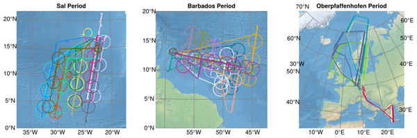
Silke Groß, Florian Ewald, Bjorn Stevens, Martin Wirth, Georgios Dekoutsidis, André Ehrlich, Dimitra Kouklaki, Konstantin Krüger, Sophie Rosenburg, Lea Volkmer, Jonas von Bismark, Lutz Hirsch, Anna E. Luebke, Eleni Marinou, Bernhard Mayer, Montserrat Pinol Sole, Manfred Wendisch, Julia Windmiller, Vassilis Amiridis, Rob Koopman, Takuji Kubota, and Markus Rapp
Atmos. Meas. Tech., 19, 3933–3959, https://doi.org/10.5194/amt-19-3933-2026, https://doi.org/10.5194/amt-19-3933-2026, 2026
Short summary
Short summary
In May 2024 the joint European Space Agency (ESA) and the Japan Aerospace Exploration Agency (JAXA) mission EarthCARE was launched. A similar payload as on the satellite was set up on the German research aircraft HALO, and deployed during an extensive measurement campaign to validated the satellite. We present our instrumentation, the measurements, and its potential for the validation of EarthCARE. We show first validation results and assessments of the EarthCARE data quality.
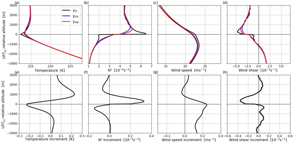
Konstantin Krüger, Andreas Schäfler, Martin Weissmann, and George C. Craig
Weather Clim. Dynam., 5, 491–509, https://doi.org/10.5194/wcd-5-491-2024, https://doi.org/10.5194/wcd-5-491-2024, 2024
Short summary
Short summary
Initial conditions of current numerical weather prediction models insufficiently represent the sharp vertical gradients across the midlatitude tropopause. Observation-space data assimilation output is used to study the influence of assimilated radiosondes on the tropopause. The radiosondes reduce systematic biases of the model background and sharpen temperature and wind gradients in the analysis. Tropopause sharpness is still underestimated in the analysis, which may impact weather forecasts.
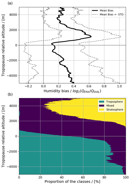
Konstantin Krüger, Andreas Schäfler, Martin Wirth, Martin Weissmann, and George C. Craig
Atmos. Chem. Phys., 22, 15559–15577, https://doi.org/10.5194/acp-22-15559-2022, https://doi.org/10.5194/acp-22-15559-2022, 2022
Short summary
Short summary
A comprehensive data set of airborne lidar water vapour profiles is compared with ERA5 reanalyses for a robust characterization of the vertical structure of the mid-latitude lower-stratospheric moist bias. We confirm a moist bias of up to 55 % at 1.3 km altitude above the tropopause and uncover a decreasing bias beyond. Collocated O3 and H2O observations reveal a particularly strong bias in the mixing layer, indicating insufficiently modelled transport processes fostering the bias.
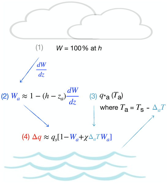
Anna Lea Albright, Bjorn Stevens, and Martin Wirth
Atmos. Meas. Tech., 19, 5973–5987, https://doi.org/10.5194/amt-19-5973-2026, https://doi.org/10.5194/amt-19-5973-2026, 2026
Short summary
Short summary
Ocean evaporation transfers heat and moisture to the atmosphere, shaping our weather and climate. Yet humidity just above the ocean is difficult to measure from space. Here we show that lasers measuring low cloud base height can infer near-surface humidity. Measurements from ships, aircraft, and weather balloons are used to validate the method. Applied to satellites, this method could help fill gaps in humidity measurements over the ocean.
Robin J. Hogan, Bernat Puigdomenech Treserras, Shannon L. Mason, Alexei Korolev, Zhipeng Qu, Kamil Mroz, David P. Donovan, Pavlos Kollias, and Mark D. Fielding
EGUsphere, https://doi.org/10.5194/egusphere-2026-5054, https://doi.org/10.5194/egusphere-2026-5054, 2026
Short summary
Short summary
The EarthCARE satellite carries advanced instruments that allow it to accurately infer vertical profiles of the properties of ice clouds, important for understanding their role in the climate system. Here we use detailed observations from meteorological research aircraft flying underneath the satellite to evaluate EarthCARE’s estimates of the mass of ice in the clouds, the average particle size, and even how fast the air is rising and falling within the cloud due to atmospheric gravity waves.
Christian Fruck, Sebastian Wolff, Sven Krautwurst, Christoph Kiemle, Mathieu Quatrevalet, Martin Wirth, Jakob Borchardt, Oke Huhs, Konstantin Gerilowski, Michał Gałkowski, Christoph Gerbig, John P. Burrows, Heinrich Bovensmann, and Andreas Fix
EGUsphere, https://doi.org/10.5194/egusphere-2026-4578, https://doi.org/10.5194/egusphere-2026-4578, 2026
This preprint is open for discussion and under review for Atmospheric Measurement Techniques (AMT).
Short summary
Short summary
Waste sites near Madrid, Spain, release large amounts of methane, a powerful greenhouse gas. Using passive, active, and in situ instruments aboard the HALO aircraft, we measured methane concentrations near these sites. By combining these complementary measurements with an atmospheric transport simulation, we account for shifting winds that complicated earlier emission estimates, yielding a more accurate and robust method. We find a combined emission rate of 8.7 ± 1.5 t h-1.
Julian Hofer, Holger Baars, Zhenping Yin, Andi Klamt, Martin Radenz, Leonard König, Athena A. Floutsi, Cristofer Jimenez, Moritz Haarig, Dietrich Althausen, Benedikt Gast, Håvard S. Buholdt, Nathan Skupin, Jonas Neumann, Sabur F. Abdullozoda, Abduvosit N. Makhmudov, Johannes Bühl, Ronny Engelmann, Ulla Wandinger, and Albert Ansmann
EGUsphere, https://doi.org/10.5194/egusphere-2026-3928, https://doi.org/10.5194/egusphere-2026-3928, 2026
This preprint is open for discussion and under review for Atmospheric Measurement Techniques (AMT).
Short summary
Short summary
A comparison of manually and automatically analyzed lidar profiles of aerosol optical properties is presented. The manual analysis was performed using a custom software in multiple analyses steps based on visual inspection of the lidar signals. The automatic analysis was performed using an automatic processing chain. The comparison shows good agreement and demonstrates the suitability of the automatic retrievals for various applications of aerosol optical property profiles.
Georgios Dekoutsidis, Silke Groß, Florian Ewald, Martina Krämer, Christian Rolf, Andreas Schäfler, and Martin Wirth
EGUsphere, https://doi.org/10.5194/egusphere-2026-3788, https://doi.org/10.5194/egusphere-2026-3788, 2026
This preprint is open for discussion and under review for Atmospheric Chemistry and Physics (ACP).
Short summary
Short summary
Cirrus clouds interact with radiation, but their exact effects are not well-defined and depend on their properties, formation process and the ambient conditions. We used airborne lidar and radar measurements and models in order to compare cirrus that formed in undisturbed conditions and during Warm Air intrusions (WAI). We found that WAIs cause a change in the formation and their properties. Our findings can improve the representation of cirrus in models and the estimation of their impact.
Georg Holger Müller, Athena Augusta Floutsi, Julian Hofer, Ronny Engelmann, Dietrich Althausen, Ulla Wandinger, Martin Radenz, Moritz Haarig, Sabur Fuzailovich Abdullaev, Shohina Kh. Khalifaeva, Albert Ansmann, and Holger Baars
EGUsphere, https://doi.org/10.5194/egusphere-2026-3390, https://doi.org/10.5194/egusphere-2026-3390, 2026
Short summary
Short summary
A five-year dataset of lidar measurements from Dushanbe, Tajikistan, was analyzed to investigate the annual dust cycle and intraanual variability in the region. The dataset consists of automatically processed data, including the separation of the dust and non-dust particle backscatter coefficient and enabling the calculation of monthly and seasonal dust mass concentration within the atmosphere. The study highlights the importance of continuous lidar measurements in the Central Asian region.
Silke Groß, Florian Ewald, Bjorn Stevens, Martin Wirth, Georgios Dekoutsidis, André Ehrlich, Dimitra Kouklaki, Konstantin Krüger, Sophie Rosenburg, Lea Volkmer, Jonas von Bismark, Lutz Hirsch, Anna E. Luebke, Eleni Marinou, Bernhard Mayer, Montserrat Pinol Sole, Manfred Wendisch, Julia Windmiller, Vassilis Amiridis, Rob Koopman, Takuji Kubota, and Markus Rapp
Atmos. Meas. Tech., 19, 3933–3959, https://doi.org/10.5194/amt-19-3933-2026, https://doi.org/10.5194/amt-19-3933-2026, 2026
Short summary
Short summary
In May 2024 the joint European Space Agency (ESA) and the Japan Aerospace Exploration Agency (JAXA) mission EarthCARE was launched. A similar payload as on the satellite was set up on the German research aircraft HALO, and deployed during an extensive measurement campaign to validated the satellite. We present our instrumentation, the measurements, and its potential for the validation of EarthCARE. We show first validation results and assessments of the EarthCARE data quality.
Holger Baars, Moritz Haarig, Leonard König, Athena A. Floutsi, Elizaveta Basharova, Julian Hofer, Henriette Gebauer, Ronny Engelmann, Dietrich Althausen, Annett Skupin, Benedikt Gast, Felix Fritzsch, Kevin Ohneiser, Cristofer Jimenez, Tom Gaudek, Martin Radenz, Håvard Buholdt, Birgit Heese, Andi Klamt, Patric Seifert, David P. Donovan, Gerd-Jan van Zadelhoff, Sabur F. Abdullaev, Shohina K. Khalifaeva, Dilovar F. Nozirov, and Ulla Wandinger
Atmos. Meas. Tech., 19, 3831–3864, https://doi.org/10.5194/amt-19-3831-2026, https://doi.org/10.5194/amt-19-3831-2026, 2026
Short summary
Short summary
The satellite mission EarthCARE (Earth Cloud, Aerosol, and Radiation Explorer) was launched in May 2024 and has 4 unique instruments on board. We used ground-based PollyNET/ACTRIS (Aerosol, Clouds and Trace gases Research Infrastructure) profiling data to discuss the quality of EarthCARE’s lidar products based on case studies from different geographic locations. Our investigations revealed that the space-borne lidar instrument has remarkable profiling capabilities but currently also still some limitations, however, not preventing first scientific studies when quality checking the data intensively.
Mahshad Soleimanpour, Torsten Seelig, Silke Groß, and Matthias Tesche
Atmos. Meas. Tech., 19, 3291–3308, https://doi.org/10.5194/amt-19-3291-2026, https://doi.org/10.5194/amt-19-3291-2026, 2026
Short summary
Short summary
Aviation affects the climate not only through carbon dioxide emissions but also by producing contrails that can alter the properties of natural cirrus clouds and influence the Earth's energy balance. In this study, we used detailed airborne laser measurements to detect contrails forming inside these clouds. We developed an automated method to identify and measure them, showing where they occur and providing a reliable way to monitor their climate impact without requiring flight data.
Athena Augusta Floutsi, Konstantinos Rizos, Dimitri Trapon, Ronny Engelmann, Dietrich Althausen, Eleni Marinou, Peristera Paschou, Julian Hofer, Emmanouil Proestakis, Henriette Gebauer, Annett Skupin, Albert Ansmann, Thorsten Fehr, Timon Hummel, Rob Koopman, Vassilis Amiridis, Ulla Wandinger, and Holger Baars
Atmos. Meas. Tech., 19, 1901–1925, https://doi.org/10.5194/amt-19-1901-2026, https://doi.org/10.5194/amt-19-1901-2026, 2026
Short summary
Short summary
We assess the representativeness of a remote ground-based station in Mindelo, Cabo Verde by utilizing continuous observations of a ground-based multiwavelength polarization Raman lidar and the LIdar climatology of Vertical Aerosol Structure (LIVAS) products. Based on a statistical analysis of the optical properties at different radii around Mindelo and case studies, we conclude that overall, the ground-based station in Mindelo can be considered conditionally representative.
Henriette Gebauer, Athena Augusta Floutsi, Julian Hofer, Moritz Haarig, Annett Skupin, Ronny Engelmann, Cristofer Jimenez, Robert Wagner, and Holger Baars
Atmos. Chem. Phys., 26, 3439–3465, https://doi.org/10.5194/acp-26-3439-2026, https://doi.org/10.5194/acp-26-3439-2026, 2026
Short summary
Short summary
The annual aerosol cycle over Mindelo, Cabo Verde, was characterized using lidar and sun photometer measurements between July 2021 and August 2023. The observations were used to define and characterize the aerosol-related seasons at this location. These are the dust season (June–September), when thick layers of Saharan dust are transported over Mindelo, and the mixing season (November–March), when this dust is mixed with smoke from the African continent. April, May, and October were defined as transition months.
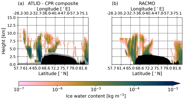
Thirza N. Feenstra, Willem Jan van de Berg, Gerd-Jan van Zadelhoff, David P. Donovan, Christiaan T. van Dalum, and Michiel R. van den Broeke
Atmos. Meas. Tech., 19, 1323–1344, https://doi.org/10.5194/amt-19-1323-2026, https://doi.org/10.5194/amt-19-1323-2026, 2026
Short summary
Short summary
Cloud representation brings large uncertainties in polar climate modeling. We show the first evaluation of Greenland clouds in the Regional Atmospheric Climate Model (RACMO2.4) with new EarthCARE satellite data. Comparing lidar and radar observations and retrieved cloud profiles with co-located RACMO output, we find RACMO captures low ice clouds but underestimates high clouds, mid-altitude liquid clouds, and snowfall. These results highlight EarthCARE's potential to improve polar climate models.
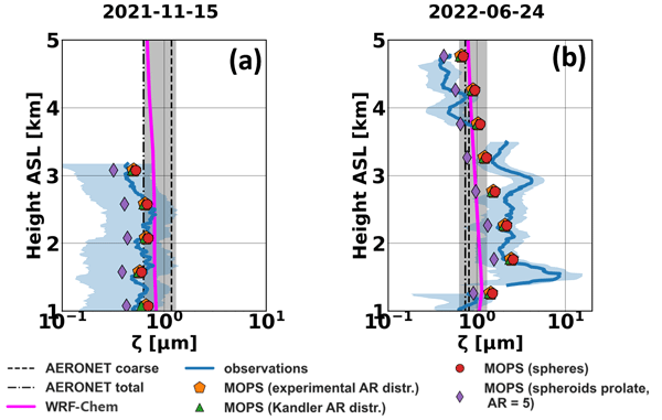
Alkistis Papetta, Maria Kezoudi, Holger Baars, Athina Floutsi, Eleni Drakaki, Konrad Kandler, Sudharaj Aryasree, Elena Louca, Theodoros Christoudias, Eleni Marinou, Chris Stopford, Troy Thornberry, Vassilis Amiridis, Jean Sciare, and Franco Marenco
Atmos. Chem. Phys., 26, 2055–2082, https://doi.org/10.5194/acp-26-2055-2026, https://doi.org/10.5194/acp-26-2055-2026, 2026
Short summary
Short summary
Dust in the atmosphere affects air quality, weather, and climate, but measuring it is challenging. We used drones and ground-based instruments to study how dust particles interact with light and relate this to their mass. Current methods often underestimate large dust particles, leading to errors in dust quantity. Our results show that regional differences in dust must be considered to improve climate models and satellite observations.
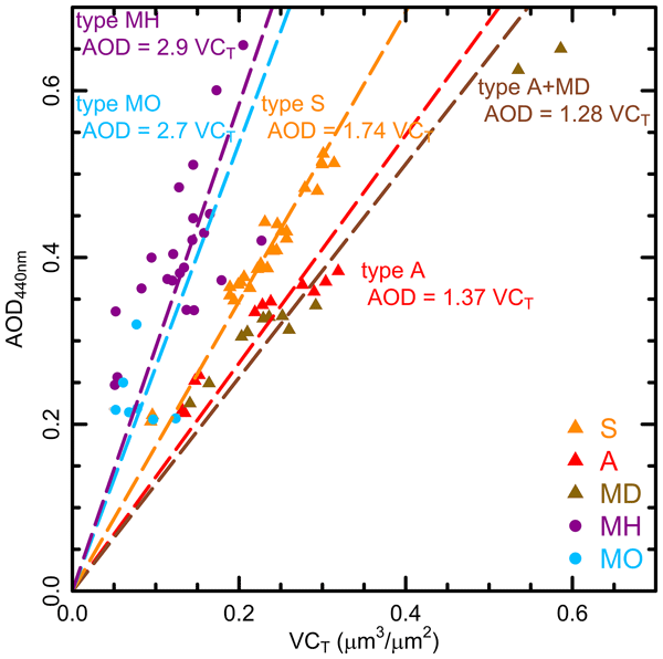
David Mateos, Carlos Toledano, Abel Calle, Roberto Román, Marcos Herreras-Giralda, Ramiro González, Sara Herrero-Anta, Daniel González-Fernández, Celia Herrero-del Barrio, Argyro Nisantzi, Rodanthi E. Mamouri, Silke Groß, Victoria E. Cachorro, Ángel M. de Frutos, and Bernadett Weinzierl
Atmos. Chem. Phys., 26, 1993–2005, https://doi.org/10.5194/acp-26-1993-2026, https://doi.org/10.5194/acp-26-1993-2026, 2026
Short summary
Short summary
A field experiment deployed in Cyprus included two sun photometers of Aerosol Robotic Network in two different sites. Mineral dust was predominant during the experiment, with Saharan and Arabian dust showing distinct optical properties, in particular, the Angstrom Exponent in the near-infrarred range and Volume Efficiency factor. Both magnitudes can served as a reliable proxy for mineral dust typing. No significant black carbon presence was detected.
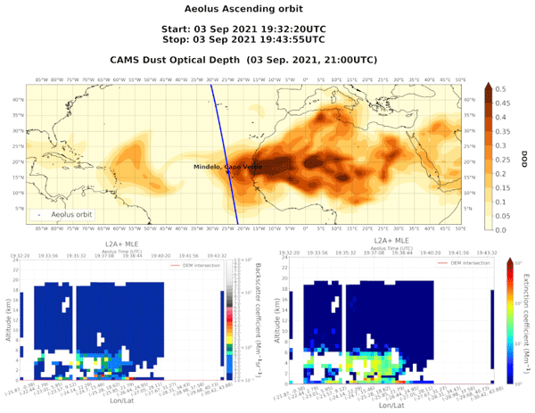
Konstantinos Rizos, Emmanouil Proestakis, Thanasis Georgiou, Antonis Gkikas, Eleni Marinou, Peristera Paschou, Kalliopi Artemis Voudouri, Athanasios Tsikerdekis, David P. Donovan, Gerd-Jan van Zadelhoff, Angela Benedetti, Holger Baars, Athena Augusta Floutsi, Nikos Benas, Martin Stengel, Christian Retscher, Edward Malina, and Vassilis Amiridis
Atmos. Meas. Tech., 19, 699–728, https://doi.org/10.5194/amt-19-699-2026, https://doi.org/10.5194/amt-19-699-2026, 2026
Short summary
Short summary
The Aeolus satellite's lidar system had limitations in detecting certain atmospheric layers and distinguishing between aerosol and cloud types. To improve accuracy, a new dust detection product was developed. By combining data from various sources and validating it with ground-based measurements, this enhanced product performs better than the original. It helps improve dust transport models and weather predictions, making it a valuable tool for atmospheric monitoring and forecasting.
Qiang Li and Silke Groß
Atmos. Chem. Phys., 25, 16657–16677, https://doi.org/10.5194/acp-25-16657-2025, https://doi.org/10.5194/acp-25-16657-2025, 2025
Short summary
Short summary
This study presents the cirrus occurrence and optical properties at high- and midlatitudes using the satellite lidar measurements. The results indicate the differences in cirrus occurrence and optical properties across latitudes. Besides seasonality, the cirrus extinction and depolarization show a consistent decrease with increasing latitude. The potential causes are discussed and it turns out that aerosol particles show much larger concentrations at midlatitudes than at high-latitudes.
Sven Krautwurst, Christian Fruck, Sebastian Wolff, Jakob Borchardt, Oke Huhs, Konstantin Gerilowski, Michał Gałkowski, Christoph Kiemle, Mathieu Quatrevalet, Martin Wirth, Christian Mallaun, John P. Burrows, Christoph Gerbig, Andreas Fix, Hartmut Bösch, and Heinrich Bovensmann
Atmos. Chem. Phys., 25, 14669–14702, https://doi.org/10.5194/acp-25-14669-2025, https://doi.org/10.5194/acp-25-14669-2025, 2025
Short summary
Short summary
Anomalously high CH4 emissions from landfills in Madrid, Spain, have been observed by satellite measurements in recent years. Our investigations of these waste facilities, using passive and active airborne remote sensing measurements, confirm these high emission rates with values of up to 13 th−1 during the overflight and show excellent agreement between the two techniques. A large fraction of the emissions is attributed to active landfill sites.
Christian Heske, Florian Ewald, and Silke Groß
Atmos. Meas. Tech., 18, 5177–5198, https://doi.org/10.5194/amt-18-5177-2025, https://doi.org/10.5194/amt-18-5177-2025, 2025
Short summary
Short summary
This study proposes a new technique to augment polarimetric radar measurements of the national German operational radar network with vertically looking cloud radars. The method is tested in two different case studies by comparison to dedicated scanning radars revealing promising results. Future usage of the method is motivated by analyzing the coverage of the operational radar network finding advantageous locations with good radar coverage.
Peristera Paschou, Nikolaos Siomos, Eleni Marinou, Antonis Gkikas, Samira M. Idrissa, Daniel T. Quaye, Désiré D. Fiogbe Attannon, Kalliopi Artemis Voudouri, Charikleia Meleti, David P. Donovan, George Georgoussis, Tommaso Parrinello, Thorsten Fehr, Jonas von Bismarck, and Vassilis Amiridis
Atmos. Meas. Tech., 18, 4731–4754, https://doi.org/10.5194/amt-18-4731-2025, https://doi.org/10.5194/amt-18-4731-2025, 2025
Short summary
Short summary
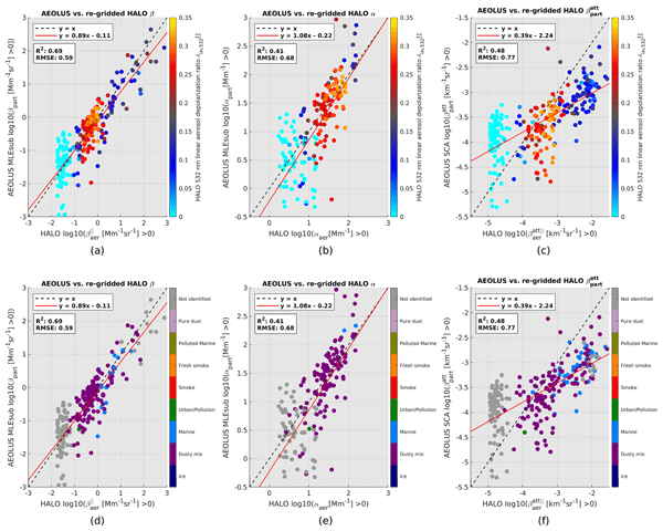
This study presents the results from a validation study on the Level 2A products (aerosol optical properties) of the ESA's (European Space Agency) Aeolus mission. Measurements from the eVe lidar, a combined linear/circular polarization and Raman lidar and ESA's ground reference system, that have been collected during the Joint Aeolus Tropical Atlantic Campaign are compared with collocated Aeolus Level 2A profiles obtained from the latest version (Baseline 16) of the Aeolus algorithms.
Dimitri Trapon, Holger Baars, Athena Augusta Floutsi, Sebastian Bley, Moritz Haarig, Adrien Lacour, Thomas Flament, Alain Dabas, Amin R. Nehrir, Frithjof Ehlers, and Dorit Huber
Atmos. Meas. Tech., 18, 3873–3896, https://doi.org/10.5194/amt-18-3873-2025, https://doi.org/10.5194/amt-18-3873-2025, 2025
Short summary
Short summary
The study highlights how aerosol measurements from aircraft can be used in synergy with ground-based observations to validate the European Space Agency's Aeolus satellite aerosol product above the tropical Atlantic. For the first time, collocated sections of the troposphere up to 626 km long are crossed. Combining measurements from satellite, aircraft, and ground-based instruments allows characterization of the optical properties of the observed dust particles emitted from the Sahara.
Anna Lea Albright, Bjorn Stevens, and Martin Wirth
EGUsphere, https://doi.org/10.5194/egusphere-2025-3551, https://doi.org/10.5194/egusphere-2025-3551, 2025
Preprint archived
Short summary
Short summary
Ocean evaporation transfers heat and moisture into the atmosphere, shaping our weather and climate, yet humidity just above the ocean is hard to measure from space. We show that lasers measuring low cloud height can accurately infer near-surface humidity. Tests on ships, aircraft, and with weather balloons are used to validate the method. Applied to satellites, this method could help fill gaps in humidity measurements over the ocean.
Victor J. H. Trees, Ping Wang, Job I. Wiltink, Piet Stammes, Daphne M. Stam, David P. Donovan, and A. Pier Siebesma
EGUsphere, https://doi.org/10.5194/egusphere-2025-2197, https://doi.org/10.5194/egusphere-2025-2197, 2025
Short summary
Short summary
We present MONKI (Monte Carlo KNMI), an efficient and accurate radiative transfer code written in Fortran. MONKI computes total and polarised radiances reflected and transmitted by planetary atmospheres, accounting for polarisation in all scattering orders. MONKI handles both homogeneous atmospheres and 3D cloud structures. MONKI has been validated, and produces reliable results even for planets with optically thick, strongly polarising atmospheres.
Martin de Graaf, Maarten Sneep, Mark ter Linden, L. Gijsbert Tilstra, David P. Donovan, Gerd-Jan van Zadelhoff, and J. Pepijn Veefkind
Atmos. Meas. Tech., 18, 2553–2571, https://doi.org/10.5194/amt-18-2553-2025, https://doi.org/10.5194/amt-18-2553-2025, 2025
Short summary
Short summary
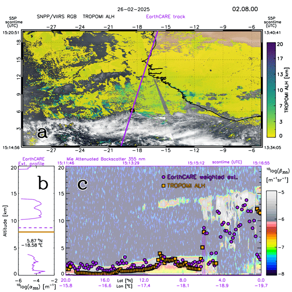
The aerosol layer height (ALH) from the TROPOspheric Monitoring Instrument (TROPOMI) has been constantly improved since its release in 2019. Over bright surfaces, fitting the albedo improved the retrieval, as shown for a set of situations, ranging from multiple layers of smoke to thick desert dust plumes and low-altitude industrial pollution. The latest results of the operational ALH are compared to profiles from the ATmospheric LIDar (ATLID) on board the recently launched EarthCARE mission.
Benedikt Gast, Cristofer Jimenez, Albert Ansmann, Moritz Haarig, Ronny Engelmann, Felix Fritzsch, Athena A. Floutsi, Hannes Griesche, Kevin Ohneiser, Julian Hofer, Martin Radenz, Holger Baars, Patric Seifert, and Ulla Wandinger
Atmos. Chem. Phys., 25, 3995–4011, https://doi.org/10.5194/acp-25-3995-2025, https://doi.org/10.5194/acp-25-3995-2025, 2025
Short summary
Short summary
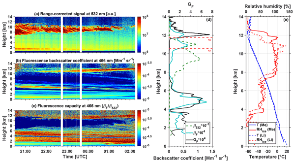
In this study, we discuss the enhanced detection capabilities of a fluorescence lidar in the case of optically thin aerosol layers in the upper troposphere and lower stratosphere (UTLS) region. Our results suggest that such thin aerosol layers are not so rare in the UTLS and can potentially trigger and impact cirrus cloud formation through heterogeneous ice nucleation. By altering the microphysical cloud properties, this could affect clouds' evolution and lifetime and thus their climate effect.

André Ehrlich, Susanne Crewell, Andreas Herber, Marcus Klingebiel, Christof Lüpkes, Mario Mech, Sebastian Becker, Stephan Borrmann, Heiko Bozem, Matthias Buschmann, Hans-Christian Clemen, Elena De La Torre Castro, Henning Dorff, Regis Dupuy, Oliver Eppers, Florian Ewald, Geet George, Andreas Giez, Sarah Grawe, Christophe Gourbeyre, Jörg Hartmann, Evelyn Jäkel, Philipp Joppe, Olivier Jourdan, Zsófia Jurányi, Benjamin Kirbus, Johannes Lucke, Anna E. Luebke, Maximilian Maahn, Nina Maherndl, Christian Mallaun, Johanna Mayer, Stephan Mertes, Guillaume Mioche, Manuel Moser, Hanno Müller, Veronika Pörtge, Nils Risse, Greg Roberts, Sophie Rosenburg, Johannes Röttenbacher, Michael Schäfer, Jonas Schaefer, Andreas Schäfler, Imke Schirmacher, Johannes Schneider, Sabrina Schnitt, Frank Stratmann, Christian Tatzelt, Christiane Voigt, Andreas Walbröl, Anna Weber, Bruno Wetzel, Martin Wirth, and Manfred Wendisch
Earth Syst. Sci. Data, 17, 1295–1328, https://doi.org/10.5194/essd-17-1295-2025, https://doi.org/10.5194/essd-17-1295-2025, 2025
Short summary
Short summary
This paper provides an overview of the HALO–(AC)3 aircraft campaign data sets, the campaign-specific instrument operation, data processing, and data quality. The data set comprises in situ and remote sensing observations from three research aircraft: HALO, Polar 5, and Polar 6. All data are published in the PANGAEA database by instrument-separated data subsets. It is highlighted how the scientific analysis of the HALO–(AC)3 data benefits from the coordinated operation of three aircraft.
Silke Groß, Volker Freudenthaler, Moritz Haarig, Albert Ansmann, Carlos Toledano, David Mateos, Petra Seibert, Rodanthi-Elisavet Mamouri, Argyro Nisantzi, Josef Gasteiger, Maximilian Dollner, Anne Tipka, Manuel Schöberl, Marilena Teri, and Bernadett Weinzierl
Atmos. Chem. Phys., 25, 3191–3211, https://doi.org/10.5194/acp-25-3191-2025, https://doi.org/10.5194/acp-25-3191-2025, 2025
Short summary
Short summary
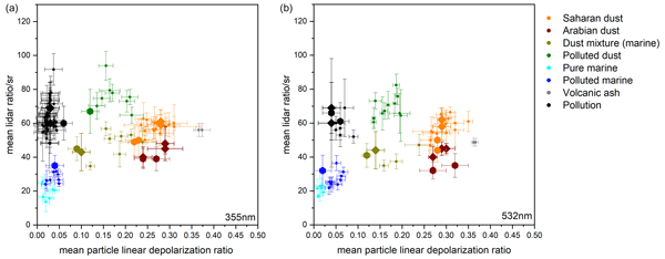
Aerosols contribute to the largest uncertainties in climate change predictions. The eastern Mediterranean is a hotspot for aerosols with natural and anthropogenic contributions. We present lidar measurements performed during A-LIFE (Absorbing aerosol layers in a changing climate: aging, lifetime and dynamics) to characterize aerosols and aerosol mixtures. We extend current lidar classification and separation schemes and compare them to classification schemes using different methods.
Victor J. H. Trees, Ping Wang, Piet Stammes, Lieuwe G. Tilstra, David P. Donovan, and A. Pier Siebesma
Atmos. Meas. Tech., 18, 73–91, https://doi.org/10.5194/amt-18-73-2025, https://doi.org/10.5194/amt-18-73-2025, 2025
Short summary
Short summary
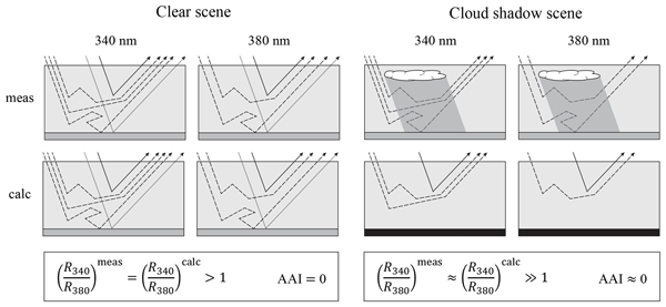
Our study investigates the impact of cloud shadows on satellite-based aerosol index measurements over Europe by TROPOMI. Using a cloud shadow detection algorithm and simulations, we found that the overall effect on the aerosol index is minimal. Interestingly, we found that cloud shadows are significantly bluer than their shadow-free surroundings, but the traditional algorithm already (partly) automatically corrects for this increased blueness.
Lev D. Labzovskii, Gerd-Jan van Zadelhoff, David P. Donovan, Jos de Kloe, L. Gijsbert Tilstra, Ad Stoffelen, Damien Josset, and Piet Stammes
Atmos. Meas. Tech., 17, 7183–7208, https://doi.org/10.5194/amt-17-7183-2024, https://doi.org/10.5194/amt-17-7183-2024, 2024
Short summary
Short summary
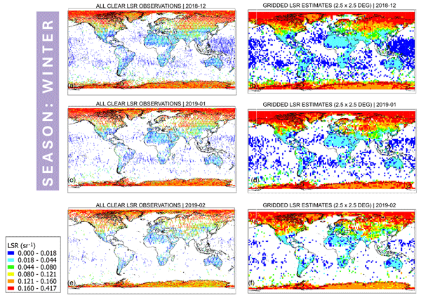
The Atmospheric Laser Doppler Instrument (ALADIN) on the Aeolus satellite was the first of its kind to measure high-resolution vertical profiles of aerosols and cloud properties from space. We present an algorithm that produces Aeolus lidar surface returns (LSRs), containing useful information for measuring UV reflectivity. Aeolus LSRs matched well with existing UV reflectivity data from other satellites, like GOME-2 and TROPOMI, and demonstrated excellent sensitivity to modeled snow cover.
Christoph Kiemle, Andreas Fix, Christian Fruck, Gerhard Ehret, and Martin Wirth
Atmos. Meas. Tech., 17, 6569–6578, https://doi.org/10.5194/amt-17-6569-2024, https://doi.org/10.5194/amt-17-6569-2024, 2024
Short summary
Short summary
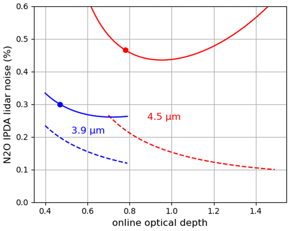
Nitrous oxide is the third most important greenhouse gas modified by human activities after carbon dioxide and methane. This study examines the feasibility of airborne differential absorption lidar to quantify emissions from agriculture, fossil fuel combustion, industry, and biomass burning. Simulations show that a technically realizable and affordable mid-infrared lidar system will be able to measure the nitrous oxide column concentration enhancements with sufficient precision.
Ping Wang, David Patrick Donovan, Gerd-Jan van Zadelhoff, Jos de Kloe, Dorit Huber, and Katja Reissig
Atmos. Meas. Tech., 17, 5935–5955, https://doi.org/10.5194/amt-17-5935-2024, https://doi.org/10.5194/amt-17-5935-2024, 2024
Short summary
Short summary
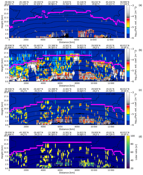
We describe the new feature mask (AEL-FM) and aerosol profile retrieval (AEL-PRO) algorithms developed for Aeolus lidar and present the evaluation of the Aeolus products using CALIPSO data for dust aerosols over Africa. We have found that Aeolus and CALIPSO show similar aerosol patterns in the collocated orbits and have good agreement for the extinction coefficients for the dust aerosols, especially for the cloud-free scenes. The finding is applicable to Aeolus L2A product Baseline 17.
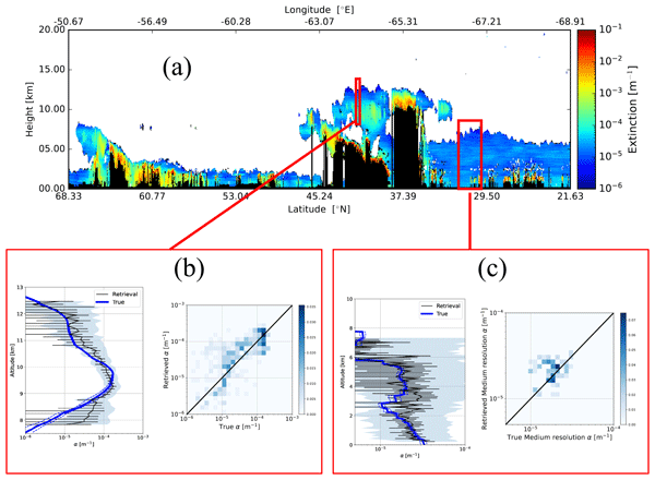
David Patrick Donovan, Gerd-Jan van Zadelhoff, and Ping Wang
Atmos. Meas. Tech., 17, 5301–5340, https://doi.org/10.5194/amt-17-5301-2024, https://doi.org/10.5194/amt-17-5301-2024, 2024
Short summary
Short summary
ATLID (atmospheric lidar) is the lidar to be flown on the Earth Clouds and Radiation Explorer satellite (EarthCARE). EarthCARE is a joint European–Japanese satellite mission that was launched in May 2024. ATLID is an advanced lidar optimized for cloud and aerosol property profile measurements. This paper describes some of the key novel algorithms being applied to this lidar to retrieve cloud and aerosol properties. Example results based on simulated data are presented and discussed.
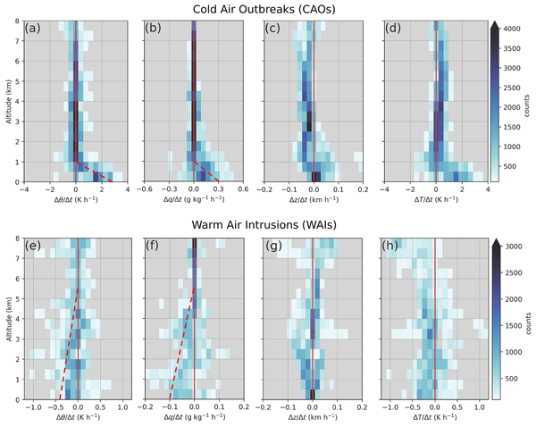
Manfred Wendisch, Susanne Crewell, André Ehrlich, Andreas Herber, Benjamin Kirbus, Christof Lüpkes, Mario Mech, Steven J. Abel, Elisa F. Akansu, Felix Ament, Clémantyne Aubry, Sebastian Becker, Stephan Borrmann, Heiko Bozem, Marlen Brückner, Hans-Christian Clemen, Sandro Dahlke, Georgios Dekoutsidis, Julien Delanoë, Elena De La Torre Castro, Henning Dorff, Regis Dupuy, Oliver Eppers, Florian Ewald, Geet George, Irina V. Gorodetskaya, Sarah Grawe, Silke Groß, Jörg Hartmann, Silvia Henning, Lutz Hirsch, Evelyn Jäkel, Philipp Joppe, Olivier Jourdan, Zsofia Jurányi, Michail Karalis, Mona Kellermann, Marcus Klingebiel, Michael Lonardi, Johannes Lucke, Anna E. Luebke, Maximilian Maahn, Nina Maherndl, Marion Maturilli, Bernhard Mayer, Johanna Mayer, Stephan Mertes, Janosch Michaelis, Michel Michalkov, Guillaume Mioche, Manuel Moser, Hanno Müller, Roel Neggers, Davide Ori, Daria Paul, Fiona M. Paulus, Christian Pilz, Felix Pithan, Mira Pöhlker, Veronika Pörtge, Maximilian Ringel, Nils Risse, Gregory C. Roberts, Sophie Rosenburg, Johannes Röttenbacher, Janna Rückert, Michael Schäfer, Jonas Schaefer, Vera Schemann, Imke Schirmacher, Jörg Schmidt, Sebastian Schmidt, Johannes Schneider, Sabrina Schnitt, Anja Schwarz, Holger Siebert, Harald Sodemann, Tim Sperzel, Gunnar Spreen, Bjorn Stevens, Frank Stratmann, Gunilla Svensson, Christian Tatzelt, Thomas Tuch, Timo Vihma, Christiane Voigt, Lea Volkmer, Andreas Walbröl, Anna Weber, Birgit Wehner, Bruno Wetzel, Martin Wirth, and Tobias Zinner
Atmos. Chem. Phys., 24, 8865–8892, https://doi.org/10.5194/acp-24-8865-2024, https://doi.org/10.5194/acp-24-8865-2024, 2024
Short summary
Short summary
The Arctic is warming faster than the rest of the globe. Warm-air intrusions (WAIs) into the Arctic may play an important role in explaining this phenomenon. Cold-air outbreaks (CAOs) out of the Arctic may link the Arctic climate changes to mid-latitude weather. In our article, we describe how to observe air mass transformations during CAOs and WAIs using three research aircraft instrumented with state-of-the-art remote-sensing and in situ measurement devices.
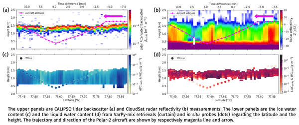
Clémantyne Aubry, Julien Delanoë, Silke Groß, Florian Ewald, Frédéric Tridon, Olivier Jourdan, and Guillaume Mioche
Atmos. Meas. Tech., 17, 3863–3881, https://doi.org/10.5194/amt-17-3863-2024, https://doi.org/10.5194/amt-17-3863-2024, 2024
Short summary
Short summary
Radar–lidar synergy is used to retrieve ice, supercooled water and mixed-phase cloud properties, making the most of the radar sensitivity to ice crystals and the lidar sensitivity to supercooled droplets. A first analysis of the output of the algorithm run on the satellite data is compared with in situ data during an airborne Arctic field campaign, giving a mean percent error of 49 % for liquid water content and 75 % for ice water content.

Georgios Dekoutsidis, Martin Wirth, and Silke Groß
Atmos. Chem. Phys., 24, 5971–5987, https://doi.org/10.5194/acp-24-5971-2024, https://doi.org/10.5194/acp-24-5971-2024, 2024
Short summary
Short summary
For decades the earth's temperature has been rising. The Arctic regions are warming faster. Cirrus clouds can contribute to this phenomenon. During warm-air intrusions, air masses are transported into the Arctic from the mid-latitudes. The HALO-(AC)3 campaign took place to measure cirrus during intrusion events and under normal conditions. We study the two cloud types based on these measurements and find differences in their geometry, relative humidity distribution and vertical structure.
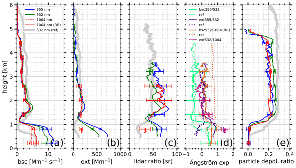
Henriette Gebauer, Athena Augusta Floutsi, Moritz Haarig, Martin Radenz, Ronny Engelmann, Dietrich Althausen, Annett Skupin, Albert Ansmann, Cordula Zenk, and Holger Baars
Atmos. Chem. Phys., 24, 5047–5067, https://doi.org/10.5194/acp-24-5047-2024, https://doi.org/10.5194/acp-24-5047-2024, 2024
Short summary
Short summary
Sulfate aerosol from the volcanic eruption at La Palma in 2021 was observed over Cabo Verde. We characterized the aerosol burden based on a case study of lidar and sun photometer observations. We compared the volcanic case to the typical background conditions (reference case) to quantify the volcanic pollution. We show the first ever measurements of the extinction coefficient, lidar ratio and depolarization ratio at 1064 nm for volcanic sulfate.
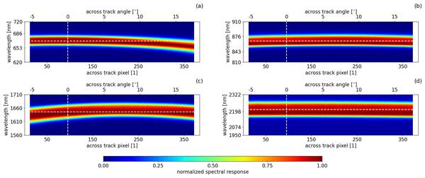
Nicole Docter, Anja Hünerbein, David P. Donovan, Rene Preusker, Jürgen Fischer, Jan Fokke Meirink, Piet Stammes, and Michael Eisinger
Atmos. Meas. Tech., 17, 2507–2519, https://doi.org/10.5194/amt-17-2507-2024, https://doi.org/10.5194/amt-17-2507-2024, 2024
Short summary
Short summary
MSI is the imaging spectrometer on board EarthCARE and will provide across-track information on clouds and aerosol properties. The MSI solar channels exhibit a spectral misalignment effect (SMILE) in the measurements. This paper describes and evaluates how the SMILE will affect the cloud and aerosol retrievals that do not account for it.
Konstantin Krüger, Andreas Schäfler, Martin Weissmann, and George C. Craig
Weather Clim. Dynam., 5, 491–509, https://doi.org/10.5194/wcd-5-491-2024, https://doi.org/10.5194/wcd-5-491-2024, 2024
Short summary
Short summary
Initial conditions of current numerical weather prediction models insufficiently represent the sharp vertical gradients across the midlatitude tropopause. Observation-space data assimilation output is used to study the influence of assimilated radiosondes on the tropopause. The radiosondes reduce systematic biases of the model background and sharpen temperature and wind gradients in the analysis. Tropopause sharpness is still underestimated in the analysis, which may impact weather forecasts.
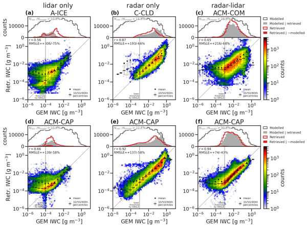
Shannon L. Mason, Howard W. Barker, Jason N. S. Cole, Nicole Docter, David P. Donovan, Robin J. Hogan, Anja Hünerbein, Pavlos Kollias, Bernat Puigdomènech Treserras, Zhipeng Qu, Ulla Wandinger, and Gerd-Jan van Zadelhoff
Atmos. Meas. Tech., 17, 875–898, https://doi.org/10.5194/amt-17-875-2024, https://doi.org/10.5194/amt-17-875-2024, 2024
Short summary
Short summary
When the EarthCARE mission enters its operational phase, many retrieval data products will be available, which will overlap both in terms of the measurements they use and the geophysical quantities they report. In this pre-launch study, we use simulated EarthCARE scenes to compare the coverage and performance of many data products from the European Space Agency production model, with the intention of better understanding the relation between products and providing a compact guide to users.
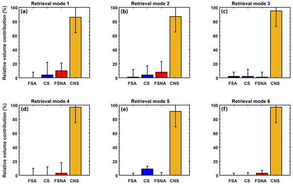
Athena Augusta Floutsi, Holger Baars, and Ulla Wandinger
Atmos. Meas. Tech., 17, 693–714, https://doi.org/10.5194/amt-17-693-2024, https://doi.org/10.5194/amt-17-693-2024, 2024
Short summary
Short summary
We introduce an aerosol-typing scheme (HETEAC-Flex) based on lidar-derived intensive optical properties and applicable to ground-based and spaceborne lidars. HETEAC-Flex utilizes the optimal estimation method and enables the identification of up to four different aerosol components, as well as the determination of their contribution to the aerosol mixture in terms of relative volume. The aerosol components represent common aerosol types such as dust, sea salt, smoke and pollution.
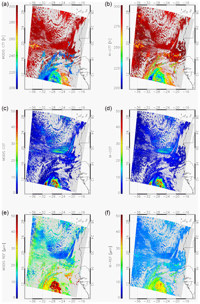
Anja Hünerbein, Sebastian Bley, Hartwig Deneke, Jan Fokke Meirink, Gerd-Jan van Zadelhoff, and Andi Walther
Atmos. Meas. Tech., 17, 261–276, https://doi.org/10.5194/amt-17-261-2024, https://doi.org/10.5194/amt-17-261-2024, 2024
Short summary
Short summary
The ESA cloud, aerosol and radiation mission EarthCARE will provide active profiling and passive imaging measurements from a single satellite platform. The passive multi-spectral imager (MSI) will add information in the across-track direction. We present the cloud optical and physical properties algorithm, which combines the visible to infrared MSI channels to determine the cloud top pressure, optical thickness, particle size and water path.
Alexandra Tsekeri, Anna Gialitaki, Marco Di Paolantonio, Davide Dionisi, Gian Luigi Liberti, Alnilam Fernandes, Artur Szkop, Aleksander Pietruczuk, Daniel Pérez-Ramírez, Maria J. Granados Muñoz, Juan Luis Guerrero-Rascado, Lucas Alados-Arboledas, Diego Bermejo Pantaleón, Juan Antonio Bravo-Aranda, Anna Kampouri, Eleni Marinou, Vassilis Amiridis, Michael Sicard, Adolfo Comerón, Constantino Muñoz-Porcar, Alejandro Rodríguez-Gómez, Salvatore Romano, Maria Rita Perrone, Xiaoxia Shang, Mika Komppula, Rodanthi-Elisavet Mamouri, Argyro Nisantzi, Diofantos Hadjimitsis, Francisco Navas-Guzmán, Alexander Haefele, Dominika Szczepanik, Artur Tomczak, Iwona S. Stachlewska, Livio Belegante, Doina Nicolae, Kalliopi Artemis Voudouri, Dimitris Balis, Athena A. Floutsi, Holger Baars, Linda Miladi, Nicolas Pascal, Oleg Dubovik, and Anton Lopatin
Atmos. Meas. Tech., 16, 6025–6050, https://doi.org/10.5194/amt-16-6025-2023, https://doi.org/10.5194/amt-16-6025-2023, 2023
Short summary
Short summary
EARLINET/ACTRIS organized an intensive observational campaign in May 2020, with the objective of monitoring the atmospheric state over Europe during the COVID-19 lockdown and relaxation period. The work presented herein focuses on deriving a common methodology for applying a synergistic retrieval that utilizes the network's ground-based passive and active remote sensing measurements and deriving the aerosols from anthropogenic activities over Europe.
Moritz Haarig, Anja Hünerbein, Ulla Wandinger, Nicole Docter, Sebastian Bley, David Donovan, and Gerd-Jan van Zadelhoff
Atmos. Meas. Tech., 16, 5953–5975, https://doi.org/10.5194/amt-16-5953-2023, https://doi.org/10.5194/amt-16-5953-2023, 2023
Short summary
Short summary
The atmospheric lidar (ATLID) and Multi-Spectral Imager (MSI) will be carried by the EarthCARE satellite. The synergistic ATLID–MSI Column Products (AM-COL) algorithm described in the paper combines the strengths of ATLID in vertically resolved profiles of aerosol and clouds (e.g., cloud top height) with the strengths of MSI in observing the complete scene beside the satellite track and in extending the lidar information to the swath. The algorithm is validated against simulated test scenes.
David P. Donovan, Pavlos Kollias, Almudena Velázquez Blázquez, and Gerd-Jan van Zadelhoff
Atmos. Meas. Tech., 16, 5327–5356, https://doi.org/10.5194/amt-16-5327-2023, https://doi.org/10.5194/amt-16-5327-2023, 2023
Short summary
Short summary
The Earth Cloud, Aerosol and Radiation Explorer mission (EarthCARE) is a multi-instrument cloud–aerosol–radiation-oriented satellite for climate and weather applications. For this satellite mission to be successful, the development and implementation of new techniques for turning the measured raw signals into useful data is required. This paper describes how atmospheric model data were used as the basis for creating realistic high-resolution simulated data sets to facilitate this process.
Zhipeng Qu, David P. Donovan, Howard W. Barker, Jason N. S. Cole, Mark W. Shephard, and Vincent Huijnen
Atmos. Meas. Tech., 16, 4927–4946, https://doi.org/10.5194/amt-16-4927-2023, https://doi.org/10.5194/amt-16-4927-2023, 2023
Short summary
Short summary
The EarthCARE satellite mission Level 2 algorithm development requires realistic 3D cloud and aerosol scenes along the satellite orbits. One of the best ways to produce these scenes is to use a high-resolution numerical weather prediction model to simulate atmospheric conditions at 250 m horizontal resolution. This paper describes the production and validation of three EarthCARE test scenes.
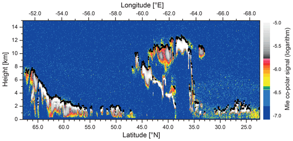
Ulla Wandinger, Moritz Haarig, Holger Baars, David Donovan, and Gerd-Jan van Zadelhoff
Atmos. Meas. Tech., 16, 4031–4052, https://doi.org/10.5194/amt-16-4031-2023, https://doi.org/10.5194/amt-16-4031-2023, 2023
Short summary
Short summary
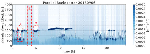
We introduce the algorithms that have been developed to derive cloud top height and aerosol layer products from observations with the Atmospheric Lidar (ATLID) onboard the Earth Cloud, Aerosol and Radiation Explorer (EarthCARE). The products provide information on the uppermost cloud and geometrical and optical properties of aerosol layers in an atmospheric column. They can be used individually but also serve as input for algorithms that combine observations with EarthCARE’s lidar and imager.
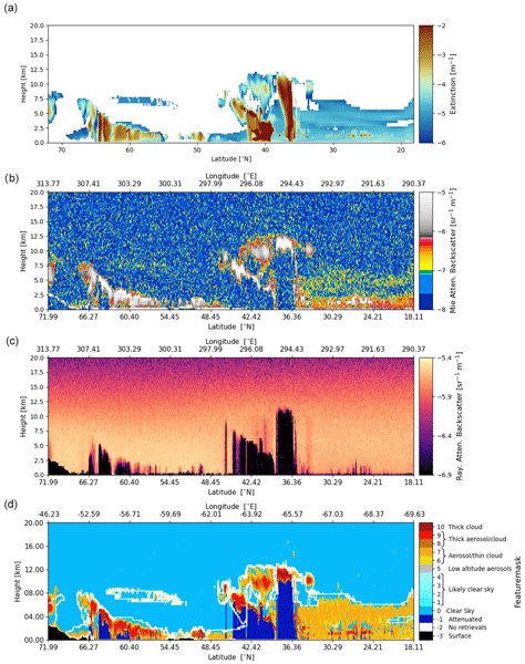
Gerd-Jan van Zadelhoff, David P. Donovan, and Ping Wang
Atmos. Meas. Tech., 16, 3631–3651, https://doi.org/10.5194/amt-16-3631-2023, https://doi.org/10.5194/amt-16-3631-2023, 2023
Short summary
Short summary
The Earth Clouds, Aerosols and Radiation (EarthCARE) satellite mission features the UV lidar ATLID. The ATLID FeatureMask algorithm provides a high-resolution detection probability mask which is used to guide smoothing strategies within the ATLID profile retrieval algorithm, one step further in the EarthCARE level-2 processing chain, in which the microphysical retrievals and target classification are performed.
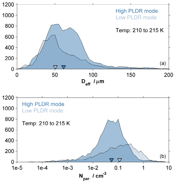
Silke Groß, Tina Jurkat-Witschas, Qiang Li, Martin Wirth, Benedikt Urbanek, Martina Krämer, Ralf Weigel, and Christiane Voigt
Atmos. Chem. Phys., 23, 8369–8381, https://doi.org/10.5194/acp-23-8369-2023, https://doi.org/10.5194/acp-23-8369-2023, 2023
Short summary
Short summary
Aviation-emitted aerosol can have an impact on cirrus clouds. We present optical and microphysical properties of mid-latitude cirrus clouds which were formed under the influence of aviation-emitted aerosol or which were formed under rather pristine conditions. We find that cirrus clouds affected by aviation-emitted aerosol show larger values of the particle linear depolarization ratio, larger mean effective ice particle diameters and decreased ice particle number concentrations.
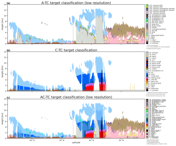
Abdanour Irbah, Julien Delanoë, Gerd-Jan van Zadelhoff, David P. Donovan, Pavlos Kollias, Bernat Puigdomènech Treserras, Shannon Mason, Robin J. Hogan, and Aleksandra Tatarevic
Atmos. Meas. Tech., 16, 2795–2820, https://doi.org/10.5194/amt-16-2795-2023, https://doi.org/10.5194/amt-16-2795-2023, 2023
Short summary
Short summary
The Cloud Profiling Radar (CPR) and ATmospheric LIDar (ATLID) aboard the EarthCARE satellite are used to probe the Earth's atmosphere by measuring cloud and aerosol profiles. ATLID is sensitive to aerosols and small cloud particles and CPR to large ice particles, snowflakes and raindrops. It is the synergy of the measurements of these two instruments that allows a better classification of the atmospheric targets and the description of the associated products, which are the subject of this paper.
Ulla Wandinger, Athena Augusta Floutsi, Holger Baars, Moritz Haarig, Albert Ansmann, Anja Hünerbein, Nicole Docter, David Donovan, Gerd-Jan van Zadelhoff, Shannon Mason, and Jason Cole
Atmos. Meas. Tech., 16, 2485–2510, https://doi.org/10.5194/amt-16-2485-2023, https://doi.org/10.5194/amt-16-2485-2023, 2023
Short summary
Short summary
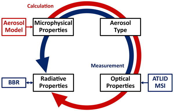
We introduce an aerosol classification model that has been developed for the Earth Clouds, Aerosols and Radiation Explorer (EarthCARE). The model provides a consistent description of microphysical, optical, and radiative properties of common aerosol types such as dust, sea salt, pollution, and smoke. It is used for aerosol classification and assessment of radiation effects based on the synergy of active and passive observations with lidar, imager, and radiometer of the multi-instrument platform.
Martin de Graaf, Karolina Sarna, Jessica Brown, Elma V. Tenner, Manon Schenkels, and David P. Donovan
Atmos. Chem. Phys., 23, 5373–5391, https://doi.org/10.5194/acp-23-5373-2023, https://doi.org/10.5194/acp-23-5373-2023, 2023
Short summary
Short summary
Clouds over the oceans reflect sunlight and cool the earth. Simultaneous measurements were performed of cloud droplet sizes and smoke particles in and near the cloud base over Ascension Island, a remote island in the Atlantic Ocean, to determine the sensitivity of cloud droplets to smoke from the African continent. The smoke was found to reduce cloud droplet sizes, which makes the cloud droplets more susceptible to evaporation, reducing cloud lifetime.
Athena Augusta Floutsi, Holger Baars, Ronny Engelmann, Dietrich Althausen, Albert Ansmann, Stephanie Bohlmann, Birgit Heese, Julian Hofer, Thomas Kanitz, Moritz Haarig, Kevin Ohneiser, Martin Radenz, Patric Seifert, Annett Skupin, Zhenping Yin, Sabur F. Abdullaev, Mika Komppula, Maria Filioglou, Elina Giannakaki, Iwona S. Stachlewska, Lucja Janicka, Daniele Bortoli, Eleni Marinou, Vassilis Amiridis, Anna Gialitaki, Rodanthi-Elisavet Mamouri, Boris Barja, and Ulla Wandinger
Atmos. Meas. Tech., 16, 2353–2379, https://doi.org/10.5194/amt-16-2353-2023, https://doi.org/10.5194/amt-16-2353-2023, 2023
Short summary
Short summary
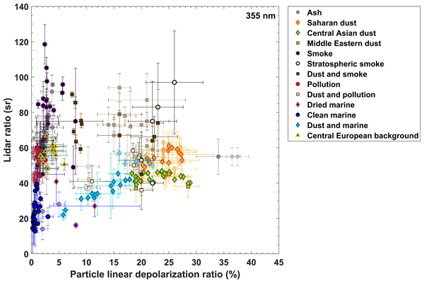
DeLiAn is a collection of lidar-derived aerosol intensive optical properties for several aerosol types, namely the particle linear depolarization ratio, the extinction-to-backscatter ratio (lidar ratio) and the Ångström exponent. The data collection is based on globally distributed, long-term, ground-based, multiwavelength, Raman and polarization lidar measurements and currently covers two wavelengths, 355 and 532 nm, for 13 aerosol categories ranging from basic aerosol types to mixtures.
Georgios Dekoutsidis, Silke Groß, Martin Wirth, Martina Krämer, and Christian Rolf
Atmos. Chem. Phys., 23, 3103–3117, https://doi.org/10.5194/acp-23-3103-2023, https://doi.org/10.5194/acp-23-3103-2023, 2023
Short summary
Short summary
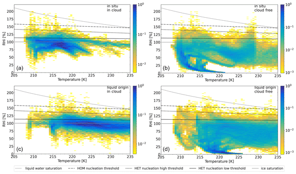
Cirrus clouds affect Earth's atmosphere, deeming our study important. Here we use water vapor measurements by lidar and study the relative humidity (RHi) within and around midlatitude cirrus clouds. We find high supersaturations in the cloud-free air and within the clouds, especially near the cloud top. We study two cloud types with different formation processes. Finally, we conclude that the shape of the distribution of RHi can be used as an indicator of different cloud evolutionary stages.
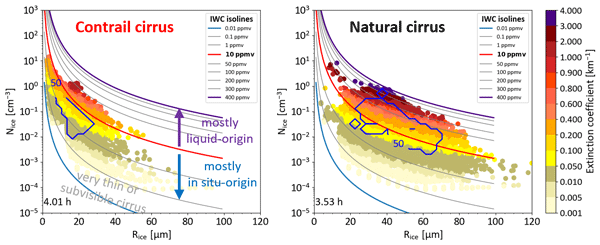
Yun Li, Christoph Mahnke, Susanne Rohs, Ulrich Bundke, Nicole Spelten, Georgios Dekoutsidis, Silke Groß, Christiane Voigt, Ulrich Schumann, Andreas Petzold, and Martina Krämer
Atmos. Chem. Phys., 23, 2251–2271, https://doi.org/10.5194/acp-23-2251-2023, https://doi.org/10.5194/acp-23-2251-2023, 2023
Short summary
Short summary
The radiative effect of aviation-induced cirrus is closely related to ambient conditions and its microphysical properties. Our study investigated the occurrence of contrail and natural cirrus measured above central Europe in spring 2014. It finds that contrail cirrus appears frequently in the pressure range 200 to 245 hPa and occurs more often in slightly ice-subsaturated environments than expected. Avoiding slightly ice-subsaturated regions by aviation might help mitigate contrail cirrus.
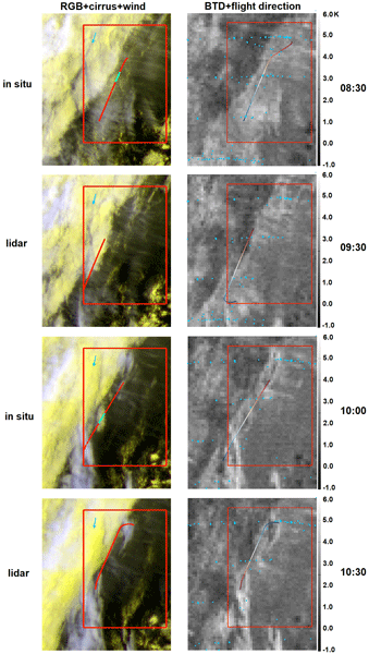
Ziming Wang, Luca Bugliaro, Tina Jurkat-Witschas, Romy Heller, Ulrike Burkhardt, Helmut Ziereis, Georgios Dekoutsidis, Martin Wirth, Silke Groß, Simon Kirschler, Stefan Kaufmann, and Christiane Voigt
Atmos. Chem. Phys., 23, 1941–1961, https://doi.org/10.5194/acp-23-1941-2023, https://doi.org/10.5194/acp-23-1941-2023, 2023
Short summary
Short summary
Differences in the microphysical properties of contrail cirrus and natural cirrus in a contrail outbreak situation during the ML-CIRRUS campaign over the North Atlantic flight corridor can be observed from in situ measurements. The cirrus radiative effect in the area of the outbreak, derived from satellite observation-based radiative transfer modeling, is warming in the early morning and cooling during the day.
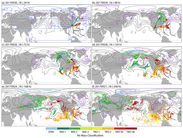
Andreas Schäfler, Michael Sprenger, Heini Wernli, Andreas Fix, and Martin Wirth
Atmos. Chem. Phys., 23, 999–1018, https://doi.org/10.5194/acp-23-999-2023, https://doi.org/10.5194/acp-23-999-2023, 2023
Short summary
Short summary
In this study, airborne lidar profile measurements of H2O and O3 across a midlatitude jet stream are combined with analyses in tracer–trace space and backward trajectories. We highlight that transport and mixing processes in the history of the observed air masses are governed by interacting tropospheric weather systems on synoptic timescales. We show that these weather systems play a key role in the high variability of the paired H2O and O3 distributions near the tropopause.
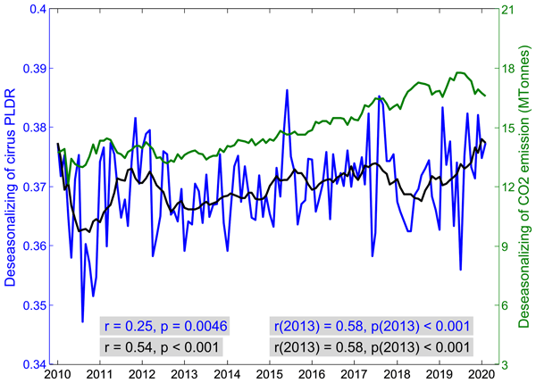
Qiang Li and Silke Groß
Atmos. Chem. Phys., 22, 15963–15980, https://doi.org/10.5194/acp-22-15963-2022, https://doi.org/10.5194/acp-22-15963-2022, 2022
Short summary
Short summary
The IPCC report identified that cirrus clouds have a significant impact on the radiation balance comparable to the CO2 effects, which, however, is still hard to parameterize. The current study investigates the possible impact of aviation on cirrus properties based on the analysis of 10-year lidar measurements of CALIPSO. The results reveal that there is a significant positive trend in cirrus depolarization ratio in the last 10 years before COVID-19, which is strongly correlated with aviation.
Konstantin Krüger, Andreas Schäfler, Martin Wirth, Martin Weissmann, and George C. Craig
Atmos. Chem. Phys., 22, 15559–15577, https://doi.org/10.5194/acp-22-15559-2022, https://doi.org/10.5194/acp-22-15559-2022, 2022
Short summary
Short summary
A comprehensive data set of airborne lidar water vapour profiles is compared with ERA5 reanalyses for a robust characterization of the vertical structure of the mid-latitude lower-stratospheric moist bias. We confirm a moist bias of up to 55 % at 1.3 km altitude above the tropopause and uncover a decreasing bias beyond. Collocated O3 and H2O observations reveal a particularly strong bias in the mixing layer, indicating insufficiently modelled transport processes fostering the bias.
Eleni Tetoni, Florian Ewald, Martin Hagen, Gregor Köcher, Tobias Zinner, and Silke Groß
Atmos. Meas. Tech., 15, 3969–3999, https://doi.org/10.5194/amt-15-3969-2022, https://doi.org/10.5194/amt-15-3969-2022, 2022
Short summary
Short summary
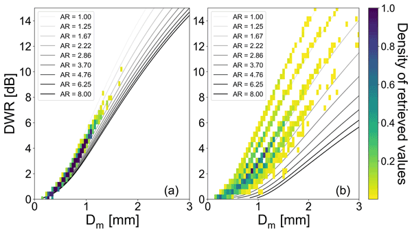
We use the C-band POLDIRAD and the Ka-band MIRA-35 to perform snowfall dual-wavelength polarimetric radar measurements. We develop an ice microphysics retrieval for mass, apparent shape, and median size of the particle size distribution by comparing observations to T-matrix ice spheroid simulations while varying the mass–size relationship. We furthermore show how the polarimetric measurements from POLDIRAD help to narrow down ambiguities between ice particle shape and size.
Manuel Gutleben, Silke Groß, Christian Heske, and Martin Wirth
Atmos. Chem. Phys., 22, 7319–7330, https://doi.org/10.5194/acp-22-7319-2022, https://doi.org/10.5194/acp-22-7319-2022, 2022
Short summary
Short summary
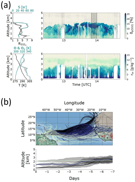
The main transportation route of Saharan mineral dust particles leads over the subtropical Atlantic Ocean and is subject to a seasonal variation. This study investigates the characteristics of wintertime transatlantic dust transport towards the Caribbean by means of airborne lidar measurements. It is found that dust particles are transported at low atmospheric altitudes (<3.5 km) embedded in a relatively moist mixture with two other particle types, namely marine and biomass-burning particles.
Theresa Mieslinger, Bjorn Stevens, Tobias Kölling, Manfred Brath, Martin Wirth, and Stefan A. Buehler
Atmos. Chem. Phys., 22, 6879–6898, https://doi.org/10.5194/acp-22-6879-2022, https://doi.org/10.5194/acp-22-6879-2022, 2022
Short summary
Short summary
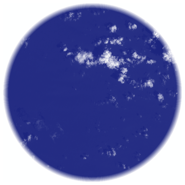
The trades are home to a plethora of small cumulus clouds that are often barely visible to the human eye and difficult to detect with active and passive remote sensing methods. With the help of a new method and by means of high-resolution data we can detect small and particularly thin clouds. We find that optically thin clouds are a common phenomenon in the trades, covering a large area and influencing the radiative effect of clouds if they are undetected and contaminate the cloud-free signal.
Victor J. H. Trees, Ping Wang, Piet Stammes, Lieuwe G. Tilstra, David P. Donovan, and A. Pier Siebesma
Atmos. Meas. Tech., 15, 3121–3140, https://doi.org/10.5194/amt-15-3121-2022, https://doi.org/10.5194/amt-15-3121-2022, 2022
Short summary
Short summary
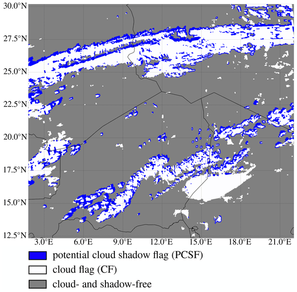
Cloud shadows are observed by the TROPOMI satellite instrument as a result of its high spatial resolution. These shadows contaminate TROPOMI's air quality measurements, because shadows are generally not taken into account in the models that are used for aerosol and trace gas retrievals. We present the Detection AlgoRithm for CLOud Shadows (DARCLOS) for TROPOMI, which is the first cloud shadow detection algorithm for a satellite spectrometer.
Birgit Heese, Athena Augusta Floutsi, Holger Baars, Dietrich Althausen, Julian Hofer, Alina Herzog, Silke Mewes, Martin Radenz, and Yoav Y. Schechner
Atmos. Chem. Phys., 22, 1633–1648, https://doi.org/10.5194/acp-22-1633-2022, https://doi.org/10.5194/acp-22-1633-2022, 2022
Short summary
Short summary
The aerosol distribution over Haifa, Israel, was measured for 2 years by a laser-based vertically resolved measurement technique called lidar. From these data, the aerosol types and their percentages of the observed aerosol mixtures were identified in terms of their size and shape. We found mostly desert dust from the surrounding deserts and sea salt from the close-by Mediterranean Sea. But aerosols from anthropogenic and industrial pollution from local and far away sources were also detected.
Martin Hagen, Florian Ewald, Silke Groß, Lothar Oswald, David A. Farrell, Marvin Forde, Manuel Gutleben, Johann Heumos, Jens Reimann, Eleni Tetoni, Gregor Köcher, Eleni Marinou, Christoph Kiemle, Qiang Li, Rebecca Chewitt-Lucas, Alton Daley, Delando Grant, and Kashawn Hall
Earth Syst. Sci. Data, 13, 5899–5914, https://doi.org/10.5194/essd-13-5899-2021, https://doi.org/10.5194/essd-13-5899-2021, 2021
Short summary
Short summary
The German polarimetric weather radar Poldirad was deployed for the international campaign EUREC4A on Barbados. The focus was monitoring clouds and precipitation in the trade wind region east of Barbados. Observations were with a temporal sequence of 5 min and a maximum range of 375 km. Examples of mesoscale precipitation patterns, rain rate accumulation, diurnal cycle, and vertical distribution show the potential for further studies on the life cycle of precipitating shallow cumulus clouds.
Heike Konow, Florian Ewald, Geet George, Marek Jacob, Marcus Klingebiel, Tobias Kölling, Anna E. Luebke, Theresa Mieslinger, Veronika Pörtge, Jule Radtke, Michael Schäfer, Hauke Schulz, Raphaela Vogel, Martin Wirth, Sandrine Bony, Susanne Crewell, André Ehrlich, Linda Forster, Andreas Giez, Felix Gödde, Silke Groß, Manuel Gutleben, Martin Hagen, Lutz Hirsch, Friedhelm Jansen, Theresa Lang, Bernhard Mayer, Mario Mech, Marc Prange, Sabrina Schnitt, Jessica Vial, Andreas Walbröl, Manfred Wendisch, Kevin Wolf, Tobias Zinner, Martin Zöger, Felix Ament, and Bjorn Stevens
Earth Syst. Sci. Data, 13, 5545–5563, https://doi.org/10.5194/essd-13-5545-2021, https://doi.org/10.5194/essd-13-5545-2021, 2021
Short summary
Short summary
The German research aircraft HALO took part in the research campaign EUREC4A in January and February 2020. The focus area was the tropical Atlantic east of the island of Barbados. We describe the characteristics of the 15 research flights, provide auxiliary information, derive combined cloud mask products from all instruments that observe clouds on board the aircraft, and provide code examples that help new users of the data to get started.
Cited articles
Amiridis, V., Marinou, E., Hostetler, C., Koopman, R., Cecil, D., Moisseev, D., Tackett, J., Groß, S., Baars, H., Redemann, J., Marenco, F., Baldini, L., Tanelli, S., Fielding, M., Janiskova, M., Tanaka, T., O’Connor, E., Fjaeraa, A. M., Paschou, P., Voudouri, K. A., Ferrare, R., Burton, S., Schuster, G., Kato, S., Winker, D., Shook, M., Bley, S., Haarig, M., Floutsi, A. A., Wandinger, U., Trapon, D., Pfitzenmaier, L., Papagiannopoulos, N., Mona, L., Posselt, D., Mason, S., Rennie, M., Benedetti, A., Hogan, R., Sogacheva, L., Balis, D., Michailidis, K., van Zadelhoff, G.-J., Nowottnick, E., Yorks, J., Mroz, K., Donovan, D., L’Ecuyer, T., Okamoto, H., Sato, K., Henderson, D., Nishikawa, T., Barker, H., Cole, J., Qu, Z., Clerbaux, N., Nakajima, T., Chase, R., Wolff, D., Landulfo, E., Kirstetter, P.-E., Mather, J., Ohigashi, T., Ryder, C., Tzallas, V., Tsikoudi, I., Tsekeri, A., Tsichla, M., Koutsoupi, I., Kubota, T., Siomos, N., Takahashi, N., Horie, H., Suzuki, K., Mace, J., McLean, W., Borderies, M., Mangla, R., Escribano, J., Moradi, I., Zhang, J., Juli, R., Ikuta, Y., Marbach, T., Bojkov, B., Accadia, C., Fougnie, B., Spezzi, L., Bozzo, A., Chimot, J., Jafariserajehlou, S., Flament, T., Mattioli, V., Strandgren, J., Bar lakas, V., and Kollias, P.: Best Practice Protocol for the validation of Aerosol, Cloud, and Precipitation Profiles (ACPPV) (Version 2), Zenodo, https://doi.org/10.5281/zenodo.15025627, 2025.
Ansmann, A., Mattis, I., Müller, D., Wandinger, U., Radlach, M., Althausen, D., and Damoah, R: Ice formation in Saharan dust over central Europe observed with temperature/humidity/aerosol Raman lidar, J. Geophys. Res., 110, D18S12, https://doi.org/10.1029/2004JD005000, 2005.
Ansmann, A., Tesche, M., Althausen, D., Müller, D., Freudenthaler, V., Heese, B., Wiegner, M., Pisani, G., Knippertz, P., and Dubovik, O.: Influence of Saharan dust on cloud glaciation in southern Morocco during SAMUM, J. Geophys. Res., 113, D04210, https://doi.org/10.1029/2007JD008785, 2008.
Baars, H., Kanitz, T., Engelmann, R., Althausen, D., Heese, B., Komppula, M., Preißler, J., Tesche, M., Ansmann, A., Wandinger, U., Lim, J.-H., Ahn, J. Y., Stachlewska, I. S., Amiridis, V., Marinou, E., Seifert, P., Hofer, J., Skupin, A., Schneider, F., Bohlmann, S., Foth, A., Bley, S., Pfüller, A., Giannakaki, E., Lihavainen, H., Viisanen, Y., Hooda, R. K., Pereira, S. N., Bortoli, D., Wagner, F., Mattis, I., Janicka, L., Markowicz, K. M., Achtert, P., Artaxo, P., Pauliquevis, T., Souza, R. A. F., Sharma, V. P., van Zyl, P. G., Beukes, J. P., Sun, J., Rohwer, E. G., Deng, R., Mamouri, R.-E., and Zamorano, F.: An overview of the first decade of PollyNET: an emerging network of automated Raman-polarization lidars for continuous aerosol profiling, Atmos. Chem. Phys., 16, 5111–5137, https://doi.org/10.5194/acp-16-5111-2016, 2016.
Baars, H., Haarig, M., König, L., Floutsi, A. A., Basharova, E., Hofer, J., Gebauer, H., Engelmann, R., Althausen, D., Skupin, A., Gast, B., Fritzsch, F., Ohneiser, K., Jimenez, C., Gaudek, T., Radenz, M., Buholdt, H., Heese, B., Klamt, A., Seifert, P., Donovan, D. P., van Zadelhoff, G.-J., Abdullaev, S. F., Khalifaeva, S. K., Nozirov, D. F., and Wandinger, U.: Validation of EarthCARE/ATLID aerosol profiling products with ground-based PollyNET lidars – case studies, Atmos. Meas. Tech., 19, 3831–3864, https://doi.org/10.5194/amt-19-3831-2026, 2026.
Boose, Y., Sierau, B., García, M. I., Rodríguez, S., Alastuey, A., Linke, C., Schnaiter, M., Kupiszewski, P., Kanji, Z. A., and Lohmann, U.: Ice nucleating particles in the Saharan Air Layer, Atmos. Chem. Phys., 16, 9067–9087, https://doi.org/10.5194/acp-16-9067-2016, 2016.
Costa, A., Meyer, J., Afchine, A., Luebke, A., Günther, G., Dorsey, J. R., Gallagher, M. W., Ehrlich, A., Wendisch, M., Baumgardner, D., Wex, H., and Krämer, M.: Classification of Arctic, midlatitude and tropical clouds in the mixed-phase temperature regime, Atmos. Chem. Phys., 17, 12219–12238, https://doi.org/10.5194/acp-17-12219-2017, 2017.
Dekoutsidis, G., Wirth, M., and Groß, S.: The effects of warm-air intrusions in the high Arctic on cirrus clouds, Atmos. Chem. Phys., 24, 5971–5987, https://doi.org/10.5194/acp-24-5971-2024, 2024.
Donovan, D. P., van Zadelhoff, G.-J., and Wang, P.: The EarthCARE lidar cloud and aerosol profile processor (A-PRO): the A-AER, A-EBD, A-TC, and A-ICE products, Atmos. Meas. Tech., 17, 5301–5340, https://doi.org/10.5194/amt-17-5301-2024, 2024.
ECMWF: ECMWF operational analyses and forecasts, European Centre for Medium-Range Weather Forecasts [data set], https://www.ecmwf.int/en/forecasts/access-forecasts/access-archive-datasets (last access: 23 August 2026), 2026.
Eisinger, M., Marnas, F., Wallace, K., Kubota, T., Tomiyama, N., Ohno, Y., Tanaka, T., Tomita, E., Wehr, T., and Bernaerts, D.: The EarthCARE mission: science data processing chain overview, Atmos. Meas. Tech., 17, 839–862, https://doi.org/10.5194/amt-17-839-2024, 2024.
ESA: A-PRO data disclaimer, https://earthcarehandbook.earth.esa.int/documents/d/earthcare-data-handbook/earthcare-product-disclaimer-atlid-level-2a-a-pro (last access: 23 August 2026), 2026a.
ESA: A-LAY data disclaimer, https://earthcarehandbook.earth.esa.int/documents/d/earthcare-data-handbook/earthcare-product-disclaimer-atlid-level-2a-a-lay-a-cth-a-ald (last access: 23 August 2026), 2026b.
Esselborn, M., Wirth, M., Fix, A., Tesche, M., and Ehret, G.: Airborne high spectral resolution lidar for measuring aerosol extinction and backscatter coefficients, Appl. Optics, 47, 346–358, https://doi.org/10.1364/AO.47.000346, 2008.
Fix, A., Steinebach, F., Wirth, M., Schäfler, A., and Ehret, G.: Development and application of an airborne differential absorption lidar for the simultaneous measurement of ozone and water vapor profiles in the tropopause region, Appl. Optics, 58, 5892–5900, https://doi.org/10.1364/AO.58.005892, 2019.
Floutsi, A. A., Rizos, K., Trapon, D., Engelmann, R., Althausen, D., Marinou, E., Paschou, P., Hofer, J., Proestakis, E., Gebauer, H., Skupin, A., Ansmann, A., Fehr, T., Hummel, T., Koopman, R., Amiridis, V., Wandinger, U., and Baars, H.: On the representativeness of the ground-based lidar observations for satellite calibration/validation – the example of the archipelago of Cabo Verde, Atmos. Meas. Tech., 19, 1901–1925, https://doi.org/10.5194/amt-19-1901-2026, 2026.
Garnier, A., Pelon, J., Pascal, N., Vaughan, M. A., Dubuisson, P., Yang, P., and Mitchell, D. L.: Version 4 CALIPSO Imaging Infrared Radiometer ice and liquid water cloud microphysical properties – Part I: The retrieval algorithms, Atmos. Meas. Tech., 14, 3253–3276, https://doi.org/10.5194/amt-14-3253-2021, 2021.
Gimmestad, G. G. and Roberts, D. W.: Lidar engineering: introduction to basic principles, Cambridge University Press, https://doi.org/10.1017/9781139014106, 2023.
Gloeckner, H. M., Mieslinger, T., Robbins-Blanch, N., George, G., Kluft, L., Kölling, T., Bony, S., Windmiller, J. M., and Stevens, B.: BEACH: Barbados and Eastern Atlantic Combined High-altitude dropsonde datasets, Earth Syst. Sci. Data, 18, 4425–4450, https://doi.org/10.5194/essd-18-4425-2026, 2026.
Groß, S., Esselborn, M., Weinzierl, B., Wirth, M., Fix, A., and Petzold, A.: Aerosol classification by airborne high spectral resolution lidar observations, Atmos. Chem. Phys., 13, 2487–2505, https://doi.org/10.5194/acp-13-2487-2013, 2013.
Groß, S., Wirth, M., Schäfler, A., Fix, A., Kaufmann, S., and Voigt, C.: Potential of airborne lidar measurements for cirrus cloud studies, Atmos. Meas. Tech., 7, 2745–2755, https://doi.org/10.5194/amt-7-2745-2014, 2014.
Groß, S., Ewald, F., Stevens, B., Wirth, M., Dekoutsidis, G., Ehrlich, A., Kouklaki, D., Krüger, K., Rosenburg, S., Volkmer, L., von Bismark, J., Hirsch, L., Luebke, A. E., Marinou, E., Mayer, B., Pinol Sole, M., Wendisch, M., Windmiller, J., Amiridis, V., Koopman, R., Kubota, T., and Rapp, M.: Persistent EarthCARE underflight studies of the ITCZ and organized convection (PERCUSION): contribution to EarthCARE validation, Atmos. Meas. Tech., 19, 3933–3959, https://doi.org/10.5194/amt-19-3933-2026, 2026.
Gutleben, M., Groß, S., and Wirth, M.: Cloud macro-physical properties in Saharan-dust-laden and dust-free North Atlantic trade wind regimes: a lidar case study, Atmos. Chem. Phys., 19, 10659–10673, https://doi.org/10.5194/acp-19-10659-2019, 2019.
Haarig, M., Hünerbein, A., Wandinger, U., Docter, N., Bley, S., Donovan, D., and van Zadelhoff, G.-J.: Cloud top heights and aerosol columnar properties from combined EarthCARE lidar and imager observations: the AM-CTH and AM-ACD products, Atmos. Meas. Tech., 16, 5953–5975, https://doi.org/10.5194/amt-16-5953-2023, 2023.
Hall, A.: EarthCARE Validation – Level 2 Algorithm Developer Needs, https://earth.esa.int/eogateway/documents/d/earth-online/earthcare-validation-l2-algorithm-developer-needs-table (last access: 1 April 2026), 2025.
Hlavka, D. L., Yorks, J. E., Young, S. A., Vaughan, M. A., Kuehn, R. E., McGill, M. J., and Rodier, S. D.: Airborne validation of cirrus cloud properties derived from CALIPSO lidar measurements: Optical properties, J. Geophys. Res., 117, D09207, https://doi.org/10.1029/2011JD017053, 2012.
Hogan, R. J., Illingworth, A. J., O'Connor, E. J., and PoiaresBaptista, J. P. V.: Characteristics of mixed-phase clouds. II: A climatology from ground-based lidar, Q. J. Roy. Meteor. Soc., 129, 2117–2134, https://doi.org/10.1256/qj.01.209, 2003.
Hu, Y., Winker, D., Vaughan, M., Lin, B., Omar, A., Trepte, C., Flittner, D., Yang, P., Nasiri, S. L., Baum, B., Holz, R., Sun, W., Liu, Z., Wang, Z., Young, S., Stamnes, K., Huang, J., and Kuehn, R.: CALIPSO/CALIOP Cloud Phase Discrimination Algorithm, J. Atmos. Ocean. Tech., 26, 2293–2309, https://doi.org/10.1175/2009JTECHA1280.1, 2009.
Hu, Y., Rodier, S., Xu, K., Sun, W., Huang, J., Lin, B., Zhai, P., and Josset, D.: Occurrence, liquid water content, and fraction of supercooled water clouds from combined CALIOP/IIR/MODIS measurements, J. Geophys. Res.-Atmos., 115, D00H34, https://doi.org/10.1029/2009JD012384, 2010.
Illingworth, A. J., Barker, H. W., Beljaars, A., Ceccaldi, M., Chepfer, H., Clerbaux, N., Cole, J., Delanoë, J., Domenech, C., Donovan, D. P., Fukuda, S., Hirakata, M., Hogan, R. J., Huenerbein, A., Kollias, P., Kubota, T., Nakajima, T., Nakajima, T. Y., Nishizawa, T., Ohno, Y., Okamoto, H., Oki, R., Sato, K., Satoh, M., Shephard, M. W., Velázquez-Blázquez, A., Wandinger, U., Wehr, T., and van Zadelhoff, G.-J.: The EarthCARE Satellite: The Next Step Forward in Global Measurements of Clouds, Aerosols, Precipitation, and Radiation, B. Am. Meteorol. Soc., 96, 1311–1332, https://doi.org/10.1175/BAMS-D-12-00227.1, 2015.
IPCC: Climate Change 2021 – The Physical Science Basis: Working Group I Contribution to the Sixth Assessment Report of the Intergovernmental Panel on Climate Change, edited by: Masson-Delmotte, V., Zhai, P., Pirani, A., Connors, S. L., Péan, C., Berger, S., Caud, N., Chen, Y., Goldfarb, L., Gomis, M. I., Huang, M., Leitzell, K., Lonnoy, E., Matthews, J. B. R., Maycock, T. K., Waterfield, T., Yelekçi, O., Yu, R., and Zhou, B., Cambridge University Press, Cambridge, United Kingdom and New York, NY, USA, https://doi.org/10.1017/9781009157896, 2023.
Irbah, A., Delanoë, J., van Zadelhoff, G.-J., Donovan, D. P., Kollias, P., Puigdomènech Treserras, B., Mason, S., Hogan, R. J., and Tatarevic, A.: The classification of atmospheric hydrometeors and aerosols from the EarthCARE radar and lidar: the A-TC, C-TC and AC-TC products, Atmos. Meas. Tech., 16, 2795–2820, https://doi.org/10.5194/amt-16-2795-2023, 2023.
Jurkat-Witschas, T., Voigt, C., Groß, S., Kaufmann, S., Sauer, D., De la Torre Castro, E., Krämer, M., Schäfler, A., Afchine, A., Attinger, R., Bartolome Garcia, I., Beer, C. G., Bugliaro, L., Clemen, H., Dekoutsidis, G., Ehrlich, A., Grawe, S., Hahn, V., Hendricks, J., Järvinen, E., Thomas, K., Krüger, K., Ovid, K., Lucke, J., Luebke, A. E., Marsing, A., Mayer, B., Mayer, J., Mertes, S., Moser, M., Müller, H., Nenakhov, V., Pöhlker, M., Pöschl, U., Pörtge, V., Rautenhaus, M., Righi, M., Röttenbacher, J., Rubin-Zuzic, M., Schaefer, J., Schnaiter, M., Schneider, J., Schumann, U., Spelten, N., Stratmann, F., Tomsche, L., Wagner, S., Wang, Z., Weber, A., Wendisch, M., Wernli, H., Wetzel, B., Wirth, M., Zahn, A., Ziereis, H., and Zöger, M.: CIRRUS-HL: Picturing high- and mid-latitude summer cirrus and contrail cirrus above Europe with airborne measurements aboard the research aircraft HALO, B. Am. Meteorol. Soc., https://doi.org/10.1175/BAMS-D-23-0270.1, 2025.
Kiemle, C., Wirth, M., Fix, A., Ehret, G., Schumann, U., Gardiner, T., Schiller, C., Sitnikov, N., and Stiller, G.: First airborne water vapor lidar measurements in the tropical upper troposphere and mid-latitudes lower stratosphere: accuracy evaluation and intercomparisons with other instruments, Atmos. Chem. Phys., 8, 5245–5261, https://doi.org/10.5194/acp-8-5245-2008, 2008.
Krautstrunk, M. and Giez, A.: The transition from FALCON to HALO era airborne atmospheric research, in: Atmospheric Physics: Background – Methods – Trends, edited by: Schumann, U., Springer-Verlag, Berlin, 609–624, https://doi.org/10.1007/978-3-642-30183-4_37, 2012.
Krüger, K., Schäfler, A., Wirth, M., Weissmann, M., and Craig, G. C.: Vertical structure of the lower-stratospheric moist bias in the ERA5 reanalysis and its connection to mixing processes, Atmos. Chem. Phys., 22, 15559–15577, https://doi.org/10.5194/acp-22-15559-2022, 2022.
Kubota, T., Kikuchi, M., Muto, M., Hashimoto, M., Imura, Y., Maruyama, K., Hoffmann, A., Hummel, T., Koopman, R., Malina, E., Rusli, S., Tzallas, V., von Bismarck, J., and Frommknecht, B.: Summary of the EarthCARE science and validation workshop 2025 – Early achievements and future perspectives for the Earth Cloud Aerosol and Radiation Explorer (EarthCARE) satellite mission, Journal of the European Meteorological Society, 4, https://doi.org/10.1016/j.jemets.2026.100037, 2026.
Li, Q. and Groß, S.: Lidar observations of cirrus cloud properties with CALIPSO from midlatitudes towards high-latitudes, Atmos. Chem. Phys., 25, 16657–16677, https://doi.org/10.5194/acp-25-16657-2025, 2025.
Lu, X., Mao, F., Rosenfeld, D., Zhu, Y., Pan, Z., and Gong, W.: Satellite retrieval of cloud base height and geometric thickness of low-level cloud based on CALIPSO, Atmos. Chem. Phys., 21, 11979–12003, https://doi.org/10.5194/acp-21-11979-2021, 2021.
Liu, Q., Huang, Z., Liu, J., Chen, W., Dong, Q., Wu, S., Dai, G., Li, M., Li, W., Li, Z., Song, X., and Xie, Y.: Validation of initial observation from the first spaceborne high-spectral-resolution lidar with a ground-based lidar network, Atmos. Meas. Tech., 17, 1403–1417, https://doi.org/10.5194/amt-17-1403-2024, 2024.
Nazaryan, H., McCormick, M. P., and Menzel, W. P.: Global characterization of cirrus clouds using CALIPSO data, J. Geophys. Res.-Atmos., 113, D16211, https://doi.org/10.1029/2007JD009481, 2008.
Piironen, P. and Eloranta, E. W.: Demonstration of a high-spectral-resolution lidar based on an iodine absorption filter, Opt. Lett., 19, 234–236, https://doi.org/10.1364/OL.19.000234, 1994.
Sassen, K., Wang, Z., and Liu, D.: Global distribution of cirrus clouds from CloudSat/Cloud-Aerosol Lidar and Infrared Pathfinder Satellite Observations (CALIPSO) measurements, J. Geophys. Res.-Atmos., 113, D00A12, https://doi.org/10.1029/2008JD009972, 2008.
Schäfler, A., Craig, G., Wernli, H., Arbogast, P., Doyle, J. D., McTaggart-Cowan, R., Methven, J., Rivière, G., Ament, F., Boettcher, M., Bramberger, M., Cazenave, Q., Cotton, R., Crewell, S., Delanoë, J., Dörnbrack, A., Ehrlich, A., Ewald, F., Fix, A., Grams, C. M., Gray, S. L., Grob, H., Groß, S., Hagen, M., Harvey, B., Hirsch, L., Jacob, M., Kölling, T., Konow, H., Lemmerz, C., Lux, O., Magnusson, L., Mayer, B., Mech, M., Moore, R., Pelon, J., Quinting, J., Rahm, S., Rapp, M., Rautenhaus, M., Reitebuch, O., Reynolds, C. A., Sodemann, H., Spengler, T., Vaughan, G., Wendisch, M., Wirth, M., Witschas, B., Wolf, K., and Zinner, T.: The North Atlantic Waveguide and Downstream Impact Experiment, B. Am. Meteorol. Soc., 99, 1607–1637, https://doi.org/10.1175/BAMS-D-17-0003.1, 2018.
Schäfler, A., Fix, A., and Wirth, M.: Mixing at the extratropical tropopause as characterized by collocated airborne H2O and O3 lidar observations, Atmos. Chem. Phys., 21, 5217–5234, https://doi.org/10.5194/acp-21-5217-2021, 2021.
Seifert, P., Ansmann, A., Mattis, I., Wandinger, U., Tesche, M., Engelmann, R., Muller, D., Perez, C., and Haustein, K.: Saharan dust and heterogeneous ice formation: Eleven years of cloud observations at a central European EARLINET site, J. Geophys. Res., 115, D12204, https://doi.org/10.1029/2009JD013222, 2010.
Stephens, G., Winker, D., Pelon, J., Trepte, C., Vane, D., Yuhas, C., L'Ecuyer, T., and Lebsock, M.: CloudSat and CALIPSO within the A-Train: Ten Years of Actively Observing the Earth System, B. Am. Meteorol. Soc., 99, 569–581, https://doi.org/10.1175/BAMS-D-16-0324.1, 2018.
Stevens, B., Ament, F., Bony, S., Crewell, S., Ewald, F., Gross, S., Hansen, A., Hirsch, L., Jacob, M., Kölling, T., Konow, H., Mayer, B., Wendisch, M., Wirth, M., Wolf, K., Bakan, S., Bauer-Pfundstein, B., Brueck, M., Delanoë, J., Ehrlich, A., Farrell, D., Forde, M., Gödde, F., Grob, H., Hagen, M., Jäkel, E., Jansen, F., Klepp, C., Klingebiel, M., Mech, M., Peters, G., Rapp, M., Wing, A. A., and Zinner, T.: A High-Altitude Long-Range Aircraft Configured as a Cloud Observatory: The NARVAL Expeditions, B. Am. Meteorol. Soc., 100, 1061–1077, https://doi.org/10.1175/BAMS-D-18-0198.1, 2019.
Stevens, B., Bony, S., Brito, E., David, R. O., Delanoe, J., Farrell, D., Groß, S., Klocke, D., Windmiller, J., Wing, A., and Wu, Y.: ORCESTRA: Organized Convection and EarthCARE Studies over the Tropical Atlantic, Tellus, 79, 35–52, https://doi.org/10.16993/tellus.4123, 2026.
Stubenrauch, C. J., Feofilov, A. G., Protopapadaki, S. E., and Armante, R.: Cloud climatologies from the infrared sounders AIRS and IASI: strengths and applications, Atmos. Chem. Phys., 17, 13625–13644, https://doi.org/10.5194/acp-17-13625-2017, 2017.
Tesche, M., Wandinger, U., Ansmann, A., Althausen, D., Müller, D., and Omar, A. H.: Ground-based validation of CALIPSO observations of dust and smoke in the Cape Verde region, J. Geophys. Res.-Atmos., 118, 2889–2902, https://doi.org/10.1002/jgrd.50248, 2013.
Urbanek, B., Groß, S., Schäfler, A., and Wirth, M.: Determining stages of cirrus evolution: a cloud classification scheme, Atmos. Meas. Tech., 10, 1653–1664, https://doi.org/10.5194/amt-10-1653-2017, 2017.
Urbanek, B., Groß, S., Wirth, M., Rolf, C., Krämer, M., and Voigt, C.: High Depolarization Ratios of Naturally Occurring Cirrus Clouds Near Air Traffic Regions Over Europe, Geophys. Res. Let., 45, 13166–13172, https://doi.org/10.1029/2018GL079345, 2018.
van Zadelhoff, G.-J., Donovan, D. P., and Wang, P.: Detection of aerosol and cloud features for the EarthCARE atmospheric lidar (ATLID): the ATLID FeatureMask (A-FM) product, Atmos. Meas. Tech., 16, 3631–3651, https://doi.org/10.5194/amt-16-3631-2023, 2023.
Vaughan, M., Young, S., Winker, D., Powell, K., Omar, A., Liu, Z., Hu, Y., and Hostetler, C.: Fully automated analysis of space-based lidar data: an overview of the CALIPSO retrieval algorithms and data products, Proc. SPIE, 5575, 16–30, 2004.
Vaughan, M. A., Powell, K. A., Kuehn, R. E., Young, S. A., Winker, D. M., Hostetler, C. A., Hunt, W. H., Liu, Z., McGill, M. J., and Getzewich, B. Z.: Fully automated detection of cloud and aerosol layers in the CALIPSO lidar measurements, J. Atmos. Ocean. Tech., 26, 2034–2050, https://doi.org/10.1175/2009JTECHA1228.1, 2009.
Wandinger, U., Haarig, M., Baars, H., Donovan, D., and van Zadelhoff, G.-J.: Cloud top heights and aerosol layer properties from EarthCARE lidar observations: the A-CTH and A-ALD products, Atmos. Meas. Tech., 16, 4031–4052, https://doi.org/10.5194/amt-16-4031-2023, 2023.
Wehr, T. (Ed.): EarthCARE Mission Requirements Document, Earth and Mission Science Division, European Space Agency, https://doi.org/10.5270/esa.earthcare-mrd.2006, 2006.
Wehr, T., Kubota, T., Tzeremes, G., Wallace, K., Nakatsuka, H., Ohno, Y., Koopman, R., Rusli, S., Kikuchi, M., Eisinger, M., Tanaka, T., Taga, M., Deghaye, P., Tomita, E., and Bernaerts, D.: The EarthCARE mission – science and system overview, Atmos. Meas. Tech., 16, 3581–3608, https://doi.org/10.5194/amt-16-3581-2023, 2023.
Winker, D. M., Hunt, W. H., and Hostetler, C. A.: Status and performance of the CALIOP lidar, in: Laser Radar Techniques for Atmospheric Sensing, Proc. SPIE, 5575, 8–15, https://doi.org/10.1117/12.571955, 2004.
Winker, D. M., Hunt, W. H., and McGill, M. J.: Initial performance assessment of CALIOP, Geophys. Res. Lett., 34, L19803, https://doi.org/10.1029/2007GL030135, 2007.
Winker, D. M., Vaughan, M. A., Omar, A., Hu, Y., and Powell, K. A.: Overview of the CALIPSO mission and CALIOP data processing algorithms, J. Atmos. Oceanic Technol., 26, 2310–2323, https://doi.org/10.1175/2009JTECHA1281.1, 2009.
Wirth, M.: WALES lidar data from the PERCUSION field campaign for the Sal period Version 1.2 (Version v1.2), Zenodo [data set], https://doi.org/10.5281/zenodo.15527242, 2025.
Wirth, M. and Groß, S.: WALES lidar data from the PERCUSION field campaign for the Barbados period Version 1.2 (Version v1.2), Zenodo [data set], https://doi.org/10.5281/zenodo.17153149, 2025a.
Wirth, M. and Groß, S.: WALES lidar data from the PERCUSION field campaign for the Oberpfaffenhofen period Version 1.2 (Version v1.2), Zenodo [data set], https://doi.org/10.5281/zenodo.17153625, 2025b.
Wirth, M., Fix, A., Mahnke, P., Schwarzer, H., Schrandt, F., and Ehret, G.: The airborne multi-wavelength water vapour differential absorption lidar WALES: system design and performance, Appl. Phys. B, 201–213, https://doi.org/10.1007/s00340-009-3365-7, 2009.
Yorks, J., Hlavka, D., Vaughan, M., McGill, M., Hart, W., Rodier, S., and Kuehn, R.: Airborne Validation of Cirrus Cloud Properties Derived from CALIPSO Lidar Measurements: Spatial Properties, J. Geophys. Res., 116, D19207, https://doi.org/10.1029/2011JD015942, 2011.
Short summary
Cloud properties from three ATLID Level 2 products (A-TC, A-FM, A-CTH) of the EarthCARE satellite mission are validated using independent airborne lidar observations collected during satellite underflights in the tropics and extratropics. The products reliably represent cloud pixel distribution and cloud top height; though ice cloud pixels and cloud top height are slightly overestimated. Comparison with a more recent baseline shows improvements, supporting their use for cloud property studies.
Cloud properties from three ATLID Level 2 products (A-TC, A-FM, A-CTH) of the EarthCARE...


